Greg Gagne
Forecaster
Our Week in Review highlights significant snowfall, weather, and avalanche events of the previous week. (Review the archived forecasts for the Salt Lake mountains.)
The danger roses for the Salt Lake mountains from Friday, December, 25 through Thursday, December 31:

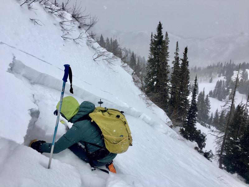
Summary: Small amounts of new snow and periods of strong winds. Several avalanches reported to the UAC, all failing on the persistent weak layer of snow that is now buried down 12-18". Many of these slides were triggered remotely, indicating the sensitivity of our cranky snowpack.
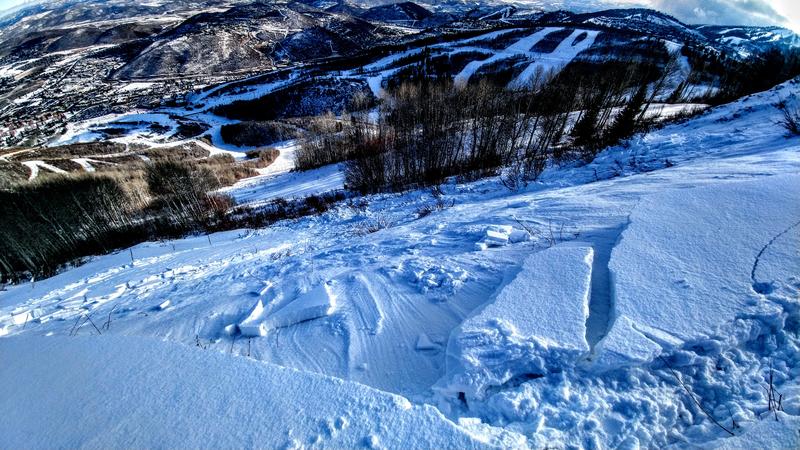
Friday, December 25: Sunshine and mild temperatures. Another remotely-triggered slide along the Park City ridgeline, Red Rock Chutes. 14" deep and 60' wide, failing on weak facets.

Saturday, December 26: Increasing clouds ahead of a weak storm late in the day that delivers 2-3". A possible human-triggered avalanche along the Park City ridgeline on a wind-loaded northeast aspect, failing yet again on the persistent weak layer of faceted snow.

Sunday, December 27: A skier-triggered slide in Wilson Glade along Big Cottonwood/Millcreek ridgeline. 18" deep and 50' wide. Triggered on their third lap on the slope. Avalanche control work in closed terrain of Park City Mountain Resort pulls out slides 50-100' wide and 12-16" deep. Of note is these slides occurred at 8600' - one of the lowest elevations for reported avalanches this season.

Of note is an increase in East winds overnight Sunday into Monday. East winds create unusual loading patterns, drifting snow on a variety of aspects (including east).
Monday, December 28: Moderate to strong southeast winds and 2-4" of new snow. A remotely-triggered slide 12" deep and 50' wide on a steep north aspect Little Water Peak along Big Cottonwood/Millcreek ridgeline.

Tuesday, December 29: Strong winds diminish somewhat, only drifting snow along the highest ridgelines at 11,000' No new avalanches reported.
Wednesday, December 30: Cold, clear weather Tuesday and into Wednesday morning weaken the snow surface. No new avalanches reported, however continued reports of collapsing, and full propagation with extended column tests:
Thursday, December 31: Cloudy skies and a trace to 1" new snow. No new avalanches reported.


