

Greg Gagne
Forecaster
Our Week in Review highlights significant snowfall, weather, and avalanche events of the previous week. (Click here to review the archived forecasts for the Salt Lake mountains.)
The danger roses for the Salt Lake mountains from Friday, February 7 through Thursday, February 13, 2020:
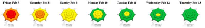
Summary: A significant storm system enters the state on Thursday, February 6 leading to a historic avalanche cycle in Little Cottonwood Canyon on Friday, February 7. Snow and water totals from this storm include:
- Little Cottonwood Canyon: 30"-41" of snow (5.52" - 6.79" water)
- Big Cottonwood Canyon: 12"-18" of snow (2.25" - 3.50" water)
- Park City Ridgeline: 9"-13" of snow (1.50" - 2.05" water)
The heavy, wet snow quickly stabilized, and by early this past week, the overall avalanche hazard was reduced to Low.
Friday, February 7: Heavy snowfall and strong winds lead to an overall High hazard, with an Extreme hazard for Little Cottonwood Canyon. An extensive natural avalanche cycle in Little Cottonwood Canyon with many large avalanche paths running full track and crossing the road, leaving very large debris piles. These slide paths include Tanners, Whitepine Chutes, Cottonwood Draw, Superior, and Toledo bowl.
The video below is from a controlled slide
The video below shows some of the storm cleanup of Little Cottonwood Highway on Saturday:
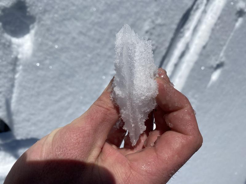
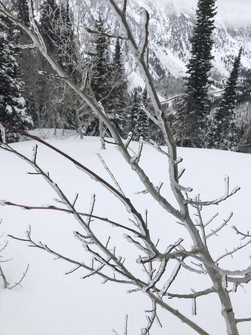
Saturday, February 8: Late Friday night and overnight into Saturday, a rain and riming event occurred, leaving many slopes with a 3-10 mm crust, and buried with a few inches of denser snow on top.
Many trees were coated in ice:
No backcountry avalanches are reported.
Sunday, February 9: No backcountry avalanches are reported.
Monday, February 10: No backcountry avalanches are reported. Increase in winds lead to shallow wind drifts and scouring on many exposed slopes. Up to 2" of snow fell in isolated locations.
Tuesday, February 11: No backcountry avalanches are reported.
Wednesday, February 12: No backcountry avalanches are reported. 1" new snow in isolated locations.
Thursday, February 13: On isolated wind pocket along Park City ridgeline (observation)
Going Forward - The rain/rime crust from Friday, February 7 now has 2-4" of weaknening snow on top of it. Many observers are noting faceting both above and below the crust. These weaknesses around the crust will have to be observed once a load of new snow and/or wind-blown snow is put on top of this facet/crust structure.


