
Greg Gagne
Forecaster
Our Week in Review highlights significant snowfall, weather, and avalanche events of the previous week. (Click here to review the archived forecasts for the Salt Lake mountains.)
The danger roses for the Salt Lake mountains from Friday Feb 2 through Thursday Feb 28:

Summary: Stable conditions early in the weekend, with strong westerly winds and warming temperatures beginning Sunday and lasting through the week. Primary avalanche hazard included wind drifts at the mid and upper elevations, and some wet loose activity in lower elevations, especially in the Ogden-area mountains. To our south, the Abajos and La Sal mountains are measuring snow in several feet, leading to heightened avalanche conditions in those ranges.
Friday February 22 - Continued cold, northwest flow with a few inches of very low-density snow during the afternoon. Stable snowpack in the central Wasatch as riders get onto bigger lines. Winds are moderate, ranging from the southeast to northeast. Only avalanche activity is sluffing in the low-density snow as well as pockets of fresh wind drifts at the upper elevations.
Saturday February 23 - Winds switch to the northwest with minor drifting at the upper elevations. Avalanche activity limited to minor wind drifts and sluffing in the loose snow at the surface.
Sunday February 24 - Westerly winds begin to drift snow at the upper elevations. In the Salt Lake mountains avalanche activity is limited to a few small pockets, but stronger winds in the Ogden mountains with sensitive wind slabs including both natural and human-triggered avalanches. Photo of natural avalanche on Cutler Ridge, as well as discussion of wind-drifting at the mid and upper elevations.
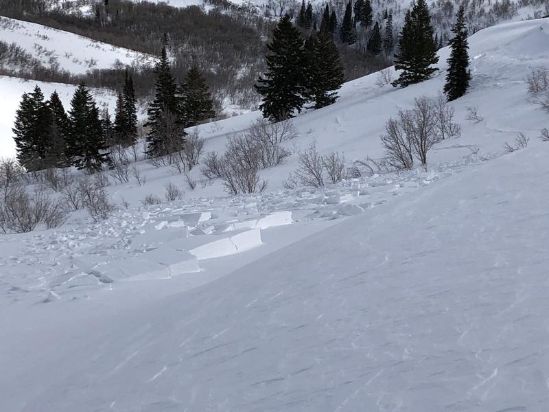
Monday February 25 - Salt Lake and Ogden mountains pick up 1-6" of dense snow, but the strong westerly winds highlight the weather with fresh wind drifts at the mid and upper elevations. Reports of pockets of fresh wind drifts, including this one from the Brighton backcountry:
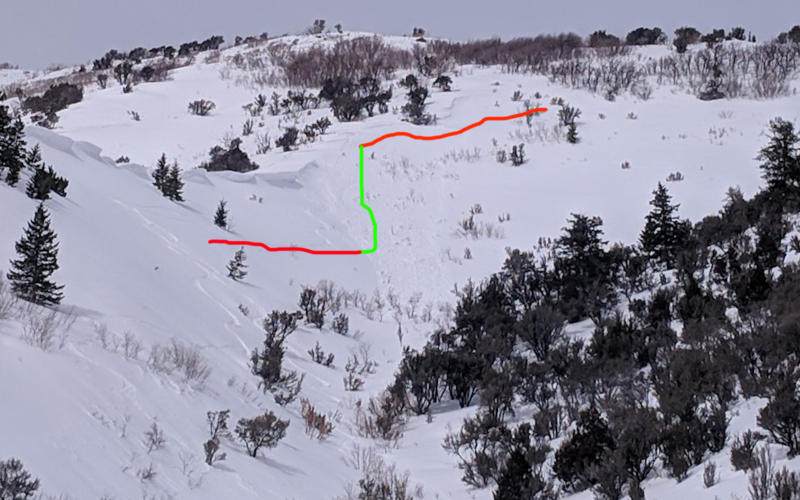
In the Ogden mountains an experienced skier intentionally triggered a wind slab on the North Ogden divide and was briefly caught before skiing out of the slide. The avalanche ran on weak snow sitting on top of the February 14 rain crust (observation). [Photo ogdenavalanche.org]
The warm temperatures led to sluffing of wet snow on both north and south-facing steeper slopes in Little Cottonwood Canyon.
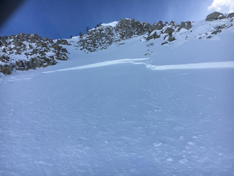
Tuesday February 26 - Strong south winds continue to create pockets of wind drifts at the mid and upper elevations. The avalanche below was triggered in Martha Bowl in the Brighton backcountry on a steep, wind-loaded slope:
Although the wind slabs thave have been triggered are not breaking out very far or deeply, they have been sensitive, especially in the upper elevations. These wind drifts are sitting on top of decomposing fragments (or 'DF's') from the 1-2" of very low-density snow that fell last Friday afternoon. The photo below shows the gray stripe of this weak layer of snow:
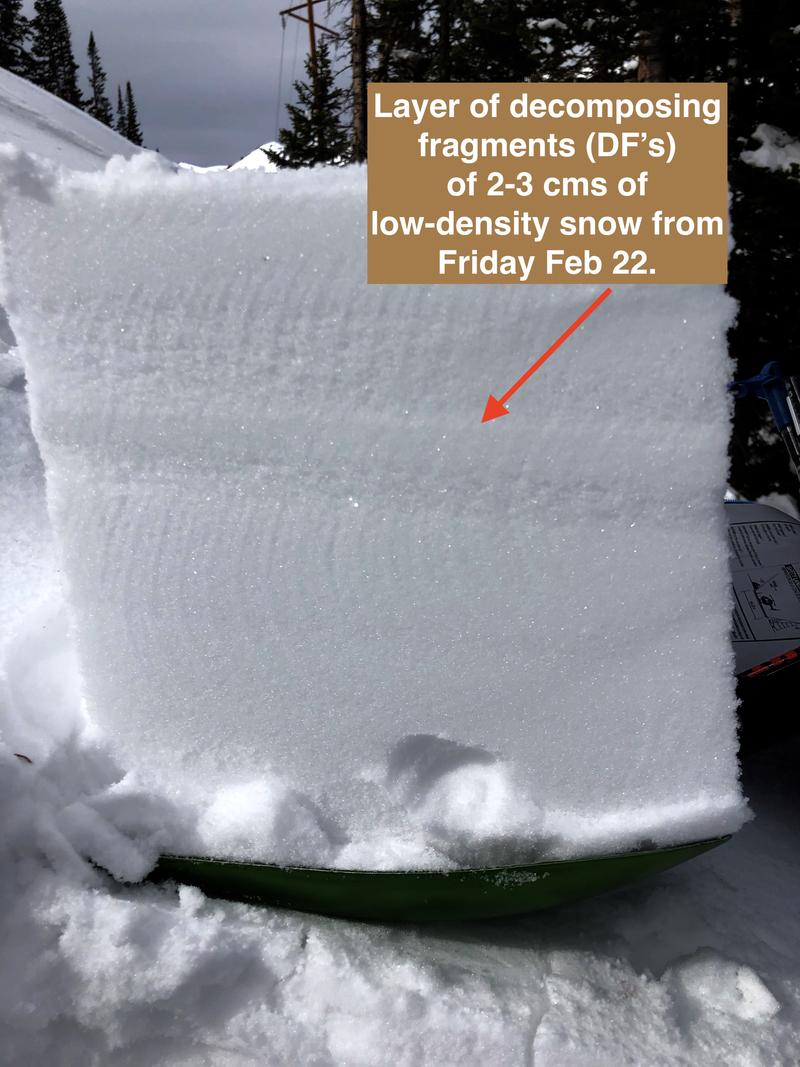
A close-up view of the DF's
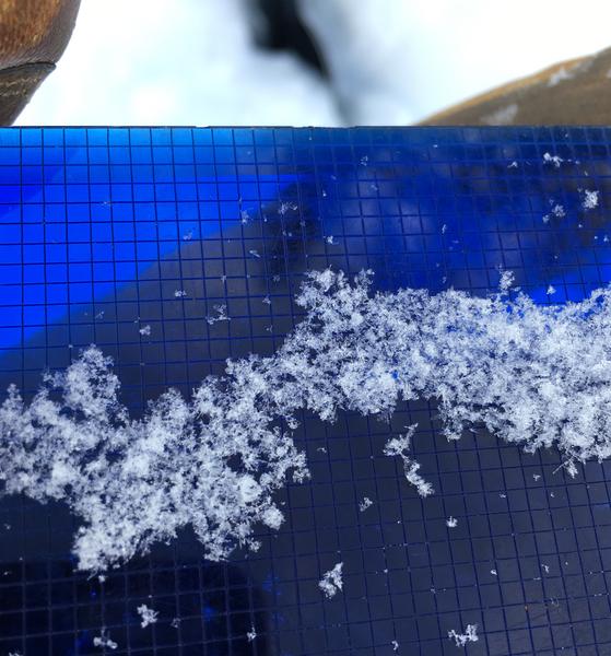
Low-density snowfall is typically very weak, but fortunately does not persist for very long and strengthens quickly, especially with the warm temperatures.
Wednesday February 27 - 1-2" of dense snow in the Salt Lake and Ogden mountains. Warm temperatures help continue to settle ut wind slabs, and observations from the backcountry and resorts indicate that although wind slabs are widespread, overall the recent wind drifts are unresponsive to stability tests. The only activity reported was in the northern end of the Ogden mountains where a skier triggered a recent wind slab that broke out 30' wide and was 8-12" thick.
Thursday February 28 - Continued warm temperatures with a trace to 2" dense snow. No backcountry avalanches are reported, and observers noting generally stable snowpack.


