[Forecaster Comments: This control work was performed Snowbird's avalanche study area in Mary Ellen Gulch.]
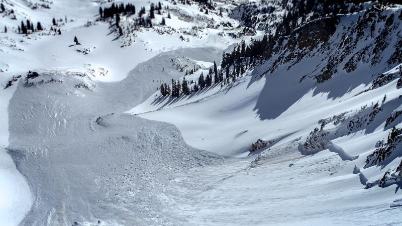
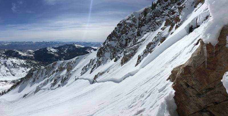
This avalanche was initiated by a single hand charge on Thursday March 8th, 2018. The route members tossed several shots onto a hanging snowfield on the eastern flanks of Silver Creek Peak without results. At approximately 8:30, the 2nd or 3rd shot placed in the area initiated a 2'x150' avalanche failing on the weak snow near the ground. The slide cascaded over the 80' to 100' cliff band and crashed onto the open bowl below. Slope angle was measured at this point. Upper field was likely closer to 32 degrees steepness. The resulting avalanche propagated over 1500' wide and stepped down from the initial faceted layer 140cm deep into basal facets as it reached numerous rock fingers lower in the bowl. The 1F hard slab broke apart and piled up on several of the benches below, and was eventually channeled into the gully systems below. Old tracks from former skiing parties in the lower drainage were obliterated and the debris piles were over 4 meters deep in places. The toe of the debris came to rest nearly 1750' below the placement of the explosive. The crown below the rock band averaged 150cm to 180cm, with its deepest point reaching 275cm. The 2/18 dirt layer is clearly visible throughout the crown and flanks, and even in the chucks of debris that were not pulverized.
Photos:
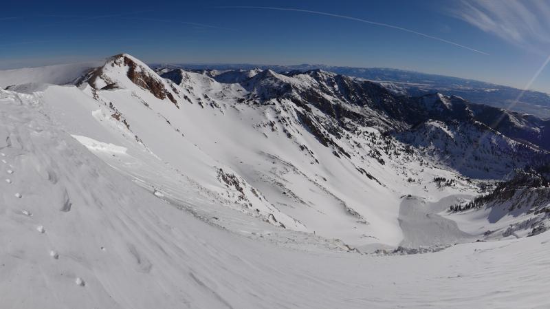
1. Taken from Silver Creek Peak showing extent of runout. PC: Nat G.
2. Upper Crown in hanging snowfield. PC: Nat G
3. Lower Crown in bowl below cliffs. Profile is from upper right portion of crown. PC: Sean ZW
4. Deepest point at 275cm stepping down into Basal facets on rock/scree. PC: Bremer
5. Layering of snowpack below cliffs, with dirt layer evident down ~100cm to ~130 cm. PC: Sean ZW
6. Debris piles in mid drainage >3m deep. PC. Sean ZW
7. Video: Edited by SZW, filmed by SZW and Bremer