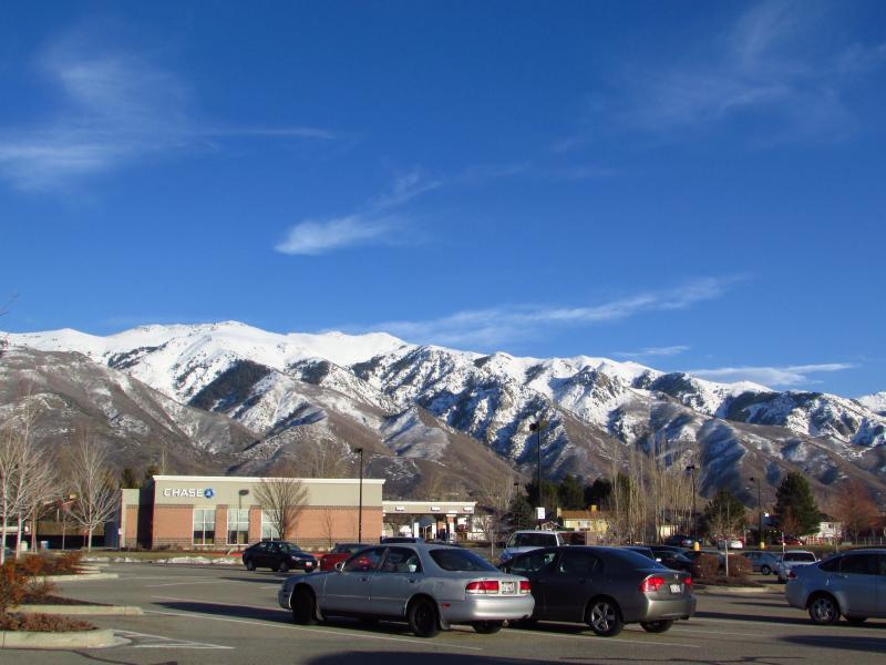
This beautiful blue bird weather today lead to some of the most impressive avalanche gazing that I have had in a long while, I was astonished to see this much activity still visible this long after such an interesting snow, wind, and rain cycle. I give credit to my wife for noticing what I thought was an optical illusion (turned out to be the main crown line off Thurston Peak) otherwise we wouldn't have made this discovery! I'm unsure as to when the cycle happened but judging by the nature of the deposition piles that we could spot, I would place them in the wet slab or wet loose and cornice release and likely the middle to end of this last week during the rain event and or the green housing and warming. In our investigation we counted 10-15 crown lines that may be connected from ridge line to ridge line and the large majority were on the middle 2/3 of main ridge, initiating on the northerly & northwesterly aspects of the westerly running sub ridges. There are so many avalanches over such similar terrain and short piece of the range I opted to lump these all in to one observation so to save some time. The pictures we took were all from the Wal-market parking lot in Layton off of 193 (it provided the best view from top to bottom and for the aspect) all pictures will be displayed observers left is north and observers right is south.
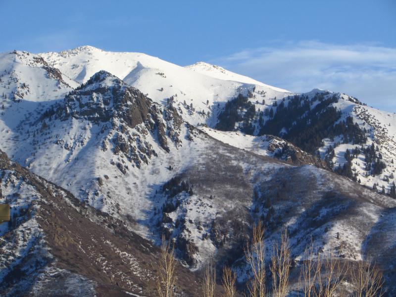
Picture # 1 is a overview of the area, North boundary is HWY 193, South boundary is the FAA towers to Farmington Canyon.
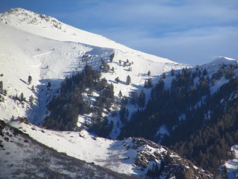
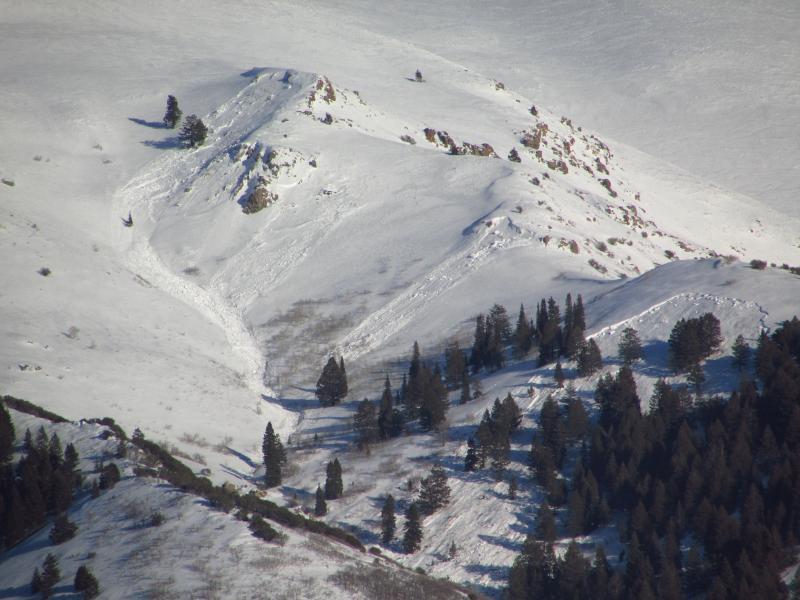
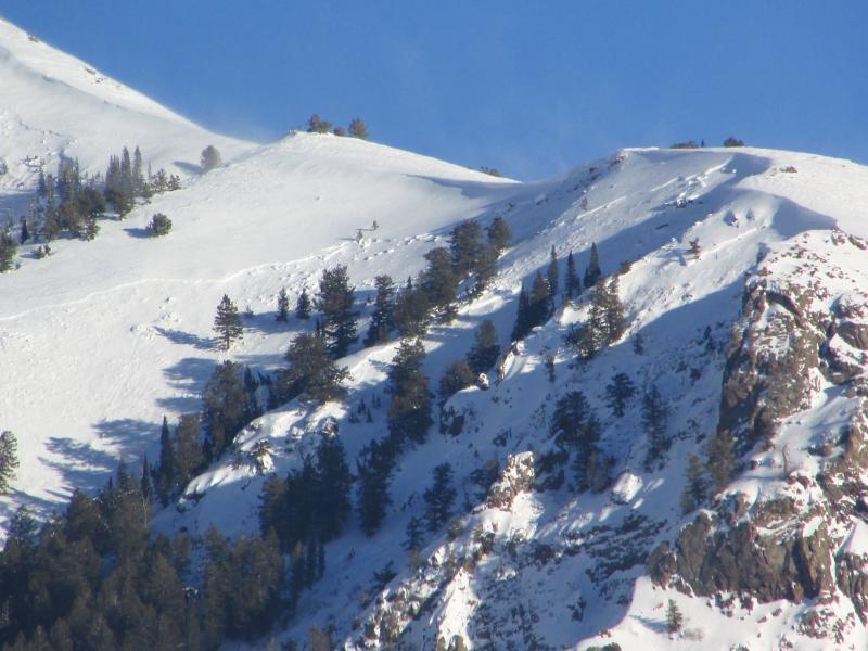
Picture # 2 is northern 1/3 or the Hobbs & Kays Creek Drainage
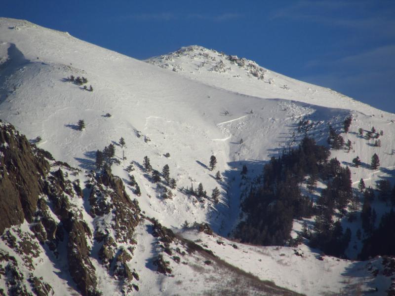
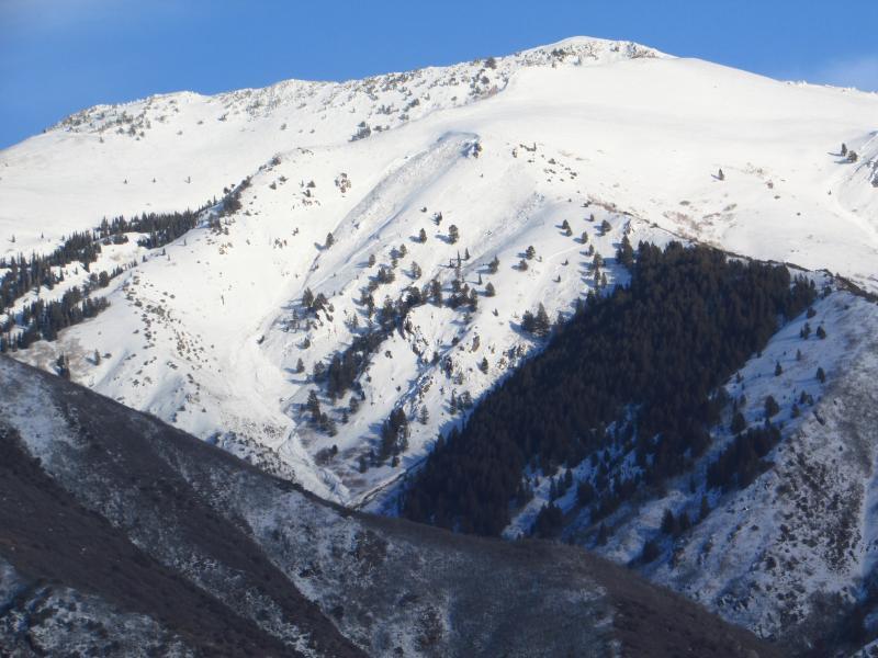
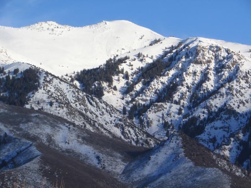
Picture # 3 is middle 1/3 or the Kays & Snow Creek Drainage & Thurston Peak(most prominent Peak North of FAA towers)
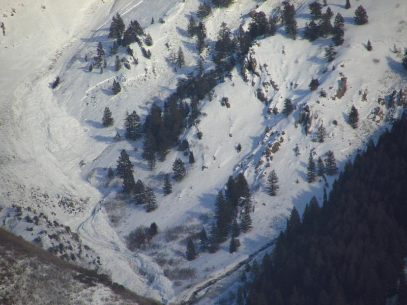
Picture # 4 is Southerly 1/3 or the Holmes Creek & Adam Canyon(very popular Hiking Trail to Waterfall)
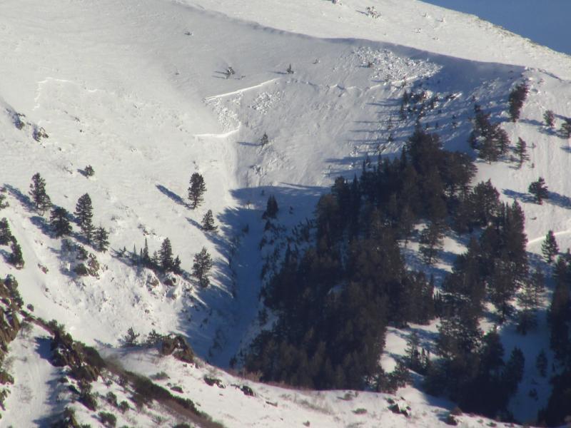
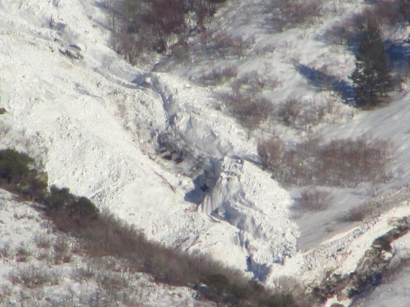
Picture # 5,6,7 are close ups of the Hobbs Creek Drainage 4 distinct Crown lines with sizeable deposition piles in the bottom with wet characteristics of gouging and dirt in debris, likely 3'+ crowns and 1500'+ vertical run on each, N-WS/WL-R3/4-D3-G
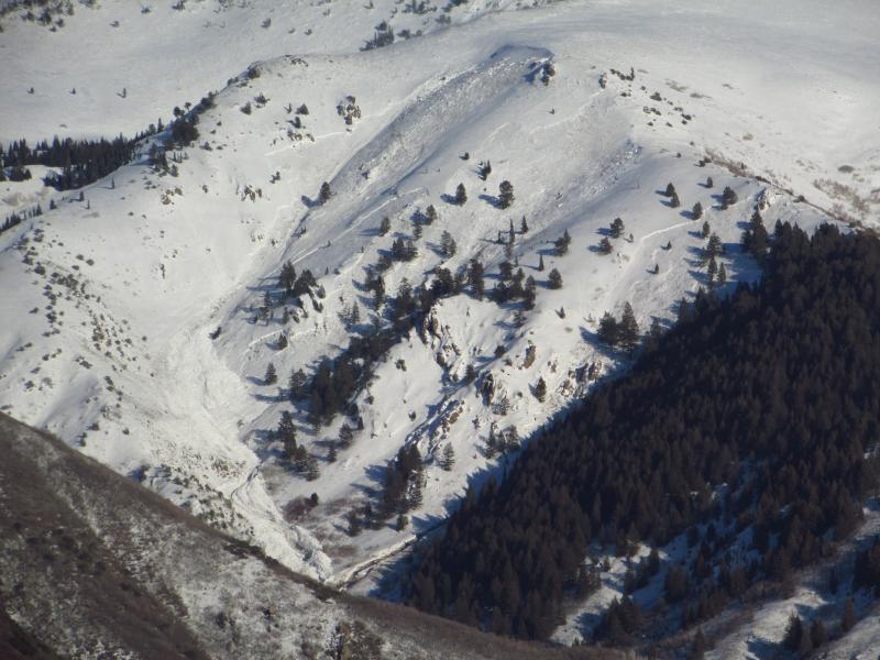
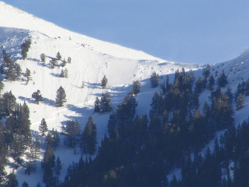
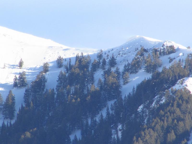
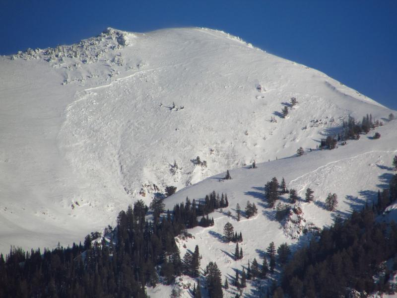
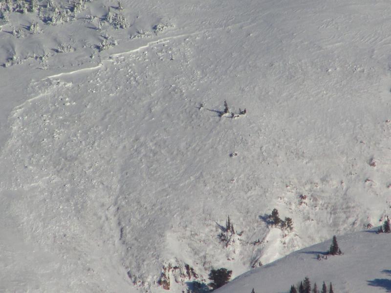
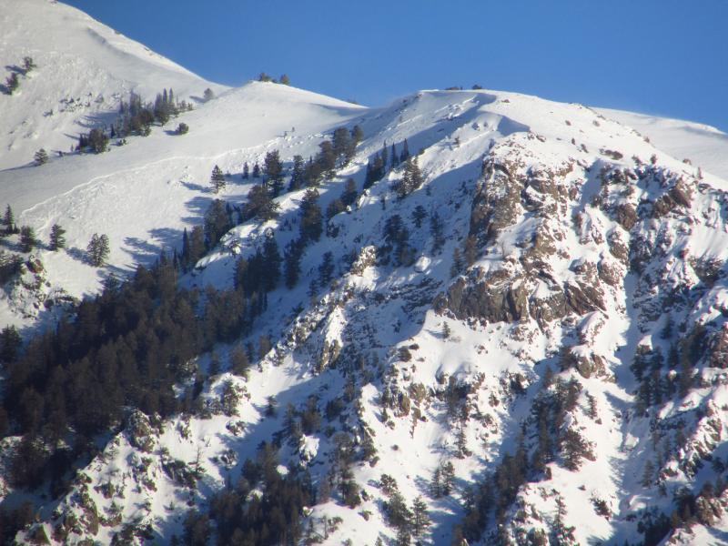
Picture # 8, 9, 10, 11, 12 are close ups of the Kays & Snow Creek Drainage & Thurston Peak(most prominent Peak North of FAA towers) 8 distinct Crown lines, N-WS/WL-R4-D3-I
4 distinct Crown lines likely 3' crowns and 500' vertical run on each, if they ran to the terminus NC-WS/WL-R3-D2-I
2 distinct Crown lines likely 3'+ crowns and 500'-1000'+ vertical run on each, if they ran to the terminus one of the larger running crown lines of all 500 yards wide N-WS/WL-R4-D3-G
2 distinct Crown lines likely 3'+ crowns and 750'-1000'+ vertical run on each if they ran to the terminus, terrain factors include large cliffs and trees N-WS/WL-R4-D3-G
Picture # 13, 14, 15, 16, 17 are close ups of the Holmes Creek & Adam Canyon(very popular recreation Hiking Trail to a Waterfall at the bottom) 2 distinct Crown lines likely 3'+ with a step down in the mid slope of the second drainage observers right. What looks to be contious crown in measured over 3/4 miles on google earth and up to 2500' vertical run on each if they ran to the terminus, N-WS/WL-R4-D3-I/G Note the observers right side large Cornice release likely 8'-10+ in height steping to the ground likely what brought out step down on observers left. NC-WS/WL-R4-D4-G. This slide could have very easly covered the drainage and the trail at the bottom and likely made a large mess and killed anyone who was on that section of the trail or falls at that time.