

Observer Name
B
Observation Date
Wednesday, October 30, 2013
Avalanche Date
Tuesday, October 29, 2013
Region
Salt Lake » Big Cottonwood Canyon » Pioneer Bowl
Location Name or Route
N through NW facing Pioneer Bowl area/Brighton
Elevation
10,100'
Aspect
Northwest
Slope Angle
40°
Trigger
Natural
Avalanche Type
Soft Slab
Avalanche Problem
New Snow
Weak Layer
Facets
Depth
12"
Width
500'
Vertical
400'
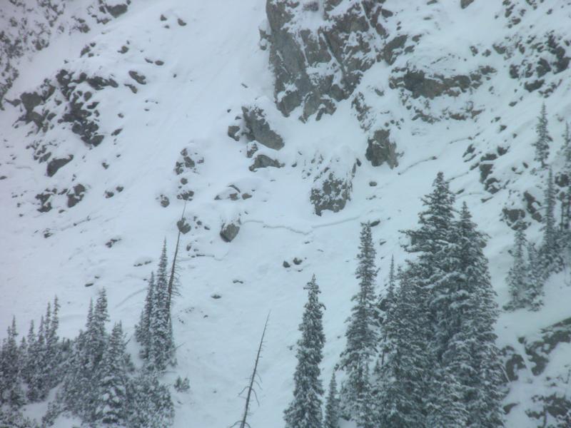
Comments
Crown visible during the day on ascent to Catherines Basin. It appeared to have released during the high PI rates early in the morning on the 29th. Connected slab that propagated through 2 distinct gully systems: All the way across Toilet Bowl (aka B) to the the rider's right side of the V Tree Chute area. Debris ran to transitional flats. Crown appeared to mimic stability test results as far as it's depth, estimated at 12 to 14 inches. Weak layer identified in the holes dug indicated it was running in moderate sized facets 1 to 2 inches below the "Snirt" Layer that was formed during the prefrontal phase of the latest event. See regular observation for details on the structure.
Coordinates