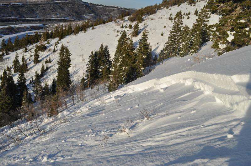
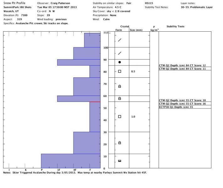
SS-ASu-R2-D2-O, 2-3' deep, 175' wide, ran 350' into a terrain trap. Total snow depth was 112cm. Avalanche appeared to step down from a layer of .5mm facets at 85cm depth to a more pronounced layer of facets at 55cm depth. One of those outlier areas with an extremely weak junk show of a snowpack. Suspect that warming contributed. Air Temp at Parleys Summit Weather station reached 45F during the day.
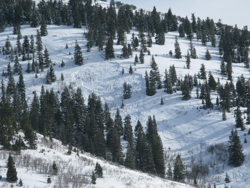
Noticed this avalanche as I was driving home up I-80. Very visible from highway. Fairly certain it occurred today as I didn't see it this morning. Appeared to be skier triggered from track leading into middle of the crown. Track exited flank 100' lower to the skiers left. Guessing that skier/rider rode slab for a bit. Photo is of skier track that likely triggered avalanche.
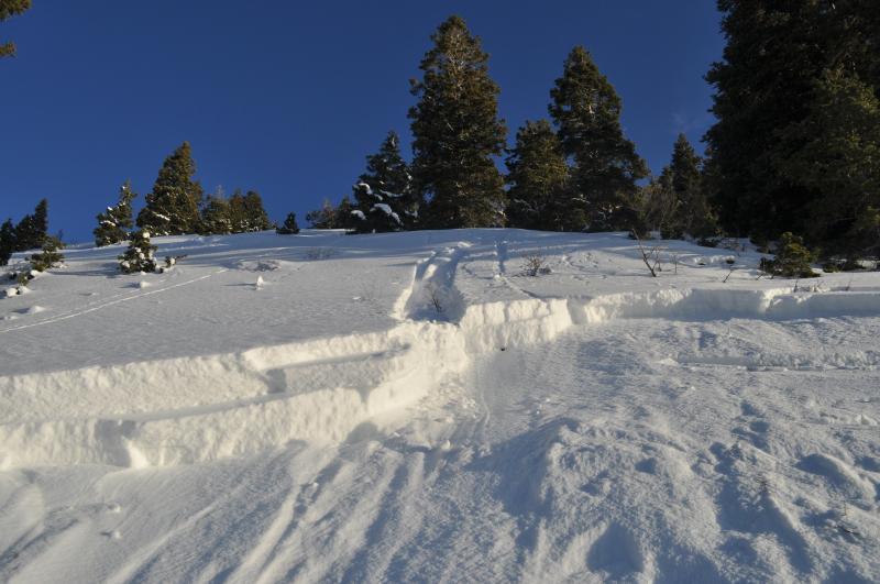
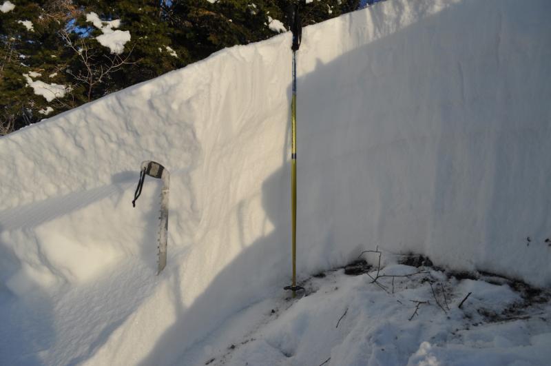
Photo of crown profile location. Assuming that avalanche was triggered on upper layer of facets and stepped down to lower layer. Tests consistently produced failures on the upper layer earlier than on the deeper layer. Test results were CT12 Q2 and CT11 Q2 on upper layer (depth at 85cm), and CT 18 Q2 and CT 16 Q2 on lower layer(depth at 55cm), all sudden collapse. Also received an ECTP30 Q1. My guess is that there was likely more energy in the snowpack earlier when this was triggered and temps were 45F. Overview photo by Craig Gordon. Rest of the photos - Craig Patterson.