Steve was wandering around getting his Christmas tree on Tuesday and noted some collapsing on failing crust beneath new snow (6"or so from Sundays storm) above facets.
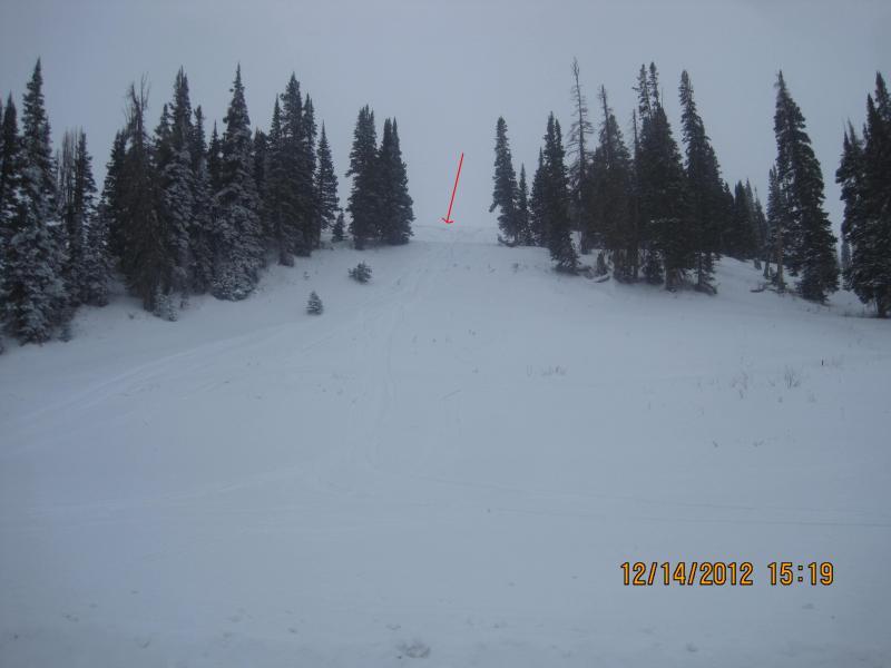
We had not seen any natural activity early in the week, and found no evidence today, but as we drove over the Miller Flat to check and clear interval board and total stake, I noticed this from the road. We had skied right here 2 weeks ago, so see that ob for a profile at that time. I suspect this was triggered on lookers right by a snowmobile (judging from the tracks) a couple of days ago. While no natural activity had been observed just after the storm, we suspected there had to be pockets that all the parts were in place, and this confirms that idea. It obviously took more than just loading, like a snowmobile, but things have had a couple more days of strengthening, so the landmines out there will be that much more stubborn.
This is a small terrain feature, a ways off the main ridgeline, and protected by trees on the west. The typical constant wind had loaded this area and produced the isolated pockety results.