Observer Name
L. Dunn
Observation Date
Tuesday, March 28, 2023
Avalanche Date
Sunday, March 26, 2023
Region
Salt Lake » Big Cottonwood Canyon » Mill B South
Location Name or Route
BCC>Mill B South
Elevation
9,500'
Aspect
Northeast
Trigger
Natural
Avalanche Type
Soft Slab
Avalanche Problem
New Snow
Weak Layer
New Snow/Old Snow Interface
Depth
5'
Width
1,500'
Comments
Forecaster Note: We recieved multiple reports of this avalanche. We have combined them all into this one observation.
L. Dunn: The avalanche in the picture below is around 9500' in the upper portion of the Mill B South drainage, to the east of Dromedary. The picture was taken from the Mineral Fork/Mill B ridgeline at the north end of Highline. We were too far away to see much, but there didn't appear to be any new snow on the bed surface, so the slide likely occurred after the snowfall quit on Monday afternoon, and more likely it was sometime overnight when the south winds picked up. Note the streamers coming off the LCC/BCC ridgeline above the avalanche. This was going on all day with lots of snow being transported by the wind.
SD:
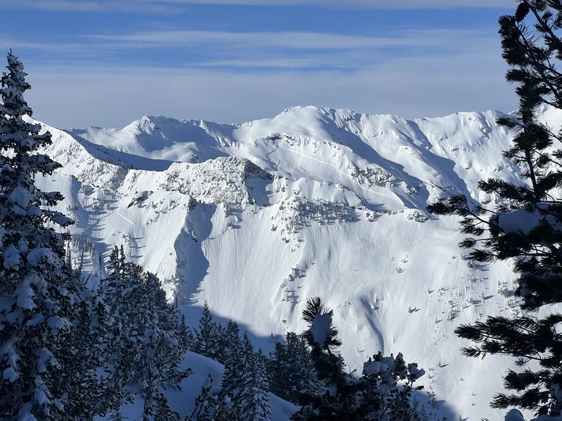
HUGE natural avalanche in upper Mill B. Likely happened during the heavy snowfall on either 3/26 or 3/27. Impossible to tell from afar how deep the crown was but certainly multiple feet. I would guess this failed on the old snow interface which may have had a small facet layer from the 4-day dry spell preceding the last storm cycle.
A similar but smaller avalanche happened on the same aspect in Mineral Fork(shown in photo). This avalanche was still large and likely unsurvivable.
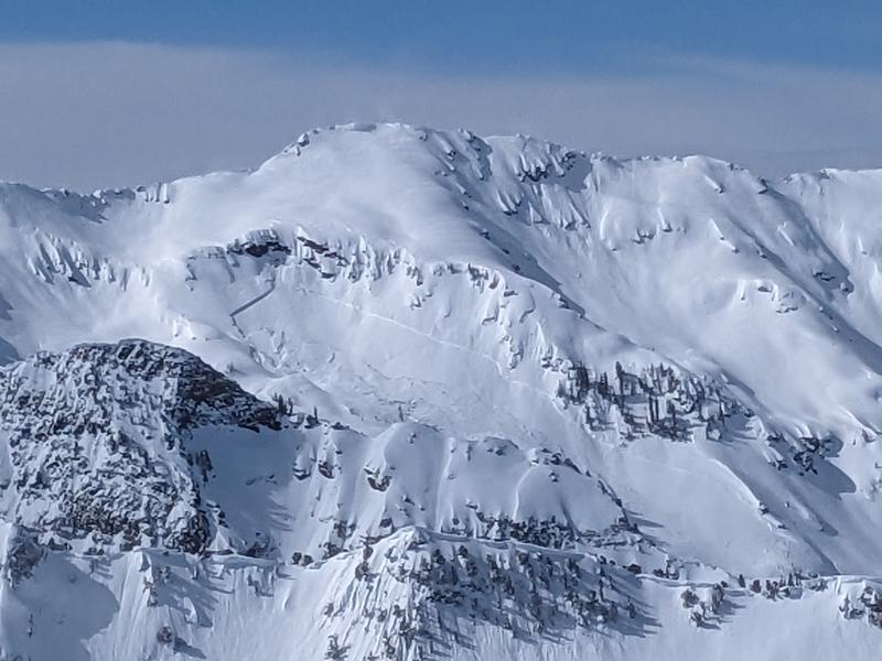
Chester: Location could be very wrong. Monster slide - very wide maby a mile. Appears to be very deep (4' or much more is a guess) judging by debris. Photo from Kessler

Coordinates


