
Observer Name
Bill Nalli, Dave Kickert
Observation Date
Tuesday, March 16, 2021
Avalanche Date
Tuesday, March 16, 2021
Region
Uintas » Upper Weber Canyon
Location Name or Route
Upper Weber Canyon
Elevation
9,800'
Aspect
South
Trigger
Skier
Trigger: additional info
Unintentionally Triggered
Avalanche Type
Wet Loose
Avalanche Problem
Wet Snow
Weak Layer
New Snow/Old Snow Interface
Depth
7"
Width
40'
Vertical
200'
Comments
It appears that Mother Nature heard our objections to Sunday's unscrupulous wind and did something to attempt to make things right. Tuesday morning we woke to a new 7"-10" of 10% density snow that fell without much wind. This snow bonded fairly well to the old, rough, wind-beaten surface and skiing and riding conditions improved immensly. Thank You.
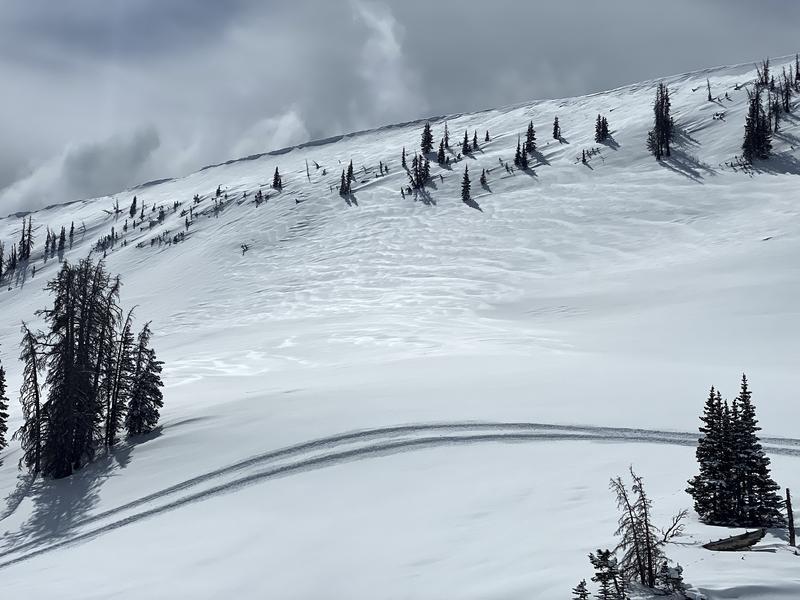
Moderate NE winds lighlty scoured north through east-facing slopes along the highest ridges but the damage was minimal as seen in Pic 1 at 10,500'. Some minor cracking was observed on southwest-facing slopes but the new soft slabs were unreactive.
Comments
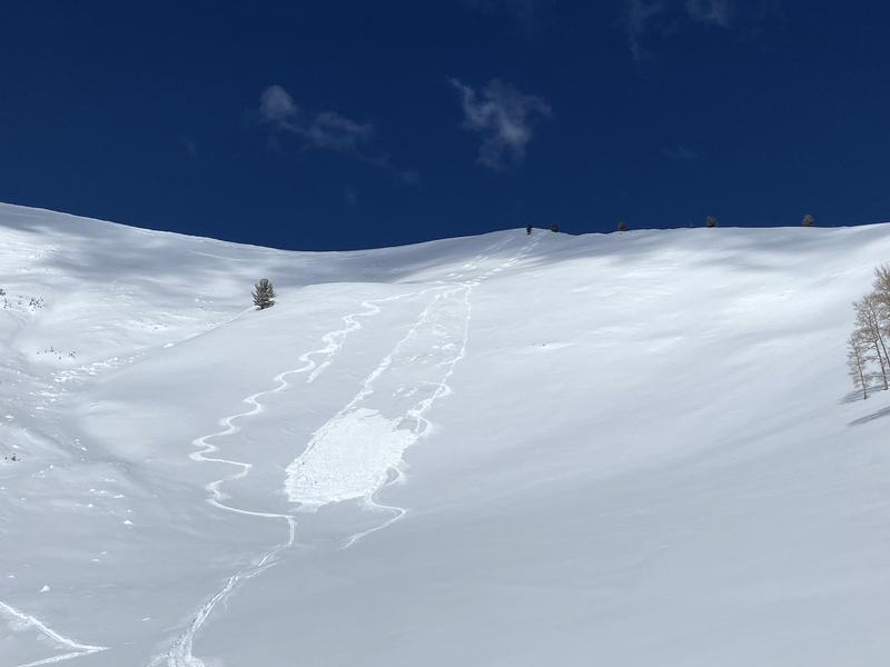
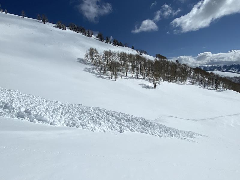
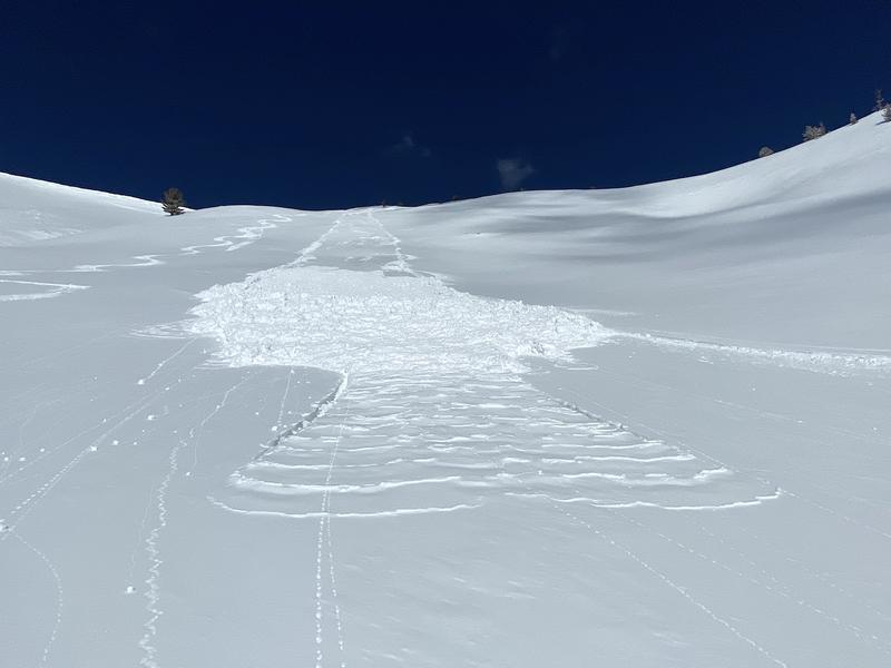
Scattered clouds through mid-morning allowed the strong March sun to warm south-facing slopes quickly. By 10am the surface became damp and by 11am, small wet-loose slides were easily triggered on steep southerlies. This small D1 was triggered unintentionally, gathering up a sizable debris pile. The slick wind-beaten old surface aided with WL initiation. West and south aspects will have a crust Wednesday morning. East and north were spared so far, except for elevations below 9000' where ambient air temps were above freezing.
Comments
As for stability on the mid and upper elevation northwest through north to east aspects where we continue to track the season-long weak layers near the ground, for now the depth hoar is old, tired and dormant. It seems unlikely that a rider could trigger one of these deep slabs but the poor structure is still something that warrants continued evaluation. Especially when we continue to record stability test results like today's ECTP 23 and PST END 40/100 on a northeast-facing slope at 10,500'.
Coordinates


