

Avalanche Advisory
| Advisory: Skyline Area Mountains | Issued by Craig Gordon for December 9, 2012 - 6:18am |
|---|


Above treeline
Near treeline
Below treeline
|
bottom line Terrain to avoid- steep, upper elevation wind loaded terrain. While isolated and limited to a small portion of the terrain, the body beating consequences of triggering a slide could be season ending. In general you'll find a LOW avalanche danger in a vast majority of the terrain along the Skyline this weekend, especially on wind sheltered slopes..
|

 |
special announcement The Manti-Skyline advisory program continues to function because of the very generous contributions you've made at our annual fundraisers along with the support from our non-profit Friends of the Utah Avalanche Center. Thanks to all of you for helping keep this vital resource up and running! We will be updating this weekend advisory by 7:00 AM each Saturday morning.
|
 |
current conditions Storm totals were greater than expected with up to 9" of new snow stacking up across the range. Temperatures are in the mid teens and westerly winds are blowing 20-30 mph. Click here to view the great trip report Steve and Darce posted from their travels Friday.
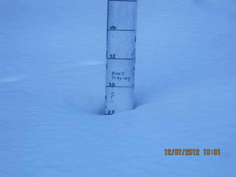
Snow stake at Miller Flat Trailhead pretty much sums up the tale of a shallow snowpack.
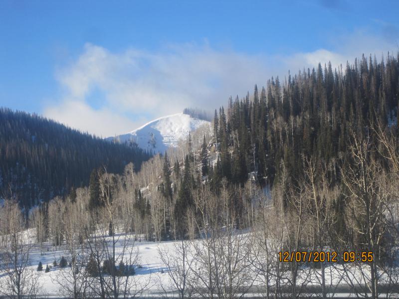
A view from Huntington Reservoir looking south towards Phone Shot. |
 |
recent activity No avalanche activity to report.
|
Avalanche Problem 1over the next 24 hours
| type | aspect/elevation | characteristics |
|---|
 |
Above treeline
Near treeline
Below treeline
|
|
|
description
Yesterday's storm laid down a nice coat of white paint along the Skyline and avalanche conditions have changed. Wind drifts along the leeward side of upper elevation ridgelines will be sensitive to the weight of a rider and could take you for a nasty ride through rocks and stumps. There great, safe riding out of the wind zone. Today it's best to avoid steep, upper elevation wind drifted slopes, especially those where the snow surface looks fat and rounded or sounds hollow like a drum. |

 |
weather Today we can expect mostly cloudy skies, light snow showers, and cold temperatures. Daytime highs only reach into the low teens and overnight lows dip to near zero. Northwest winds will continue to be a nuisance along the high peaks, gusting in the mid 30's. Light snow showers are on tap for Monday with an additional 2"-4" expected. Look for a slight warming trend Tuesday and Wednesday with another round of snow slated for Friday. |
| general annoucements Remember your information can save lives. If you see anything we should know about, please participate in the creation of our own community avalanche advisory by submitting snow and avalanche conditions. You can call me directly at 801-231-2170, email [email protected], or email by clicking HERE This is a great time of year to schedule a free avalanche awareness presentation for your group or club. You can contact me at 801-231-2170 or email [email protected] Donate to your favorite non-profit –The Friends of the Utah Avalanche Center. The UAC depends on contributions from users like you to support our work. The information in this advisory is from the US Forest Service which is solely responsible for its content. This advisory describes general avalanche conditions and local variations always occur. The advisory expires 24 hours after the date and time posted, but will be updated by 7:00 AM Saturday December 15th.
|