

| Advisory: Salt Lake Area Mountains | Issued by Brett Kobernik for November 18, 2012 - 7:04am |
|---|


Above 9,500 ft.
8,000-9,500 ft.
Below 8,000 ft.
|
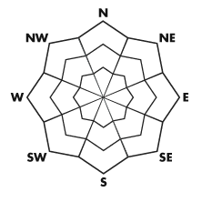
bottom line The avalanche danger starts out at MODERATE this morning for both new snow and persistent slab avalanches. New snow activity will be more widespread and moderately dangerous, persistent slab avalanches are more isolated to only the upper elevation north slopes, but, more dangerous. The danger may rise if we receive more snow than expected.
|
 |
current conditions This little storm that didn’t look too promising a few days back is actually adding some well needed snow, at least in the upper elevations. The upper elevations are averaging about 5 inches of new snow. There is a good amount of graupel in the new snow. Alta recorded 7 inches of snow in the last 24 hours and Park City Ski Resort 9 inches containing 1 inch of water, so, it’s quite heavy. Temperatures have been mild in the low to mid 30s at 8000 feet and that’s about the elevation where the rain snow line has been. Southwest winds have been moderate with some stronger gusts along the ridges. |
| type | aspect/elevation | characteristics |
|---|
 |


Above 9,500 ft.
8,000-9,500 ft.
Below 8,000 ft.
|
|
|
description
The new snow will be your primary concern today. Poke and prod at it as you travel performing shear tests and ski cuts to see if it’s sensitive. It’s hard to say how it will react just yet but our friend Titus at Alta reported some shearing involved with the new snow this morning. The winds will have drifted this new snow into some deeper drifts on the northerly aspects so a little extra caution should be applied in those areas. |
| type | aspect/elevation | characteristics |
|---|
 |


Above 9,500 ft.
8,000-9,500 ft.
Below 8,000 ft.
|
|
|
description
Your second concern will be the deeper buried weak snow. We have not heard much from this in a few days but propagation is still occurring in tests and we have just added a half inch to an inch of water weight on top of it. I don’t expect to hear much from this but don’t be surprised if you take a ride poking around in those upper elevation northerly aspects. Avalanches here could contain a lot of snow and no doubt will be dangerous if they release. |
 |
weather A warm southerly flow will continue to bring periods of snow to the region into tonight. Another 3 to 6 inches is possible. Temperatures will remain mild with the rain-snow line around 7500 or 8000 feet dropping just a bit mid day. Mid 30s at 8000 feet and near 30 along the ridges is expected. Southwest winds will remain moderate with some stronger gusts along the ridges. We’ll dry out for the first half of the week. |
| general annoucements If you trigger an avalanche in the backcountry - especially if you are adjacent to a ski area – please call the following teams to alert them to the slide and whether anyone is missing or not. Rescue teams can be exposed to significant hazard when responding to avalanches, and do not want to do so when unneeded. Thanks. Salt Lake and Park City – Alta Central (801-742-2033) Ogden – Snowbasin Patrol Dispatch (801-620-1017) Provo – Sundance Patrol Dispatch (801-223-4150) Dawn Patrol Forecast Hotline, updated by 05:30: 888-999-4019 option 8. Twitter Updates for your mobile phone Daily observations are frequently posted by 10 pm each evening. Subscribe to the daily avalanche advisory e-mail click HERE. UDOT canyon closures UDOT at (801) 975-4838 Wasatch Powderbird Guides does daily updates about where they'll be operating on this blog http://powderbird.blogspot.com/ . Remember your information can save lives. If you see anything we should know about, please participate in the creation of our own community avalanche advisory by submitting snow and avalanche conditions. You can also call us at 801-524-5304 or 800-662-4140, or email by clicking HERE Donate to your favorite non-profit –The Friends of the Utah Avalanche Center. The UAC depends on contributions from users like you to support our work. We will update this forecast tomorrow. Thanks for calling. |