

| Advisory: Provo Area Mountains | Issued by Brett Kobernik for March 10, 2013 - 7:08am |
|---|


Above 9,500 ft.
8,000-9,500 ft.
Below 8,000 ft.
|
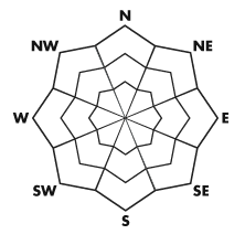
bottom line An overall MODERATE avalanche danger remains today. This means human triggered avalanches are possible. Heating from the sun will make the snow unstable as the day progresses and the new snow along with recent fresh wind drifts may still be sensitive to the weight of a person.
|
 |
current conditions North and northeast winds during the day on Saturday drifted the new snow to a certain extent in some locations but overall, the winds were better behaved than I thought they might be. They're from the north now and are light to moderate in speed in the low and mid elevations. There's still some stiffer gusts up around 11,000 feet. Temperatures cooled into the mid to low teens overnight. |
 |
recent activity There was some avalanche activity on Saturday and while overall, things are not all that dangerous, I anticipate that people will choose to get into terrain which could produce avalanches today. There were a handful of small new snow human triggered avalanches on Saturday, some due to the wind, some just due to the new snow being sensitive. There was one avalanche reported from Alexander Basin in Mill Creek Canyon that may have broke into weak faceted snow in very steep, exposed rocky terrain with a shallow snowpack, everything you need to get a persistent weak layer to fail. DETAILS Park City snow safety also released a wind slab with explosive testing at around 8000 feet which ran a few hundred vertical and then gouged into loose wet snow turning the avalanche into a wet slide. Others noted the saturated snow in the mid and lower elevations. These are all examples of what we should keep in mind again for today. |
| type | aspect/elevation | characteristics |
|---|
 |


Above 9,500 ft.
8,000-9,500 ft.
Below 8,000 ft.
|
|
|
description
The first item of concern is how the new snow will react to today's sun. It's common that new snow events in the spring produce loose snow avalanches the first time the sun comes out after a storm. These don't pose much threat as they usually don't catch people after being triggered by someone, but, rather can catch the unwary traveler who is in confined terrain such as the bottom of a steep gully or coulior. It might be best to avoid hiking directly up steep chutes today. Along with the warming comes the saturated and unconsolidated snow below around 8000 feet which may become more unstable as the day goes on. This is just another reason to avoid the steep confined terrain traps. |
| type | aspect/elevation | characteristics |
|---|
 |


Above 9,500 ft.
8,000-9,500 ft.
Below 8,000 ft.
|
|
|
description
The new snow instabilities along with the fresh wind slabs should be more stable today however anticipate that they may still crack out. If you're in steep exposed terrain, you're in the type of place that this could cause you problems. Continue to do shear tests as you travel and perform slope cuts prior to just diving into your descents. |
| type | aspect/elevation | characteristics |
|---|
 |


Above 9,500 ft.
8,000-9,500 ft.
Below 8,000 ft.
|
|
|
description
|
 |
weather We'll be under a northerly flow over the next few days as a ridge of high pressure slowly makes it's way east into our area. Today we'll see mostly clear skies and ridgetop temperatures will be around freezing or a bit higher. North winds should remain in the moderate speed. We'll see some clouds Monday and Tuesday as moisture spills over the top of the ridge until the ridge is squarely over us mid week with continued warming. Weather models hint at a more active pattern for the latter part of the month but are quite erratic so confidence is low at this time. |
| general annoucements Go to http://www.backcountry.com/utah-avalanche-center to get tickets from our partners at Beaver Mountain, Canyons, Sundance, and Wolf Mountain. All proceeds benefit the Utah Avalanche Center. If you trigger an avalanche in the backcountry - especially if you are adjacent to a ski area – please call the following teams to alert them to the slide and whether anyone is missing or not. Rescue teams can be exposed to significant hazard when responding to avalanches, and do not want to do so when unneeded. Thanks. Salt Lake and Park City – Alta Central (801-742-2033), Canyons Resort Dispatch (435-615-3322) Ogden – Snowbasin Patrol Dispatch (801-620-1017) Powder Mountain Ski Patrol Dispatch (801-745-3772 ex 123) Provo – Sundance Patrol Dispatch (801-223-4150) Dawn Patrol Forecast Hotline, updated by 05:30: 888-999-4019 option 8. Twitter Updates for your mobile phone - DETAILS Daily observations are frequently posted by 10 pm each evening. Subscribe to the daily avalanche advisory e-mail click HERE. UDOT canyon closures UDOT at (801) 975-4838 Wasatch Powderbird Guides does daily updates about where they'll be operating on this blog http://powderbird.blogspot.com/ . Remember your information can save lives. If you see anything we should know about, please participate in the creation of our own community avalanche advisory by submitting snow and avalanche conditions. You can also call us at 801-524-5304 or 800-662-4140, email by clicking HERE, or include #utavy in your tweet. Donate to your favorite non-profit –The Friends of the Utah Avalanche Center. The UAC depends on contributions from users like you to support our work. For a print version of this advisory click HERE. This advisory is produced by the U.S. Forest Service, which is solely responsible for its content. It describes only general avalanche conditions and local variations always exist. Specific terrain and route finding decisions should always be based on skills learned in a field-based avalanche class. |