

Avalanche Advisory
| Advisory: Ogden Area Mountains | Issued by Evelyn Lees for November 12, 2012 - 5:59am |
|---|


Above 8,500 ft.
7,000-8,500 ft.
Below 7,000 ft.
|
bottom line The avalanche danger remains CONSIDERABLE on steep, upper elevation northwest, north and northeasterly facing slopes, where sugary old October snow is the weak layer. Slides can be triggered from a distance, and will break to the ground - up to 3’ deep. Any ride will be rough and rocky, with a full burial possible. The avalanche danger is MODERATE on any steep slope with old drifts of wind blown snow, most widespread along the highest ridge lines. We will update this forecast tomorrow, Tuesday.
|

 |
special announcement Alta, Snowbird and Solitude Mountain Resorts will be closed to Uphill Traffic today in preparation for their scheduled opening date. Please observe all closure signs at all resorts. Welcome to the new look of the avalanche advisory. This past summer we had a series of meetings and negotiated a unified look-and-feel of the avalanche advisories and web pages for other avalanche centers in this region including Jackson, Wyoming, Sun Valley and the Sierra Avalanche Center. Eventually all these sites should look very similar and the plan is for Colorado to join the look next winter. In another week or two we expect to have two viewing choices for the advisory page--this basic view and the "advanced" view most are familiar with from last season with colored danger ratings in the aspect-elevation diagram. We are still in the process of transferring the pages and content from our old website to the new site, so be patient. We are also tweaking the look and design so you may notice some changes. When everything is finished, it should all be pretty cool. |
 |
current conditions Final storm totals are in : approximately 9 to 11” in the Provo area mountains, up to 19” in the Ogden area mountains, generally 2 feet on the Park City side with up to 3’ along the ridge line, and 3 to just over 4 feet in the Cottonwoods. Temperatures in the Ogden area mountains are currently in the low teens at all elevations. The winds are gradually shifting to the west and decreasing. Most stations are averaging less than 15 mph, with even the highest peaks less than 20 mph. |
 |
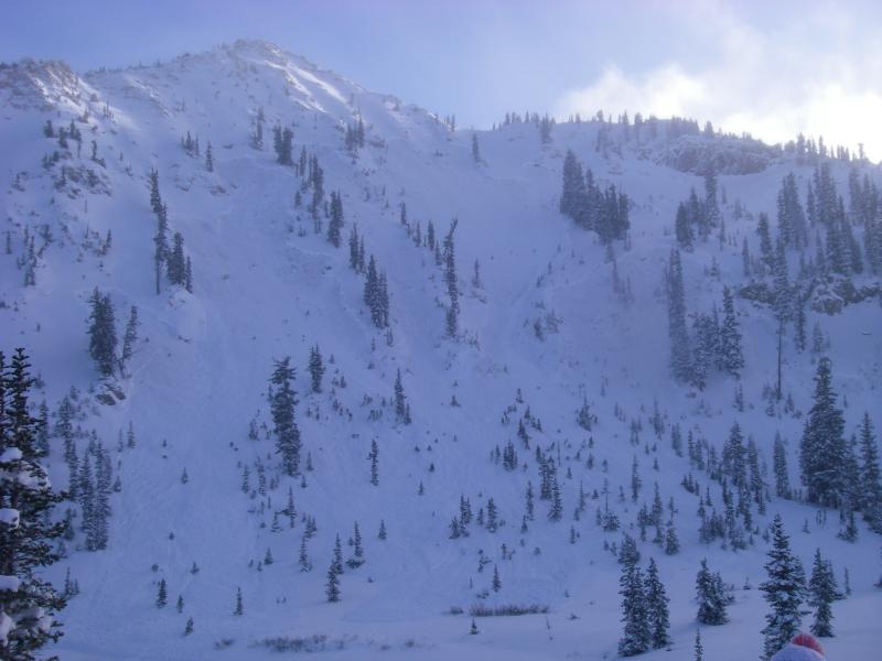
recent activity The weak facets on the ground were active as expected yesterday, but I didn’t expect the shallow layer to be able to connect across terrain features as wide as the huge remotely triggered slide on north facing Sunset – a ¼ mile wide (10,400’, upper Big Cottonwood). There were 4 other slides breaking to the ground on the facets, 3 remotely triggered, with a person carried in 4th. They were 60’ to 100’ wide, all on northerly facing slopes, at 9700’ and above. (Upper Days, Patsy Marly, Sunset/Rocky point. Check out the details in “All The Good Stuff” ). Explosive control work at the Little Cottonwood resorts produced similar results of large avalanches breaking near the ground. |
Avalanche Problem 1over the next 24 hours
| type | aspect/elevation | characteristics |
|---|
 |
Above 8,500 ft.
7,000-8,500 ft.
Below 7,000 ft.
|
|
|
description
Yesterday’s “in your face” avalanche activity presents a very clear pattern – all the north, northeasterly and northwesterly facing upper elevation slopes are suspect. The Ogden area mountains do have this same layer of weak, sugary old snow from October on the ground, and the upper elevation, shady slopes are suspect. Slides 1 to 3 feet deep could be triggered remotely from a distance and from below, or by the third person on a slope, and will take out the entire snowpack to the ground. Widespread collapsing, or whumphing noises, are a huge warning sign that you are in an area with this old snow weak layer. This facet layer may not be as sensitive in the Ogden area mountains because they didn't receive as much snow. |

Avalanche Problem 2over the next 24 hours
| type | aspect/elevation | characteristics |
|---|
 |


Above 8,500 ft.
7,000-8,500 ft.
Below 7,000 ft.
|
|
|
description
The strong winds over the past 3 days have blown from south through northwest, and snow drifts can be found on both sides of the ridgelines, and cross loaded along sub ridges and gully walls. These old snow drifts will be more stubborn today, but can still be triggered by a person. |

 |
weather High pressure building in will be interrupted by a very weak disturbance that will bring increasing clouds this afternoon, with a few snow flurries possible tonight. Winds today will shift to the southwest, and continue to decrease, averaging less than 15 mph at most locations. Temperatures today will warm into the upper teens to mid twenties, with lows tonight in the 10 to 15 degree range. This quiet weather pattern will continue through mid week, with gradually warming temperatures and occasional clouds. The next chance for snow will be late Friday or early Saturday, with only minimal accumulations expected. |
| general annoucements If you trigger an avalanche in the backcountry - especially if you are adjacent to a ski area – please call the following teams to alert them to the slide and whether anyone is missing or not. Rescue teams can be exposed to significant hazard when responding to avalanches, and do not want to do so when unneeded. Thanks. Salt Lake and Park City – Alta Central (801-742-2033) Ogden – Snowbasin Patrol Dispatch (801-620-1017) Provo – Sundance Patrol Dispatch (801-223-4150) Dawn Patrol Forecast Hotline, updated by 05:30: 888-999-4019 option 8. Twitter Updates for your mobile phone Daily observations are frequently posted by 10 pm each evening. Subscribe to the daily avalanche advisory e-mail click HERE. UDOT canyon closures UDOT at (801) 975-4838 Wasatch Powderbird Guides does daily updates about where they'll be operating on this blog http://powderbird.blogspot.com/ . Remember your information can save lives. If you see anything we should know about, please participate in the creation of our own community avalanche advisory by submitting snow and avalanche conditions. You can also call us at 801-524-5304 or 800-662-4140, or email by clicking HERE Donate to your favorite non-profit –The Friends of the Utah Avalanche Center. The UAC depends on contributions from users like you to support our work. We will update this forecast tomorrow morning. Thanks for calling. |