

| Advisory: Ogden Area Mountains | Issued by Bruce Tremper for November 8, 2012 - 6:23am |
|---|


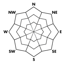
Above 8,500 ft.
7,000-8,500 ft.
Below 7,000 ft.
|
bottom line Old snow left over from our last storm has mostly melted and there is still about 6 inches to a foot of stable snow on the upper elevation, northerly-facing slopes. The expected storm this weekend should bond well to the bare ground but it may produce soft slabs on the pre-existing snow from the last storm especially on upper elevation, northerly-facing slopes.
|
 |
special announcement Welcome to the new look of the avalanche advisory. This past summer we had a series of meetings and negotiated a unified look-and-feel of the avalanche advisories and web pages for other avalanche centers in this reagion including Jackson, Wyoming, Sun Valley and the Sierra Avalanche Center. Eventually all these sites should look very similar and the plan is for Colorado to join the look next winter. In another week or two we expect to have two viewing choices for the advisory page--this basic view and the "advanced" view most are familiar with from last season with colored danger ratings in the aspect-elevation diagram. We are still in the process of transferring the pages and content from our old website to the new site, so be patient. We are also tweaking the look and design so you may notice some changes. When everything is finished, it should all be pretty cool. |
 |
current conditions Despite 2-3 feet of snow from our last storm, most of the snow has melted away in the Ogden area mountains but you can still find about 6 inches to a foot of settled snow on the upper elevation, northwest through northeast facing slopes. |
| type | aspect/elevation | characteristics |
|---|
 |


Above 8,500 ft.
7,000-8,500 ft.
Below 7,000 ft.
|
|
|
description
What little old snow left over from the last storm is starting to facet, so it may be a slippery layer for the expected snowstorm Friday and Saturday. There is about 6 inches to a foot of old snow on the northerly-facing slopes above about 8,000'. With this weekend's storm, we expect the new snow to bond well to the bare ground but there may be some soft slab avalanches sliding on the more slippery layer of old snow. |
 |
weather Enjoy Thursday while you can because a strong cold front is expected on Friday with dramatically colder temperatures and a foot or two of new snow in the mountains by Sunday. It should come in waves with the first wave on Friday and some periods of lake effect squalls through Sunday. The latest forecast is for a foot or two of new snow. You can get more details on the Cottonwood Canyon forecast or the Snow Page. |