

| Advisory: Logan Area Mountains | Issued by Toby Weed for February 15, 2013 - 6:24am |
|---|


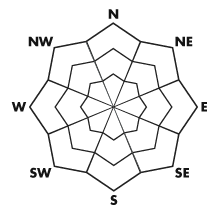
Above 8,500 ft.
7,000-8,500 ft.
5,000-7,000 ft.
|
bottom line There is a MODERATE (or level 2) danger in the backcountry. Heightened avalanche conditions exist, and you could trigger dangerous stiff wind slab avalanches or cornice falls in terrain exposed to drifting from northwest winds. Although becoming more unlikely, you still might trigger large and dangerous persistent slab avalanches on isolated slopes with poor snow structure and recent wind deposits. Loose wet avalanches are possible on sunny slopes with saturated surface snow. Evaluate the snow and terrain carefully, and continue to use safe travel protocols,
|
 |
current conditions In the past couple days, we've seen moist clouds depositing fine-grained rime at upper elevations and sustained northwest winds drifting last weekend's light snow around in exposed terrain. Even so, you'll still be able to find nice fast shallow powder conditions in sheltered areas that didn't get baked in the sun yesterday. The Tony Grove Snotel at 8400' reports 1 inch of new snow from yesterday afternoon. It's 19 degrees, there is 58 inches of total snow, and 64% of average water content for the date. It's 13 degrees at the CSI Logan Peak weather station, and overnight northwest wind speeds diminished into the single digits overnight. |
 |
recent activity No new avalanches were reported in the Logan Area Mountains since early last week. Here's a link to our updated Avalanche List.
|
| type | aspect/elevation | characteristics |
|---|
 |


Above 8,500 ft.
7,000-8,500 ft.
5,000-7,000 ft.
|
|
|
description
Expect to find stiff wind slabs and treacherous cornices in terrain exposed to drifting from northwest winds. Avoid stiffer wind deposited snow on steep slopes, and watch for potential wind slabs in and around terrain features like sub-ridges, gullies, and cliff bands. Wind slabs are drifts that can appear chalky, rounded or bulging, and can sound hollow or drum-like. Be cautious along the ridges, since cornices might break further back than expected and cornice falls could trigger dangerous wind slab avalanches on slopes below.
|
| type | aspect/elevation | characteristics |
|---|
 |


Above 8,500 ft.
7,000-8,500 ft.
5,000-7,000 ft.
|
|
|
description
A new load from recent drifting might reactivate the early January weak layer in some isolated areas. I've been finding very weak January faceted snow in many areas, but my recent tests have shown this layer to be rather non-reactive. There may be some exceptions, and avalanches might fail 1 to 2 feet deep on weak faceted snow created during the drawn-out January high pressure systems. I'm also keeping a close eye on the small grained facet/rime layer that was on the surface during the cold early February high pressure and is now only shallowly buried by the recent accumulations. Steep upper elevation slopes with generally shallow and weak snow cover and recent wind loads are the most suspect today. Although the chances are slim, you might trigger dangerous persistent slab avalanches in some areas remotely, from a distance or worse, from below. |
| type | aspect/elevation | characteristics |
|---|
 |


Above 8,500 ft.
7,000-8,500 ft.
5,000-7,000 ft.
|
|
|
description
Loose wet avalanches are possible on lower and mid elevation sunny slopes, especially if the sun comes out earlier or temperatures rise further than expected. Roller balls, pin-wheels, and sluffs are signs the the saturated snow on steep slopes is prone to avalanche. |
 |
weather Clearing and high pressure conditions will develop today, but only persist for the first part of the weekend. Expect skies to clear today in the mountains, with 9000' high temperatures around 29 degrees and winds shifting around from the southwest this afternoon. We'll see clear skies overnight and tomorrow, with south and even southeast winds and mild temperatures. Mountain temperatures will likely rise a few degrees above freezing tomorrow. Clouds will increase tomorrow afternoon, and we'll see clouds, wind, and little snow on Sunday. The next chance for significant snow comes in the middle of next week, with what at this point looks like a substantially larger and colder system pushing into the Great Basin Tuesday.... Check out the new Logan Mountain Weather page...
|
| general annoucements The infamous annual CROWBAR backcountry ski race is scheduled for Saturday, February 23 in Beaver Creek Canyon. Click HERE for more details... For a printer friendly version of this advisory click HERE Remember your information from the backcountry can save lives. If you see or trigger an avalanche, or see anything else we should know about, please send us your snow and avalanche observations. You can also call us at 801-524-5304 or email by clicking HERE. In the Logan Area you can contact Toby Weed directly at 435-757-7578. I will update this advisory on Monday, Wednesday, Friday, and Saturday mornings by around 7:30... This advisory is produced by the U.S.D.A. Forest Service, which is solely responsible for its content. It describes only general avalanche conditions and local variations always exist. |