Forecast for the Salt Lake Area Mountains

Friday morning, January 2, 2026
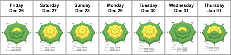
With heavy new snow and moderate winds, avalanche danger has risen to CONSIDERABLE on W-N-E facing slopes above 9,500 feet. Hard slab avalanches could be triggered, breaking 1–3+ feet deep and up to 100 feet wide on a persistent weak layer, particularly on steep, rocky slopes loaded by wind. On remaining upper elevation aspects and mid-elevation slopes facing W-N-E, danger is MODERATE.
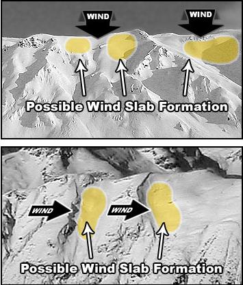
Watch for blowing and drifting snow today. Avalanches initially triggered in wind-drifted snow could step down to deeper weak layers. Evaluate snow and terrain carefully, make conservative decisions, and avoid slopes steeper than 30 degrees with poor snow structure. Lower angled slopes offer safer options while still providing good riding.
A slick rain crust is creating hazardous slide-for-life conditions. Exercise extra caution on steep, exposed terrain where self-arrest would be difficult.