Forecast for the Salt Lake Area Mountains

Nikki Champion
Issued by Nikki Champion for
Friday, March 15, 2024
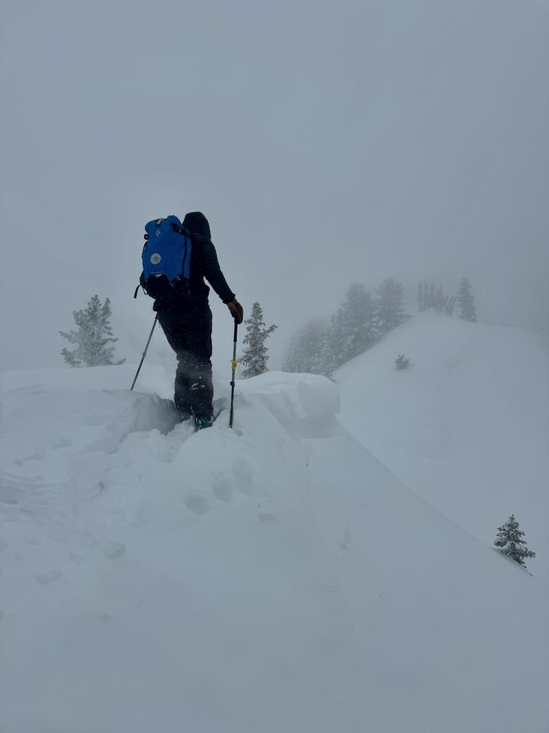
The avalanche danger is CONSIDERABLE at upper elevation terrain facing northwest, through west, through southeast, where easterly winds will continue to form unstable slabs of wind-drifted snow throughout the day. The remaining upper and all mid-elevation slopes have a MODERATE danger, where periods of heavy snowfall and elevated winds have created heightened avalanche conditions today.
Outside the wind zone, both loose snow and slab avalanches may be possible within the different layers of new snow from the past few days. The elevated winds should keep the wet snow at bay, but when the strong sun comes out, there could be some rollerballs, pinwheels, and small point releases.
The avalanche danger is LOW at low elevations.
Easterly winds are unusual for the Wasatch, and with unusual weather patterns come unusual loading patterns. Pay attention to changing or abnormal conditions throughout the day. Making conservative choices isn't a bad idea when there is uncertainty.
Low
Moderate
Considerable
High
Extreme
Learn how to read the forecast here
Special Announcements
Support the UAC website rebuild by donating to our Spring Campaign. Save lives by making a donation today!
Weather and Snow
This morning, the downslope winds are cranking in the valley, and skies are finally clear in the mountains. The strong cold front made its way out of Northern Utah as an easterly flow set up over the area. Final storm totals are between 10 to 24 inches of snow (containing 0.9 to 1.95 inches of water), favoring upper Little Cottonwood. Temperatures are in the upper teens to low 20s °F, and winds have remained easterly, gusting near 50 mph at 10,500'. Currently, mid-elevation ridgelines are reporting higher wind speeds than upper elevations.
Today, dry conditions will persist over the mountains of the north as the storm system brings most of its precipitation to southern Utah. This will result in mostly sunny skies and elevated easterly winds, with peak wind speeds expected this morning before beginning to decrease throughout the day. Expect gusts up to 35 mph along exposed ridges and peaks at mid-elevations, and gusts up to 40 mph at upper elevations. Temperatures will climb into the mid-30s and low 40s °F.
Outlook: In northern Utah, expect dry and warmer conditions due to a ridge in the Pacific Northwest. Southern Utah may see scattered showers with temperatures near normal. By next Thursday, a low-pressure system over the desert southwest will move east, but uncertainty remains about subsequent weather patterns. Expect scattered showers in southern Utah, while northern Utah stays warm and clear. Towards the end of the week, there's a chance of a pattern change with either more precipitation or another ridge. Time will tell.

With all of the fresh and drifted snow, travel and riding conditions should be excellent today. Solar aspects may have a thin crust on the surface from bursts of sun yesterday, but any polar aspect should still be holding cold dry snow. Seize the opportunity while you can, as winds have shifted more easterly and will continue into the weekend; easterly winds are notorious for wreaking havoc on the Wasatch.
Recent Avalanches
While not as busy as Wednesday, a few more reports of sensitive soft slabs within both the new snow and wind-drifted snow were observed in the backcountry yesterday. Over the past two days, most of these avalanches were D1-2 in size, ranging between 15-50 feet wide and running 15-100 feet long. On the solar aspects, most of these avalanches failed 10-18 inches deep on the firm new snow, old snow interface. Outside of the solar aspects, some of these avalanches failed shallower in the snowpack within a density change within the snow, the wind-drifted snow, or on top of the new snow old snow interface.
Ski resorts reported elevated winds, some crossloading on west-facing slopes, and similar soft slabs.
Ad
Avalanche Problem #1
Wind Drifted Snow
Type
Location
Likelihood
Size
Description
The easterly flow, combined with soft snow available for transport, will continue to form soft slabs of wind-drifted snow up to 1-3 feet deep. While winds will decrease throughout the day, it won't take much wind to move the soft snow around and these slabs can quickly grow and become more cohesive. They will be most pronounced on lee-ward-facing slopes, but high winds can load any aspect due to swirling and changing wind directions in the mountains.
Look for signs of wind-drifted snow such as texture and pillow-shaped features. However, with a few inches of recent snow, identifying these features may be more challenging. Consequently, approach steep terrain features that could accumulate drifting snow cautiously, as triggering a fresh soft slab is possible.

Easterly wind patterns are uncommon for Northern Utah and tend to create challenging avalanche conditions. Last year, during a similar easterly weather pattern, forecaster Drew Hardesty remarked, "Nothing good comes from an east wind." While the impact of these easterly winds has been relatively mild so far, continue to pay attention to changing conditions while traveling in the backcountry today.
Photo of drifting snow, poor visibility and a small cornice. (D. Kelly)
CORNICES are extremely hazardous. Limit your exposure to ridgelines near cornices and slopes below them. A cornice fall could trigger a slab of wind-drifted snow below.
Avalanche Problem #2
New Snow
Type
Location
Likelihood
Size
Description
Most of the instabilities within the storm snow should continue to settle out today. However, outside of the wind zone, you may still find sensitive soft slabs of new snow and fast, long-running sluffs on all aspects.
The elevated easterly winds should keep the snow surface cooler today. However, when the strong sun emerges for the first time following this storm cycle and hits the cold snow, we may see some pinwheels, rollerballs, and small point releases. If the snow surface begins to dampen or signs of wet snow appear on solar aspects, it could be a good idea to change to colder aspects.
Any type of avalanche today could entrain a lot more snow than expected. Watch for terrain traps where a smaller avalanche could bury a person.
General Announcements
This information does not apply to developed ski areas or highways where avalanche control is normally done. This forecast is from the U.S.D.A. Forest Service, which is solely responsible for its content. This forecast describes general avalanche conditions and local variations always occur.