Forecast for the Uintas Area Mountains

Issued by Craig Gordon for
Saturday, April 6, 2024
Saturday, April 6, 2024
A solid looking shot of snow is headed our way and the avy danger rises accordingly throughout the day-
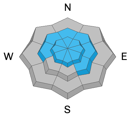
In the wind zone, above treeline, you'll find MODERATE avalanche danger around the dial. Shallow, fresh drifts materialized with yesterday's storm and human triggered avalanches are POSSIBLE on steep, leeward, wind drifted slopes. As today's storm develops and new snow begins stacking up, I suspect drifts begin creeping into mid elevation terrain as well.
Lower elevation slopes, like those around our trailheads, offer generally LOW avalanche danger and human triggered slides are UNLIKELY.

Low
Moderate
Considerable
High
Extreme
Learn how to read the forecast here