


Forecast for the Uintas Area Mountains

Issued by Craig Gordon on
Tuesday morning, February 27, 2024
Tuesday morning, February 27, 2024
While we slept, a storm quietly slid into the region, bumping the avy danger up a notch-
At and above treeline you'll find CONSIDERABLE avalanche danger. Human triggered avalanches are LIKELY around the dial, especially in the wind-zone where you'll encounter fresh drifts reactive to our additional weight. Becoming more the exception than the rule, we can still trigger a deep, dangerous slide that breaks to the ground in steep, rocky terrain facing the north half of the compass.
Storm snow and fresh drifts dot the lower elevation landscape where you'll find MODERATE avalanche danger. Human triggered avalanches are possible on steep, wind drifted slopes.
Here's your exit strategy-
Not feelin' it today? Well then, you came to the right place, cause the Uintas offer tons of mellow terrain less than 30 degrees in steepness where you'll find LOW avalanche danger with human triggered avalanches UNLIKELY.

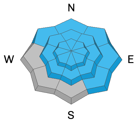
Low
Moderate
Considerable
High
Extreme
Learn how to read the forecast here
 Special Announcements
We are seeking a passionate individual to join us as Executive Director of the nonprofit Utah Avalanche Center. Click here for more information.
 Weather and Snow
Nowcast- Cold air sweeping through the City of Salt collided with a nice slug of moisture late last night, and that combo delivered a slightly denser than average, yet evenly distributed 8" of snow with about .60" H2O. At o'dark thirty, temperatures are diving into the teens and single digits as our mountains wring out even more snow from a thick band of clouds overhead. The same winds that usher in cold air, also rake the peaks where they blow in the 30's and 40's from the west and northwest. Riding and turning conditions are gonna be a bit rugged near the ridges, but hang down low in sheltered terrain and I suspect you'll be rewarded with cold, creamy snow.
Forecast- Snow showers begin tapering off around sunrise, but I bet we pick up a couple more inches before the storm shuts down. Cold air filtering into the area keeps temperatures at bay and they don't vary much from where we're at this morning. West and northwest winds blow in the 40's and 50's near the high peaks, delivering burley wind chill values. Overnight low temperatures crater into the single digits under clearing skies.
Futurecast- Look for a brilliant midweek period with bright sunshine and much more reasonable winds, before it all reloads again for later in the week. Deets are coming together and I'll have a solid finger on the pulse in the next day or two.

Whole lotta winter love from our good friends at the NWS offering a myriad of watches and warnings
SNOTEL sites in the Uintas, and much are Utah, report snow water equivalent amounts of 104%-146% of the 30 year median.
 Recent Avalanches
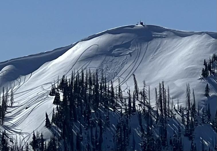
From Sunday... not exactly breaking news, but a great image of a sledder triggering a deep wind drift near Currant Creek Peak.
In addition - on Saturday my crew and I in upper Chalk Creek remotely triggered a large avalanche that broke to the ground, up to 10 feet deep and 350 feet wide. We triggered the nasty slide from a distance, a few football fields away, on an adjacent low angle slope.
For all Uinta observations and recent avalanche activity click HERE.

Avalanche Problem #1
Persistent Weak Layer
Type
Location
Likelihood
Size
Description
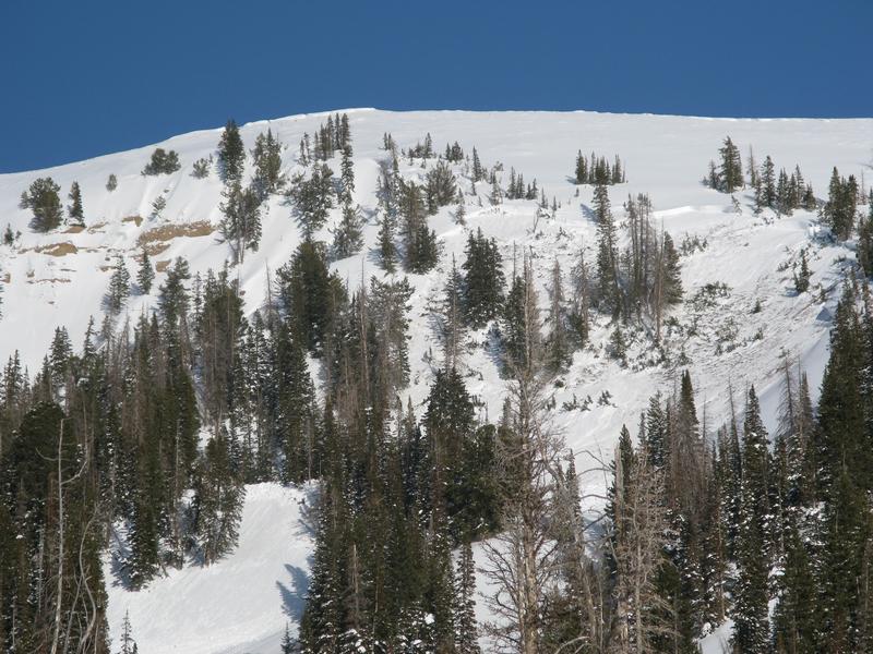
Chad and his crew were skiing in upper Weber Canyon this weekend where they described it as a "tale of two snowpacks". Most areas had deep snow until they walked onto a slope with just over 3 feet of total snow and they triggered the largest collapse they had every experienced with cracks shooting 150 feet from them (viddy above).
The odds of triggering an avalanche breaking near the ground on an old persistent weak layer are drastically different from one slope to the next, so ya gotta give this some thought. While many slopes offer a deep and relatively strong snowpack where triggering a monster slide is unlikely, other slopes, especially those that have remained thin and weak this season are likely suspects.

To avoid this avalanche dragon, you'll have to be a detective and identity terrain with shallow snow. Notice the rocky area in the left side of the photo of this avalanche. Steep rocky zones are likely trigger points because they offer a much thinner snowpack.
Avalanche Problem #2
Wind Drifted Snow
Type
Location

Likelihood
Size
Description
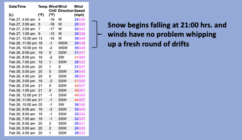
A 24 hour data dump from Windy Peak (10,662') illustrates recent wind and temperature trends.
Winds have been all over the map and have no problem whipping up a fresh round of drifts reactive to our additional weight. Found mostly on the leeward side of ridges and around terrain features like chutes and gullies, I wouldn't be too surprised to find loading a little lower downslope than we usually expect to see. In any case... lose the wind and you lose the problem. Simply dump some elevation and steer your snow vehicle towards mid elevation wind sheltered terrain where you'll find deep, creamy snow.
Avalanche Problem #3
New Snow
Type
Location
Likelihood
Size
Description
February's storm track is the gift that keeps giving, stacking up multiple feet of snow on top of several weak layers. The storm snow is settling and becoming a cohesive slab that helps tie things together. Now, take that combo onto a steep slope and the recipe for a slab avalanche is coming together. The only missing ingredient is us.
Here's where it gets tricky... shaded slopes harbor buried surface hoar now buried about three feet deep. And while it hasn't produced avalanches, it'll be something to keep and eye on.
On the south half of the compass, sunny slopes have a thin layer of facets on top of a crust that was buried 12"-18" deep on Valentine's day. This layer delivered two avalanches in Mill Hollow last Tuesday and Wednesday. In American Fork Canyon on Thursday, this layer produced a huge avalanche and a close call.
Additional Information
The Uinta weather station network was upgraded this summer and all that real-time info is found HERE. Simply click on "western Uinta" tab and then "weather stations" tab.
We are always looking for snow and avalanche observations or just general riding conditions. So... if you see something, say something. You can reach me directly at [email protected] or 801-231-2170.
Also, if you're looking for more avy education opportunities for yourself, your crew, or your club please don't hesitate to reach out to me and we'll find a presentation, class, or clinic for ya!
General Announcements
Issued at 0400 on Tuesday, February 27th this forecast will be updated by 0400 Wednesday, February 28th, 2024.
This forecast is from the U.S.D.A. Forest Service, which is solely responsible for its content. This forecast describes general avalanche conditions and local variations always occur.