Forecast for the Logan Area Mountains

Toby Weed
Issued by Toby Weed for
Tuesday, March 26, 2024
The snow is stable, and the avalanche danger is LOW. This afternoon, rapid or more-than-expected snow accumulation and/or an increase in winds could elevate avalanche conditions in some upper-elevation terrain. People might trigger small soft slab, loose, or wet avalanches of storm snow on slopes steeper than 30°.

Use normal caution and increased situational awareness in the backcountry. With shallow new snow, the best riding conditions are found in low-angled terrain.
Low
Moderate
Considerable
High
Extreme
Learn how to read the forecast here
Special Announcements
Donate today to help us rebuild our website backend platform to ensure uninterrupted access to avalanche information and the ongoing security of the website and the data stored on the site.
Weather and Snow
In the past few days, the mountains picked up about 5-6" of new snow on upper-elevation slopes. Around 2 or 3 inches fell overnight; more is expected to accumulate today, with 3 to 5 inches possibly up high.
A few inches of fresh snow has insulated the soft and soggy old snow that was on the surface during last week's warm spell, and you sink ankle-deep into it when you step off your sled or out of your skis. Today's best riding conditions will be on lower-angled slopes where you won't feel this moist, spongy snow or soft melt-freeze crust as much.

The Tony Grove Lake Snotel at 8400' reports 3 inches of new snow overnight. It's 19° F and there is 97 inches of total snow containing 116% of normal snow water equivalent. On Logan Peak, winds are blowing from the west-northwest around 16 mph, and it's 15° F at 9700' in elevation.
At our new Paris Peak weather station at 9500', it's 13°F, and the wind is blowing from the west at 13 mph. It's 18° F at the new Card Canyon weather station at 8800', with 85 inches of total snow on the ground.

It'll be mostly cloudy today with snow likely in the afternoon and 3 to 5 inches of accumulation possible at upper elevations. The snow could be heavy at times, and some thunder is also possible. High temperatures at 8500' should reach around 29° F, and winds will blow from the west, increasing in the afternoon to 16 to 21 mph.
Tonight, temperatures will drop into the teens again, winds blowing from the west-northwest 13 to 21 mph, with wind chill values near 0° F. Snow showers are likely, with 1 to 3 inches of accumulation possible.
Tomorrow will be partly sunny, with high temperatures near 34° F and winds from the west-southwest 13 to 21 mph.
Snow could fall heavily at times on Thursday, with 4 to 8 inches possible, and it looks like more is on tap for the weekend, so you'll want to keep your extra goggles dry.
Recent Avalanches
Sunday, riders unintentionally triggered a handful of small soft wind slabs running on the storm interface in the Tony Grove Area in generally north-facing terrain at upper elevations. The largest was reported to be about 6" deep and 70' wide, occurring at around 8800' in elevation. See report.
Check out all local observations and avalanches HERE.
Ad
Avalanche Problem #1
Normal Caution
Type
Location
Likelihood
Size
Description
Today, periods of heavy snow, increasing winds, and/or more-than-expected accumulations could elevate avalanche conditions. People might trigger small soft slab or loose avalanches of storm snow on slopes steeper than 30°. Avalanches could fail on a weak layer within the new snow.
  • In drifted terrain, watch for cracking and other obvious signs of instability, like recent avalanches on similar slopes.
  • In steep terrain, you could trigger fast-moving sluffs of new snow.
  • In steep, sunny terrain (if there's a break in the clouds), you might trigger small wet avalanches, entraining a few inches of heavy, melt-saturated new snow.
  • Small soft slab, loose, or wet avalanches in steep terrain could carry you into trees or other terrain traps below.

*** Hot tip: You will find better riding conditions in lower-angled terrain where the shallow new snow keeps you off the old crusty or spongy surface.
Additional Information
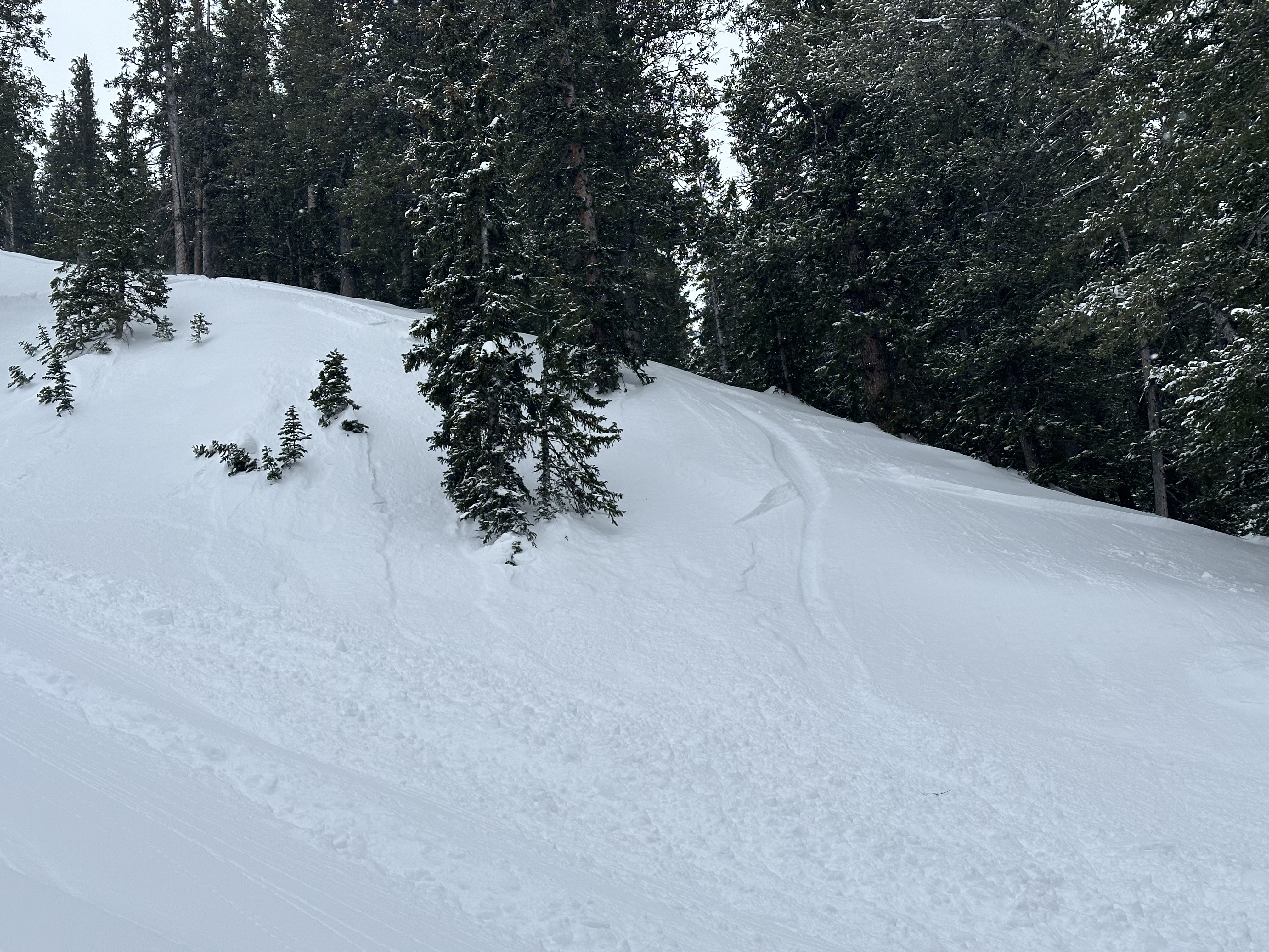
Sunday, riders triggered a handful of small soft wind slab avalanches and sluffs of new snow that ran fast and picked up decent piles of snow. Avalanches like these could be a problem in steep terrain if they carry you into trees or other terrain traps like gullys, sinks, or rock outcroppings.
General Announcements
-National Forest Winter Recreation Travel Maps show where it's open to ride: UWCNF Logan, Ogden LRD Tony Grove, Franklin Basin CTNF Montpelier
-Listen to your very own Logan Zone avalanche forecasters on the UAC Podcast HERE.
-Read Toby's blog about wind, drifting, and avalanches HERE.
-Sign up for forecast region-specific text message alerts. You will receive messages about changing avalanche conditions, watches, and warnings...HERE.
-For all questions on forecasts, education, Know Before You Go, events, online purchases, or fundraising, call 801-365-5522.
-To report an avalanche or submit an observation from the backcountry, go HERE.
-Come practice companion rescue at the Franklin Basin TH Beacon Training Park. It's free and open to everyone. For easy user instructions, go HERE.
-We will update this forecast tomorrow by 7:30 AM.
This forecast is from the U.S.D.A. Forest Service, which is solely responsible for its content. This forecast describes general avalanche conditions, and local variations always occur.