BOTTOM LINE
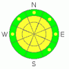
Danger by aspect and elevation on slopes approaching 35° or steeper.
(click HERE for tomorrow's danger rating)
|

Danger Rose Tutorial
|
The avalanche danger is on the upper end of MODERATE today. This means human triggered avalanches are possible and I'd be surprised if we don't hear about any after the day is done. The most likely places to trigger these are on mid to upper elevation slopes that face west through north through southeast. The danger is low in areas that had little or no snow prior to this storm. Keep in mind that the danger could rise if we experience a period of heavy snowfall during the day. Strong avalanche assessment skills are recommended for travel in the upper elevations today. |
|
|
CURRENT CONDITIONS |

|
This well needed storm produced a good shot of snow but maybe not quite as much as we'd all hoped. (Analysis) A few more inches trickled in overnight with Alta measuring a total of around a foot of snow that contained about 3/4 of an inch of water. Backcountry observers were reporting an average of 6 to 10 inches at varying locations through the Central Wasatch. Gusty winds on Saturday did transport snow into deeper drifts along the lee sides of the upper ridges giving the snow a thicker feel. Temperatures are chilly this morning with many locations in the single digits or below zero along the highest peaks. Winds are fairly light in the 10 to 15 mph range gusting into the 20s along the upper ridges. |
|
|
RECENT ACTIVITY |

|
The storm teased us up to the brink but really didn't get the avalanche activity going gang busters. Numerous indicators were there including, the most obvious, a few human triggered avalanches. Most notable were a couple of slides triggered in West Monitor which demonstrate the two patterns emerging with our weak snowpack structure. (Photos) The first slide was triggered remotely from about 30 feet away on an east southeast aspect which failed on facets above the most recent crust. It ran on top of the crust and was around 8 inches deep and 100 feet wide running around 350 feet vertical. The second was on an east northeast aspect triggered from skiers stomping a cornice and initially failed on the same faceted snow above the crust but reportedly broke through the crust into the faceted weak snow below it. It was also around 100 feet wide and averaged 1 to 3 feet deep and reportedly a bit deeper at the max.
UDOT snow safety in Big Cottonwood was able to get a north facing slope to collapse with shooting cracks "spiderwebbing" the slope. UDOT in Little Cottonwood found a small pocket about 15 feet wide that ran above the crust. (Photos) Drew was able to demonstrate to an avalanche class an ECT test propagating upon isolation only to not be able to duplicate the results. He consequently got the entire slope to collapse after they were done monkeying around. Do you need any more testing then that? |
|
|
THREAT #1 |

|
| WHERE |
PROBABILITY |
SIZE |
TREND |
|
|
|
|
| |
|
|
Over the next
24
hours.
|
|
|
The main concern for today is triggering an avalanche that breaks into weak facet snow above the most recent crust or one that breaks into weak faceted snow below the crust. Obviously, you're most likely to find these in upper elevation terrain that had pre-existing snow prior to this storm. Areas that were recently loaded from winds on Saturday will also be more prone to avalanching. |
|
|
MOUNTAIN WEATHER |

|
Moisture and unstable air will linger through the day with snow showers possible at times. Accumulations will be in the 1 to 5 inch range. Temperatures will be cold in the low teens with northwest ridgetop winds in the 10 mph range gusting into the 20s and shifting more west and southwest as the day progresses. Chances for snow decrease this afternoon. Looking ahead, we'll have a few periods during the week where we could pick up some more snow with the next one Monday into Tuesday. Check back on our Wasatch Weather Forecast after about noon for more details. |
|
|
GENERAL ANNOUNCEMENTS |
If you want to get this avalanche advisory e-mailed to you daily click HERE.
UDOT highway avalanche control work info can be found by calling (801) 975-4838. Our statewide toll free line is 1-888-999-4019 (early morning, option 8).
The UAC depends on contributions from users like you to support our work. To find out more about how you can support our efforts to continue providing the avalanche forecasting and education that you expect please visit our Friends page.
If you’re getting out and see anything we should know about please let us know. You can leave a message at (801) 524-5304 or 1-800-662-4140, or email us at uac@utahavalanchecenter.org. (Fax 801-524-6301).
The information in this advisory is from the U.S. Forest Service, which is solely responsible for its content. This advisory describes general avalanche conditions and local variations always occur.
Bruce Tremper will update this forecast by 7:30 on Monday morning. |
|
|
This information does not apply to developed ski areas or highways where avalanche control is normally done. This advisory is from the U.S.D.A. Forest Service, which is solely responsible for its content. This advisory describes general avalanche conditions and local variations always occur. |
|
This advisory provided by the USDA Forest Service, in partnership with:
The Friends of the Utah Avalanche Center, Utah Division of State Parks and Recreation, Utah Division of Emergency Management, Salt Lake County, Salt Lake Unified Fire Authority and the friends of the La Sal Avalanche Center. See our Sponsors Page for a complete list. |
