I have a favorite spot in Grizzly Gulch that I go to 4-6 times in the early season to monitor the temporal variability of the snowpack. This is on a northwest aspect at about 9500'. It is easy for me to get in to and it allows me to observe the changes in the snowpack on the same slope over a period of time. I returned today and contrasted results from the last time I was in there on Nov 26 (Wednesday before Thanksgiving.)
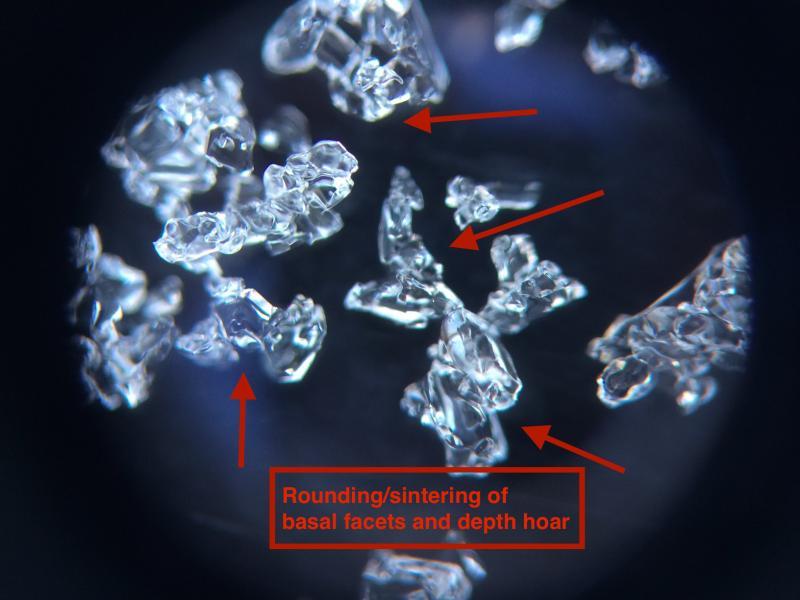
Extended column tests on 11/26 were yielding full propagation, Q1 failures (ECTP6 - ECTP17) failing in a 30 cm layer of basal facets. Different story today with ECTX, and the 30 cm layer had compressed to 20 cms, increasing in hand hardness going from F+ to 4F+. Looking at the faceted crystals down at the ground also showed evidence of rounding and sintering. Clearly continuing to move in the right direction in deeper snowpack areas.
Due to another grim week of high pressure, two concerns going forward:
1. Thin snowpack areas will continue to weaken and facet. On 12/6 I was finding very weak snow on an upper elevation northerly slope in BCC.
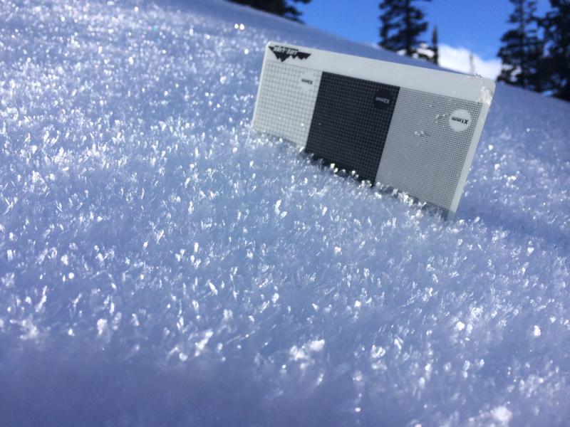
2. Snow surface is weakening with widepread surface hoar and near surface facets. On some steeper slopes I was able to ski cut and get the weak snow to sluff easily on the dense slab underneath. This setup could provide a weak layer/bed surface for any new load of snow.
Contrasting pit profiles from 11/26 and 12/07


Photo of (1) basal facets on 12/07 indicating rounding and sintering (affectionately called "necking" of adjacent crystals) and (2) widespread surface hoar (5-10 mm).


Am still calling the hazard Moderate from what I saw on Saturday where I was getting ECTPV results in thinner snowpack areas where the basal facets were still quite weak. It is unlikely there is much of this type snowpack around however, and most of the central Wasatch currently has a Low danger. Could be quite a good week for alpine tours.


