

Forecast for the Uintas Area Mountains

Issued by Craig Gordon on
Thursday morning, April 4, 2024
Thursday morning, April 4, 2024
Strong April sun pumps heat into the snow surface, but wind and cloud cover may help to temper its effect... not quite a slackline, but it'll be a balancing act none-the-less-
As temperatures soar and recent storm snow gets kissed by the sun and takes on heat, the avalanche danger rises to MODERATE around the dial, especially during the heat of the day. As the day wares on, human triggered avalanches are POSSIBLE on sustained steep slopes.

Low
Moderate
Considerable
High
Extreme
Learn how to read the forecast here
 Weather and Snow
Nowcast- High pressure shifts east this morning, opening the door to the warm before the storm. Winds blowing from the south began ramping into the 30's right around sunset Wednesday, and continue in that spirit at o'dark thirty this morning. From tip to tail, temperatures hover right around freezing and I think the powder party is temporarily on hold. However, a bad day on the snow is better than a good day organizing the garage and I bet there's a narrow window of supportability on low elevation south facing slopes, where you can squeak out a couple hours of corn harvest.
Forecast- The next storm is in the wings waiting to come online, but as it marches towards the Beehive State we'll have to endure a day of warm, windy weather, and I suspect some dust gets thrown into the mix as well. For today, look for mostly sunny skies with temperatures soaring into the 50's. Winds blowing from the south are gonna be obnoxious, gusting into the 40's and 50's near the high peaks. Overnight lows dip into the low 30's.
Futurecast- Clouds thicken Friday and a cold front delivers a couple inches of snow late in the day. A break is slated for Friday night, with another shot of snow on tap for a good portion of Saturday. I'm cautiously optimistic we stack up a foot of snow by early Sunday morning.
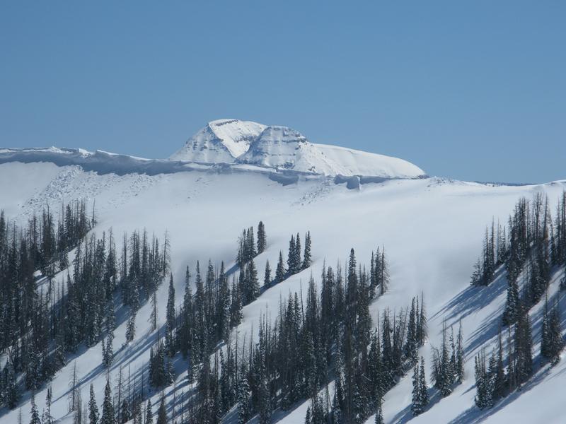
Guardians of the steep... Bald Mountain and Reids Peak keep a watchful eye on Upper Moffit Basin from afar.
The Uintas are fat and white. In fact, last weeks stormy weather stacked up nearly three feet of snow with over 4" of water at the Trial Lake SNOTEL
 Recent Avalanches
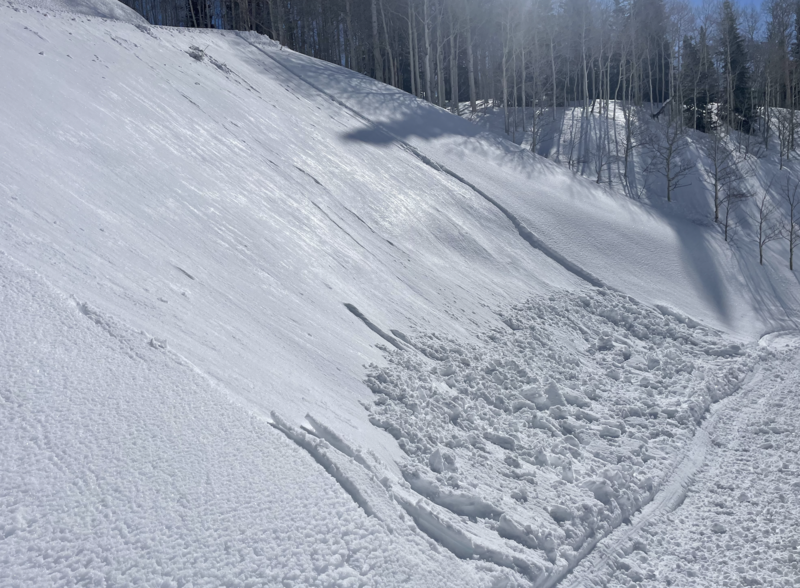
Yesterday's strong sunshine brought the weekend storm snow to life, resulting in shallow, damp slides, like this one above a road cut late in the afternoon.
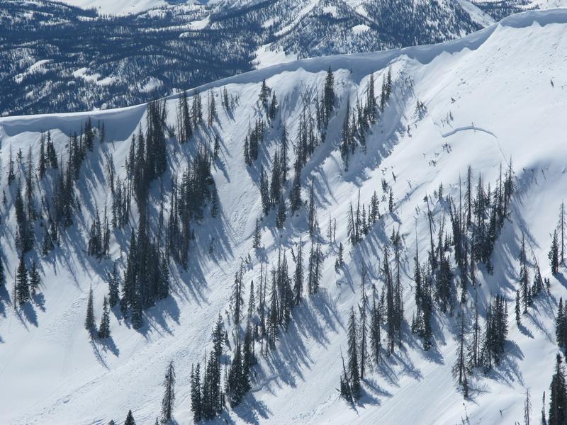
Yesterday, Trevor spotted this natural slide in Upper Moffit Basin from Sunday's strong wind and periods of intense snowfall.
For all Uinta observations and archived avalanche activity click HERE.

Avalanche Problem #1
Wet Snow
Type
Location

Likelihood
Size
Description
As the weekend storm snow continues heating up today, it'll react to intense April sun and begin shedding a few shallow layers of white paint on sustained, steep slopes. With a mixture of wind, clouds, and sun, I don't think the snow is coming unglued, but the best rule of thumb is to simply get off of and out from under steep terrain, especially during the heat of the day. In addition, think about your exit strategy and avoid terrain traps like gullies and road cuts where wet, manky, tree snapping debris can stack up very deeply.
Additional Information
The Uinta weather station network was upgraded this summer and all that real-time info is found HERE. Simply click on "western Uinta" tab and then "weather stations" tab.
We are always looking for snow and avalanche observations or just general riding conditions. So... if you see something, say something. You can reach me directly at [email protected] or 801-231-2170.
Also, if you're looking for more avy education opportunities for yourself, your crew, or your club please don't hesitate to reach out to me and we'll find a presentation, class, or clinic for ya!
General Announcements
Issued at 0330 on Wednesday, April 4th this forecast will be updated by 0700 Friday, April 5th, 2024.
This forecast is from the U.S.D.A. Forest Service, which is solely responsible for its content. This forecast describes general avalanche conditions and local variations always occur.