Forecast for the Uintas Area Mountains

Mark Staples
Issued by Mark Staples for
Monday, March 25, 2024
Today the avalanche danger is MODERATE above treeline where the main danger comes from slabs of wind drifted snow. You may find some of these wind slabs near treeline as well but fewer of them and they should be less sensitive. Near and below treeline today the danger is LOW.
The season for skiing the high peaks of the Uintas is upon us, but remember that going into more radical terrain means that even a very small avalanche can have severe consequences.
Low
Moderate
Considerable
High
Extreme
Learn how to read the forecast here
Special Announcements
Please help support the UAC rebuild our website backend platform to ensure the ongoing security of the website and the data stored on the site by donating to our spring campaign. Save lives by making a donation today!
Weather and Snow
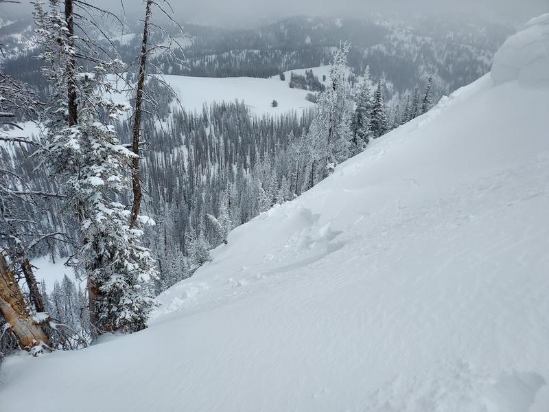
Since yesterday, an additional 2-3 inches of snow fell bringing the storm totals since Sunday evening to 6-8 inches of new snow (0.6-0.8" water).
This morning temperatures are in the teens F and winds from the north are blowing 6-15 mph with slightly higher gusts.
Today expect similar weather to yesterday with mostly cloudy skies with periods of snowfall that should deliver an inch or two of new snow. A low pressure trough with north winds will bring more cold air over Utah today keeping high temperatures in the 20s F. Winds will stay fairly light and slowly shift direction and blow from the west this afternoon.
The hard icy snow surface is slowly getting buried and conditions are improving. High, north-facing slopes before the storm started Sunday afternoon still had some old powder under a soft ice crust. Most other slopes had a more substantial ice crust.
A few more inches of snow should fall Tuesday afternoon, then a break and some sunshine Wednesday. Another area of low pressure will reach Utah Thursday bringing more snow through the weekend. It doesn't look there's a day with major snowfall, but there should be a similar pattern with a few inches each day. Building on top of the most recent snow, conditions could be quite nice by next weekend.
Recent Avalanches
Regular observer Mike J was able to intentionally trigger a slab of wind drifted snow near Hoyt Peak 8-14 inches deep and 80 feet wide by dropping a cornice onto the slope below.

For all Uinta observations and archived avalanche activity click HERE.
Ad
Avalanche Problem #1
Wind Drifted Snow
Type
Location
Likelihood
Size
Description
Mike's avalanche (above) was 8-14 inches deep. Another observer noted that the new snow and wind blown snow was generally well bonded but some drifts were up to 2 feet deep.
Winds have blew from the south pretty strong on Sunday and then blew at lower wind speeds from the north late Sunday evening and this morning. By this afternoon they should be blowing from the west but still remain at light to moderate speeds.
These soft slabs of wind drifted snow should be slowly bonding and stabilizing, but they are still worth looking for and avoiding. They should be fairly soft, and it maybe not totally obvious to see where they are.
Additional Information
The Uinta weather station network was upgraded this summer and all that real-time info is found HERE. Simply click on "western Uinta" tab and then "weather stations" tab.

We are always looking for snow and avalanche observations or just general riding conditions. So... if you see something, say something. You can reach me directly at [email protected] or 801-231-2170.
Also, if you're looking for more avy education opportunities for yourself, your crew, or your club please don't hesitate to reach out to me and we'll find a presentation, class, or clinic for ya!
General Announcements

Issued 0700 on Monday, March 25th this forecast will be updated by 0700 Tuesday, March 26th, 2024.
This forecast is from the U.S.D.A. Forest Service, which is solely responsible for its content. This forecast describes general avalanche conditions and local variations always occur.