Forecast for the Uintas Area Mountains

Craig Gordon
Issued by Craig Gordon for
Saturday, March 23, 2024
Heads up... winter is working through a self-inflicted sunburn and lingering fog from spring break in Miami, but returns with a bang later tonight, and the avy danger rises accordingly-
LOW avalanche is found on most slopes throughout the Uinta range and human triggered avalanches are UNLIKELY for today.
Note to self... I remember hearing Low avy danger doesn't mean No avy danger. And that mantra suggests I still travel with caution and carry rescue gear. I evaluate each slope on an individual basis. And I only expose one person at a time to hazard. Done, done, and done... sounds pretty straight-forward.

Low
Moderate
Considerable
High
Extreme
Learn how to read the forecast here
Special Announcements
Please help support the UAC rebuild our website backend platform to ensure the ongoing security of the website and the data stored on the site by donating to our spring campaign. Save lives by making a donation today!
Weather and Snow
Nowcast- High pressure shifts east and moth-eaten clouds drift through the region, playing hide and seek with a waxing Worm Moon. Winds blowing from the south ramped into the 20's and 30's late last night and continue in that spirit at o'dark thirty, while temperatures register in the mid 20's across the board. Snow surface conditions are gonna be a bit rugged today. The corn harvest is going to be hit or miss and is of course, aspect, elevation, and cloud cover dependent. Low elevation sunnies generally kick off the party around 10:00, and working around the compass towards west facing, should last into early afternoon. On the other side of the compass, you'll find a few swaths of shallow, yet coolish pow on upper elevation shadies.
Forecast- Look for increasing clouds and scattered snow showers developing as the day wares on. Winds from the south are gonna be obnoxious, blowing in the 40's and 50's near the high peaks. High temperatures climb into the mid 30's.
Futurecast- The main event arrives later today, delivering a good coat of white paint, much colder temperatures, along with some thunder-snow late this afternoon! I suspect 4"-8" is a good bet by early Sunday morning with snow showers lingering for a good portion of the day. On and off snow is slated for the beginning of the workweek, a break in the action on Wednesday, while another strong storm with heavy mountain snow is in the queue for Thursday into Friday.
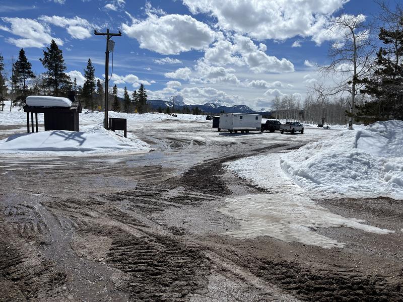
Strong spring sun coupled with warm temps down low signal the beginning of mud season...
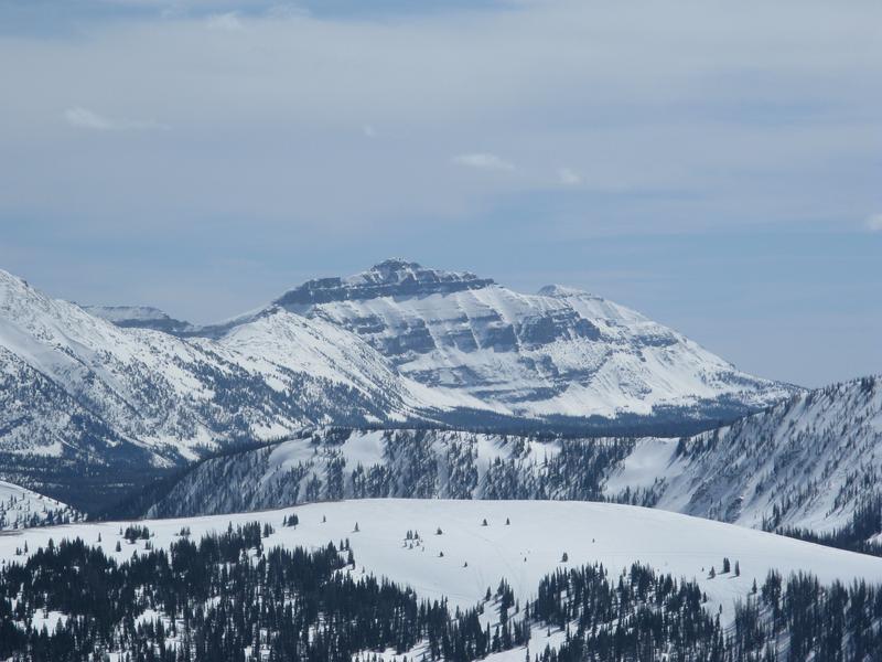
While up high, winter is still in command. In fact, Ted found soft snow in the Whitney Basin yesterday.
Recent Avalanches
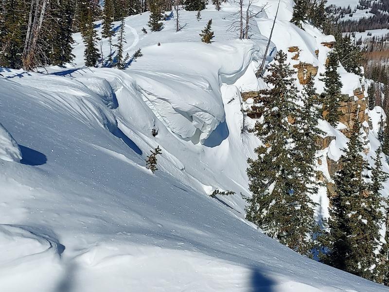
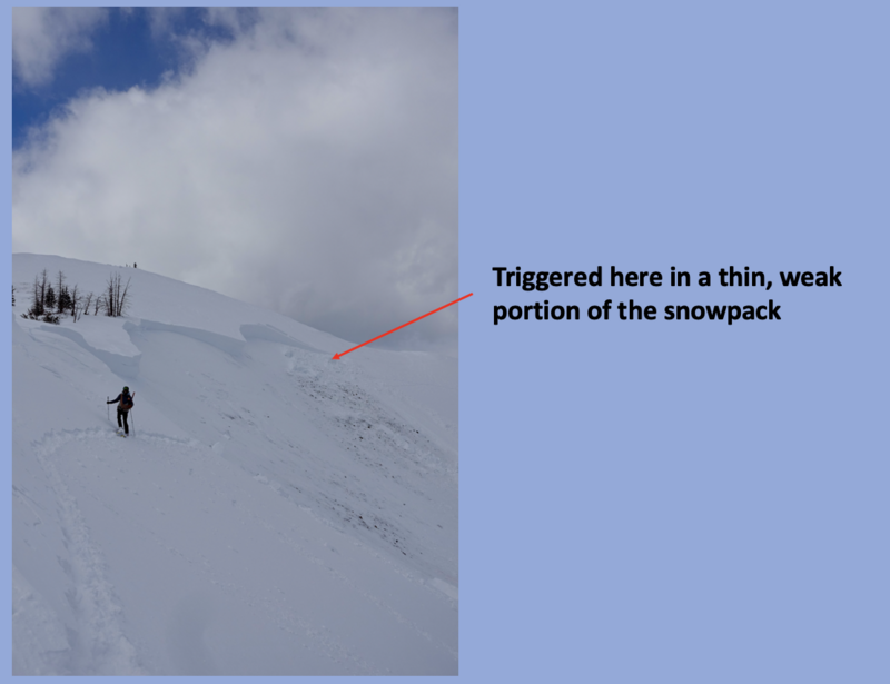
No significant avalanche activity to report.

For all Uinta observations and archived avalanche activity click HERE.
Ad
Avalanche Problem #1
Normal Caution
Type
Location
Likelihood
Size
Description
The snowpack is deep, it's homogeneous, it's happy in its own skin, and it's generally bomb dot com. Yeah... avy danger is straight-forward and there's plenty of room to roam on a go-anywhere base.
A couple things to consider as we stretch our wings-
Boxcar sized cornice loom large overhead and are unpredictably peeling off of ridges. Please give these Titanic sinking pieces of snow a wide margin of error as they would instantly ruin your day if you're clobbered by one.
It's been over three weeks since we observed or recorded an avalanche breaking to old snow. With miles and miles of solid snow, you'd have to get extremely unlucky to trigger a slide that breaks to old, weak layers of snow now buried deep in the snowpack. In other words... if you did trigger a deep, dangerous avalanche then it's probably not time to head to Vegas on a hunch you're gonna do well at the craps table :) The usual, dark alley suspects come to mind... steep, rocky slopes in the wind zone is the kind of terrain we wanna steer clear of.
Additional Information
The Uinta weather station network was upgraded this summer and all that real-time info is found HERE. Simply click on "western Uinta" tab and then "weather stations" tab.

We are always looking for snow and avalanche observations or just general riding conditions. So... if you see something, say something. You can reach me directly at [email protected] or 801-231-2170.
Also, if you're looking for more avy education opportunities for yourself, your crew, or your club please don't hesitate to reach out to me and we'll find a presentation, class, or clinic for ya!
General Announcements

Issued 0300 on Saturday, March 23rd this forecast will be updated by 0700 Sunday, March 24th, 2024.
This forecast is from the U.S.D.A. Forest Service, which is solely responsible for its content. This forecast describes general avalanche conditions and local variations always occur.