Forecast for the Salt Lake Area Mountains

Drew Hardesty
Issued by Drew Hardesty for
Friday, March 22, 2024
The avalanche danger is LOW and the snow is generally stable. Remember that Low danger does not mean No danger. Even small avalanches can lead to trouble in extreme terrain.
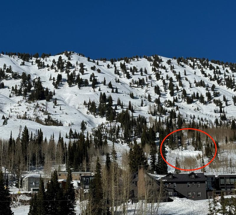
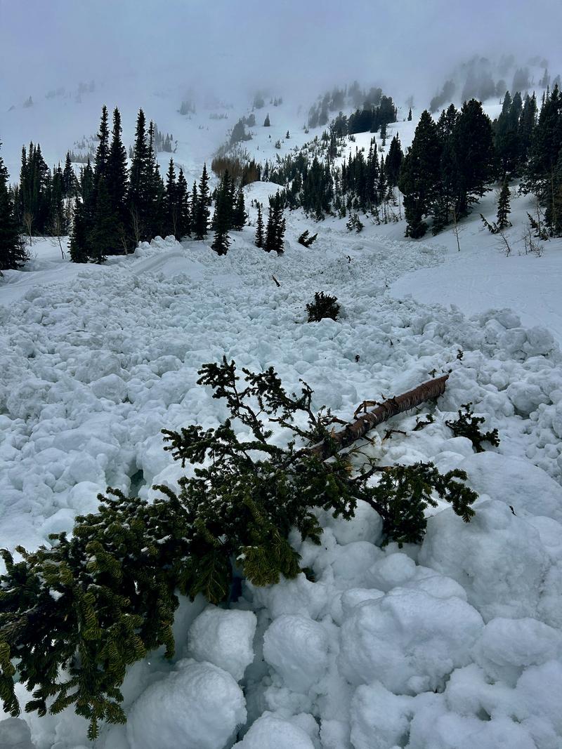
With daytime warming and/or greenhousing, the snow today may become wet, unsupportable, and unstable. Move off of these aspects. I would also avoid Stairs Gulch and Broads Fork of BCC to avoid most of the glide avalanche issues for the next few days...
Low
Moderate
Considerable
High
Extreme
Learn how to read the forecast here
Special Announcements
Based upon the gouging, long running wet slide in Flagstaff on the afternoon of Wednesday, March 20th, please use cautious consideration when traveling or skiing above roadways, structures, other people during this period of warm weather.
Support the UAC website backend platform to ensure the ongoing security of the website and the data stored on the site rebuild by donating to our spring campaign. Save lives by making a donation today!

The Utah Avalanche Center is hosting The Banff Film Festival tonight/Friday, March 22 in Moab.
Weather and Snow
Skies are clear.
Most* mountain temperatures are in the mid to upper 20s. Winds are from the west-northwest, blowing 10-15mph. Along the highest ridgelines, wind speeds are 20-25mph with gusts to 30.
Today and tomorrow are transition days with the weather. A strong cold front is expected Saturday afternoon, ushering in a good round of heavy snowfall through Saturday night. For today, we'll see increasing high and mid-level clouds and increasing winds backing to the southwest. Temperatures will be in the mid-30s up high, the upper 40s down low.
Despite a whole trace to an inch of new yesterday, skiing and riding conditions remain rough and rugged and reserved for only the most penitent. Patches of corn skiing can be found on some solar aspects.
The Outlook: Saturday's initial rain/snow line may be as high as 8000' before dropping to the benches overnight. Totals look to be roughly 8-14" by midday Sunday. We should see additional snowfall through early week with a well defined storm on Thursday.

* A few weather stations in the mid-elevation "thermal belt" outside of the Cottonwood Canyons (Park City, Ogden, Provo) haven't had a decent refreeze since Sunday night.
Recent Avalanches
No reports of avalanches from the backcountry yesterday other than a 'new-ish' glide releases near Blue Ice in Broads Fork of BCC.
On Wednesday, a wet loose avalanche ran from near the top of false Flagstaff and ran 1300', just crossing the Michigan City trail above the town of Alta, leaving a 20' debris pile.
Ad
Avalanche Problem #1
Normal Caution
Type
Location
Likelihood
Size
Description
Our general Normal Caution wording reads as follows: This is not a specific avalanche problem. It is used by UAC forecasters most often when avalanche conditions are generally safe and there is no predominant avalanche problem. Any avalanche type is possible but the most common would be wind slab, loose wet, and loose dry avalanches and they would be expected to be small. Do not approach a Normal Caution avalanche problem as an “anything goes” situation. Continue to keep your guard up and look for any signs of snow instability. Evaluate snow and weather conditions as you travel.
Wet avalanches may be possible with warming today. If the snow becomes unsupportable and unstable, seek low angle terrain.
Cornices become tender and unstable during periods of sun and heating. Give them a wide berth.
Glide avalanches are possible in the usual terrain of Stairs, Broads, and Mill B South in BCC and upper Porter Fork of MCC. Remember these are large and destructive avalanches.
General Announcements
This information does not apply to developed ski areas or highways where avalanche control is normally done. This forecast is from the U.S.D.A. Forest Service, which is solely responsible for its content. This forecast describes general avalanche conditions and local variations always occur.