Forecast for the Ogden Area Mountains

Greg Gagne
Issued by Greg Gagne for
Tuesday, March 19, 2024
The avalanche danger will rise to MODERATE for wet snow avalanches on all aspects other than upper-elevation northerly-facing terrain. It's time to move off of these aspects once the snow becomes wet, unsupportable, and unstable.

Avoid traveling on or underneath corniced ridgelines as cornices may collapse due to warming.
Low
Moderate
Considerable
High
Extreme
Learn how to read the forecast here
Special Announcements
Support the UAC website backend platform to ensure the ongoing security of the website and the data stored on the site rebuild by donating to our spring campaign. Save lives by making a donation today!
The Utah Avalanche Center is hosting The Banff Film Festival on Thursday, March 21, and Friday, March 22 in Moab.
Weather and Snow
This Morning: Clear skies and temperatures in the low to mid 30's F. Winds are light (< 10 mph).
Today marks the first day of Spring and it will certainly feel like it with sunshine and temperatures rising into the upper 40's F. Winds will be from the west/northwest and remain light, with gusts around 15 mph.

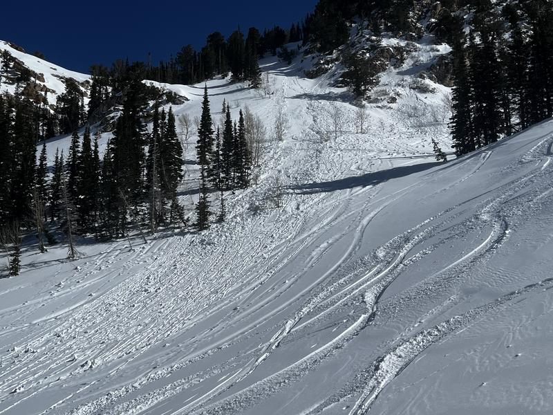
Wind, sun, and warm temperatures have taken a toll on snow surfaces, but you can find dry, chalky snow on upper-elevation northerly aspects with a nascent crop of corn developing on upper-elevation solar aspects.

Extended Forecast: Our long period of uncanny easterly winds has run its course as winds shift to a westerly direction and increase Wednesday ahead of unsettled weather and snow showers on Thursday. After a brief break on Friday, a cold front is expected this weekend with unsettled weather through at least the early part of next week. It's too early to talk snowfall amounts, but they could be significant!

Recent Avalanches
There were reports of wet loose avalanches on sunny aspects during afternoon heating.
Check out all recent Observations HERE.
Ad
Avalanche Problem #1
Wet Snow
Type
Location
Likelihood
Size
Description
Avalanches involving wet snow will become likely as the snow surface heats up from sunshine and warm temperatures. This problem is most pronounced on steep slopes - especially those around rocky features - facing east/south/west, but also low and mid-elevation northerly facing terrain.
Avoid traveling on or underneath large cornices as they may become sensitive to heating and collapse naturally onto a slope below.
Wet snow can easily be handled by moving to shadier slopes once the snow surface takes on too much heat. Watch for signs of warming such as rollerballs and sluffing in wet snow as shown in the photo below.
General Announcements
This information does not apply to developed ski areas or highways where avalanche control is normally done. This forecast is from the U.S.D.A. Forest Service, which is solely responsible for its content. This forecast describes general avalanche conditions and local variations always occur.