Forecast for the Moab Area Mountains

Eric Trenbeath
Issued by Eric Trenbeath for
Thursday, March 21, 2024
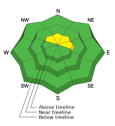
Most terrain has generally LOW danger. On upper elevation, northerly aspects, particularly in areas of extreme terrain, an isolated, or MODERATE danger exists for avalanches involving slabs of wind drifted snow. Even a small avalanche in these areas can have extreme consequences.
In isolated areas on northerly aspects near treeline and below, a layer of weak faceted snow exists two feet below the surface. The distribution of this layer is spotty at best, and it has been shown to be non-reactive, but it deserves to be on your radar.
Be alert to signs of wet instability such as roller balls and pinwheels on sun exposed slopes. Stay off of, and out from under steep slopes if theses signs are present.
Low
Moderate
Considerable
High
Extreme
Learn how to read the forecast here
Special Announcements
Road Conditions: The Geyser Pass Road was plowed on Monday 3/18. It gets pretty sloppy and muddy later in the day.
Grooming: Ranger Ben groomed all trails yesterday.
***Support the UAC website rebuild by donating to our spring campaign. Save lives by making a donation today! HERE

The Banff Film Festival is returning to Moab on Thursday 3/21 and Friday 3/22 For tickets and information visit our event page.
Weather and Snow
6:00 a.m. Snow and Weather Data
24 Hour Snow 0" 72 Hour Snow 0" Season Total Snow 168" Depth at Gold Basin 62"
Winds on Pre-Laurel Peak: NW 10-15 Temp 23° F Percent of Normal: 119%

Weather
Ridging over the desert Southwest will bring mostly sunny skies, warm temperatures, and generally light winds out of the NW to the mountains today. A weak disturbance passing by to the north will bring cloudy skies to our area tonight. Ridging continues through Friday, but we should see increasing clouds, and winds shifting to the SW. By Saturday, we should begin to feel the effects of the next storm system moving into the region with a continued, unsettled weather pattern into early next week.
General Conditions
March conditions are in full effect and you can find a little bit of everything out there right now including varying degrees of breakable sun crust that turn sloppy late in the day, and soft, settled powder on sheltered, northerly aspects. The sun is high in the sky however, and low angle northerly aspects are now open to sun exposure. Over the past several days we've been venturing further into the high country with slabs of wind drifted snow being our primary concern. We found no instabilities yesterday and folks are pushing higher without incident. That said, I continue to be wary of obvious wind drifts, especially in areas of consequential terrain where even a small avalanche can have extreme consequences.
Snowpack and Weather Data
Gold Basin Storm Stake (10,000')
Gold Basin SNOTEL site (10,000')
SNOTEL site near Geyser Pass Winter Trailhead (9600')
Wind Station on Pre-Laurel Peak (11,400')
NWS forecast for the La Sal Mountains.
Recent Avalanches
In our travels over the past several days we have observed numerous avalanches that ran during the March 13-16 storm cycle. Most of these avalanches involve slabs of wind-drifted snow. For a full updated list of recent avalanche activity click here.
This avalanche in Talking Mountain Cirque, appears to have failed deeper on a layer of facets as did this avalanche in Horse Creek Chutes. Both of these slopes are repeat runners, meaning they avalanched previously this season, leaving behind a shallow and weak snowpack.
I documented this avalanche on the North Face of Mount Tukuhnikivatz yesterday that also ran on or around March 16.
Ad
Avalanche Problem #1
Normal Caution
Type
Location
Likelihood
Size
Description
As we trend toward LOW danger and a generally stable snowpack, here are a few things to keep in mind:
  • The most likely place for you to find trouble is on upper elevation, northerly aspects. In these areas, isolated slabs of wind drifted snow may still pose a threat. Remain on the lookout for smooth, rounded drifts, especially in areas of consequential terrain where even a small avalanche can have extreme consequences.
  • A weak layer of faceted snow is still popping up in isolated areas. This layer is about two feet below the surface, and it exists in steep, sparsely treed, north-facing terrain near treeline and below. The distribution of this layer is spotty at best, but backcountry travelers should exercise caution when entering steep loosely treed slopes. When you do find this layer, it tends to be very obvious.
  • Repeat running slide paths still harbor shallow weak snow that is capable of producing avalanches as the recent slides in Horse Creek attest. The recent load has been a good test, but recognition and avoidance of repeat running slide paths is a prudent strategy. See the avalanche database to find out if your objective is a repeat offender.
  • Under a strong March sun, loose wet avalanches remain a possibility on sun exposed slopes. Be alert to signs of wet instability such as roller balls and pinwheels on sun exposed slopes. Stay off of, and out from under steep slopes if theses signs are present.
Additional Information
Want some more insight into the La Sal Mountains as well as the communal impacts of a tragic avalanche? Check out the latest UAC podcast with forecaster Eric Trenbeath where he discusses the range, it's often treacherous snowpack, and how the devastating avalanche in February, 1992, affected the Moab community.
Our avalanche beacon checker sign and beacon training park are up and running. A huge thanks to Talking Mountain Yurts for sponsoring those this season!
Sign up for forecast region-specific text message alerts. You will receive messages about changing avalanche conditions, watches, warnings and road plowing closures.
Follow us on Instagram @utavy_moab
General Announcements
This forecast is from the U.S.D.A. Forest Service, which is solely responsible for its content. This forecast describes general avalanche conditions and local variations always occur.