Forecast for the Moab Area Mountains

Dave Garcia
Issued by Dave Garcia for
Friday, March 15, 2024
A storm is on our doorstep, bringing Easterly winds and a good shot of snow stacking up throughout the day. Shifting winds will blow and drift snow onto all aspects near treeline and above and the avalanche danger is MODERATE. Human-triggered avalanches in newly formed soft slabs of wind-drifted snow are POSSIBLE.
On shady slopes, near treeline and below, we are tracking a weak layer of faceted snow that exists about a foot below the surface. The distribution of this layer is spotty at best, but it is found in steep, sparsely treed, Northerly facing terrain. As snow stacks up over the next few days, and the wind blows, this layer is capable of producing avalanches.
There is a bit of uncertainty about how this storm will play out. If precipitation rates exceed the forecasted amounts, be alert to changing conditions and rising avalanche danger. Evaluate snow and terrain carefully.
Low
Moderate
Considerable
High
Extreme
Learn how to read the forecast here
Special Announcements
Road Conditions: The Geyser Pass Road is not plowed. Expect challenging driving conditions. 4x4 and good tires will be necessary. It's a good idea to carry chains.
Grooming: Trails are not groomed
Newly released; "To the Hills & Back" is a heart-wrenching documentary by the UAC
***Support the UAC website rebuild by donating to our spring campaign. Save lives by making a donation today! HERE
The Banff Film Festival is returning to Moab on Thursday 3/21 and Friday 3/22 For tickets and information visit our event page.
Weather and Snow
6:00 a.m. Snow and Weather Data
24 Hour Snow 2" 72 Hour Snow 8" Season Total Snow 155" Depth at Gold Basin 59"
Winds on Pre-Laurel Peak: ENE 18 G 27 Temp 25° F Percent of Normal: 102%

Weather
The National Weather Service has issued a winter storm warning for the La Sal and Abajo Mountains beginning at 12 PM Thursday and lasting through 6 AM Saturday. Heavy snow is expected above 7,000'. The Abajos will do better than the La Sals, and could pick up 18-24" inches of snow, with the La Sals picking up maybe a foot. But it's truly anyone's guess, as weather models continue to struggle with the evolution of this cut-off low.
This morning, under overcast skies, it is currently snowing in Gold Basin. It is 25 degrees. Snow showers will continue throughout the day. Winds will blow out of the SE at 20-25 MPH, with gusts up to 35 MPH possible. Snow totals will slowly stack up with maybe 2-4" today, and 1-3" tonight. It appears that the highest precipitation will fall in the La Sals during the daytime on Saturday. This system is really a mess, but when it is all said and done, we should see around a foot of new snow. Clouds and lingering snow showers may persist through Sunday.
General Conditions
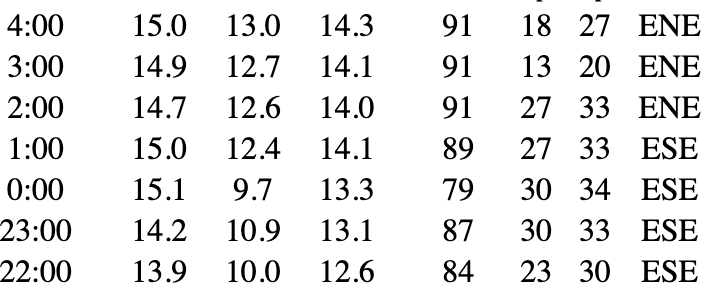
The skiing is excellent right now, and will only get better with the arrival of today's storm. Yesterday, Chris and I found great riding in shallow soft powder in the high alpine cirques of Gold Basin. Snow will continue to stack up on the existing soft base. On solar aspects, you will most likely feel the hard crust underneath. Overnight winds blew from the ESE, they are currently ENE, and will shift to the SE today. Easterly winds are abnormal for the La Sals, and this will result in some atypical loading patterns. Throughout the day, blowing and drifting snow will create fresh soft slabs near treeline and above around the compass. Anticipate wind-drifted snow in places you don't normally expect it. Be alert to changing conditions as the storm develops. There is a bit of uncertainty in the weather forecast, and the avalanche danger will continue to rise as the storm progresses, especially during any periods of heavy snowfall.
Additionally, we have been tracking a weak layer of faceted snow in the upper pack. This layer is currently buried about a foot below the surface, and by the end of the storm, it could be down about 2 feet. We have been finding this very weak snow on some Northerly facing slopes near treeline and below. The distribution of this layer is spotty at best, but it seems to be popping up in isolated areas of steep, sparsely treed terrain. This layer should be on your radar because it is very sensitive, and as slabs build over the next few days, this weak layer could show its hand and produce more avalanches. Given its high sensitivity, expect collapsing and cracking to be associated with this layer. Be sure to read my reports from both Tuesday and Wednesday, as I have been hunting around for this layer. On Tuesday a skier found a slab of wind-drifted snow above this weak layer and triggered a small avalanche.

Snowpack and Weather Data
Gold Basin Storm Stake (10,000')
Gold Basin SNOTEL site (10,000')
SNOTEL site near Geyser Pass Winter Trailhead (9600')
Wind Station on Pre-Laurel Peak (11,400')
NWS forecast for the La Sal Mountains.
Ad
Avalanche Problem #1
Wind Drifted Snow
Type
Location
Likelihood
Size
Description
A quick snap-shot shows Easterly winds overnight on Pre-Laurel humming at the perfect speeds to blow and drift snow. Winds will shift to the SE today, and continue to blow in the moderate to strong range. Fresh soft slabs of wind-drifted snow will continue to develop near treeline and above around the compass. Easterly winds are not typical for the La Sals, so pay close attention, and anticipate drifted snow on slopes where you might not expect it. Cracking and collapsing are sure signs of instability.
In my travels yesterday, I found light powder resting on top of slick hard crusts on many slopes left behind by Monday's wind event. This unconsolidated snow, resting on a hard bed surface, will make the perfect weak interface for slabs of wind-drifted snow to fail easily and run farther than you might expect.
Additional Information
Want some more insight into the La Sal Mountains as well as the communal impacts of a tragic avalanche? Check out the latest UAC podcast with forecaster Eric Trenbeath where he discusses the range, it's often treacherous snowpack, and how the devastating avalanche in February, 1992, affected the Moab community.
Our avalanche beacon checker sign and beacon training park are up and running. A huge thanks to Talking Mountain Yurts for sponsoring those this season!
Sign up for forecast region-specific text message alerts. You will receive messages about changing avalanche conditions, watches, warnings and road plowing closures.
Follow us on Instagram @utavy_moab
General Announcements
This forecast is from the U.S.D.A. Forest Service, which is solely responsible for its content. This forecast describes general avalanche conditions and local variations always occur.