

Observer Name
Yannick & Nuttall/ UAC Staff
Observation Date
Monday, March 25, 2024
Avalanche Date
Monday, March 25, 2024
Region
Salt Lake » Big Cottonwood Canyon » Silver Fork » Ricardos
Location Name or Route
Ricardo's Roll
Elevation
9,400'
Aspect
East
Trigger
Skier
Avalanche Problem
New Snow
Weak Layer
New Snow/Old Snow Interface
Depth
2.5'
Width
100'
Vertical
400'
Comments
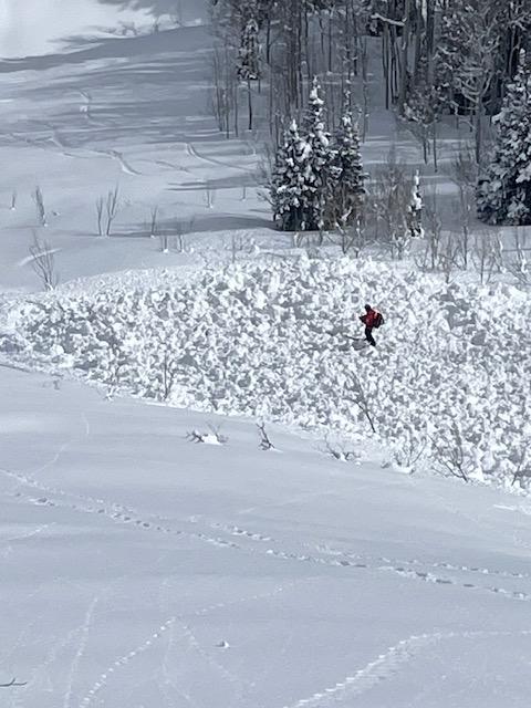
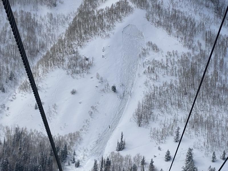
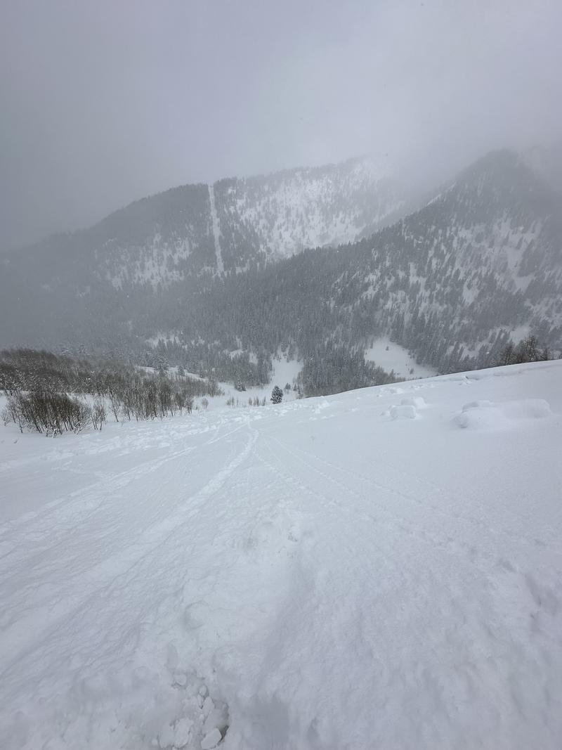
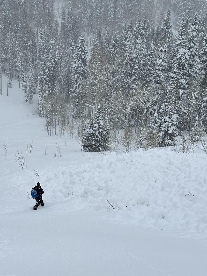
A Solitude patroller spotted a fresh slide in Ricardo's Roll this afternoon around 15:10. There was a clear track in but the track out was nebulous with a few traversing tracks around. Solitude sent a team of two to investigate. Getting closer in the bottom of Silverfork we felt confident that we could see where the skier exited near where they entered, presumably turning out after triggering the slide. We skinned up and then traversed into the middle of the path and the start of the debris pile. One member of the party conducted a beacon search of the debris pile while the other stood by on the left flank in the aspens given the increasing hazard from solar heating. Additionally we had a spotter looking across from the resort ridge-top. Fortunately no signals were found and we exited uneventfully. WS-AS-R3-D2-I
A reminder to all in the Wasatch backcountry, please call Alta Central or notify the nearest resort if you trigger a potentially harmful slide. It prevents SAR resources from needlessly exposing themselves to avalanche hazards and/or physical injury. Stay safe out there.
Comments
Photo: Nuttall
Comments
UAC Forecaster Notes:
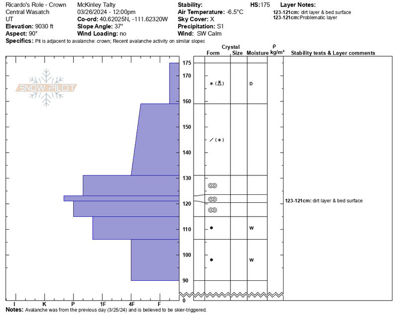
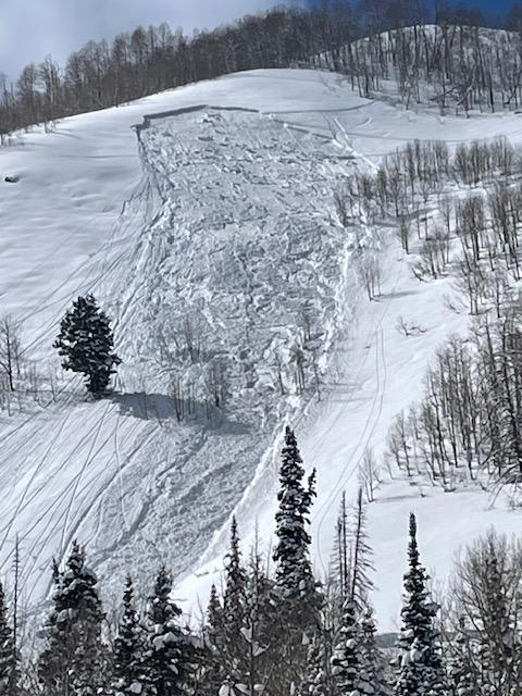
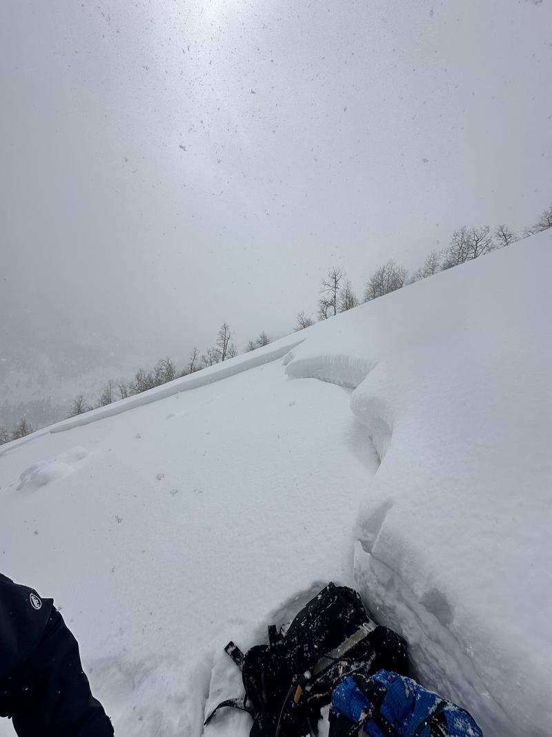
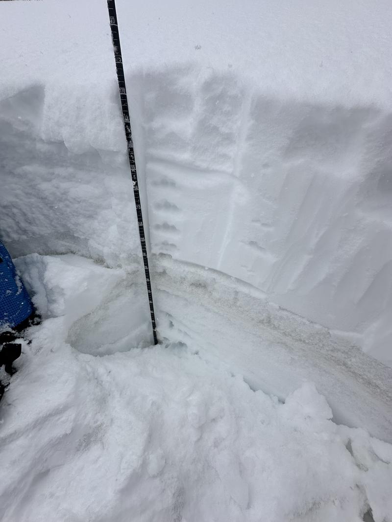
On Tuesday, March 26th, we went to inspect the recent avalanche on Ricardo's Roll. Initially, it seemed to fail as a soft slab of new snow at around 9010 feet, near the new snow/old snow interface containing the most recent dust layer. This avalanche failed between two melt-freeze layers within the snowpack, though no facets were obvious or found within the crown there could have been a very small near surface facet layer between the two crusts - or just an internal temperature gradient.
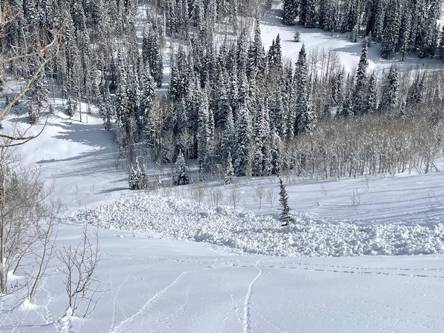
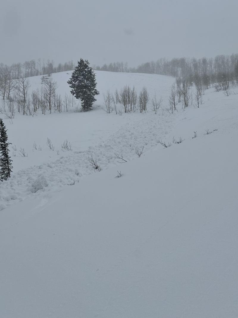
The avalanche failed approximately 100 feet wide and ran for about 400 feet. As we descended around 250 feet down the slide path, it appeared that more wet snow was entrained, likely due to the damp snow surface caused by lower elevation and sunlight. The debris pile exhibited characteristics of wet snow, while the crown and initial failure seemed to have characteristics of soft snow/dry snow.
This avalanche, unique in appearance, likely began as a dry snow avalanche with the debris becoming wet, showing signs of trenching into the snow. Despite initially being dry snow, the debris had predominantly wet snow characteristics, indicating that heat was necessary for the slab to develop. The debris pile measured 8'-10' deep.
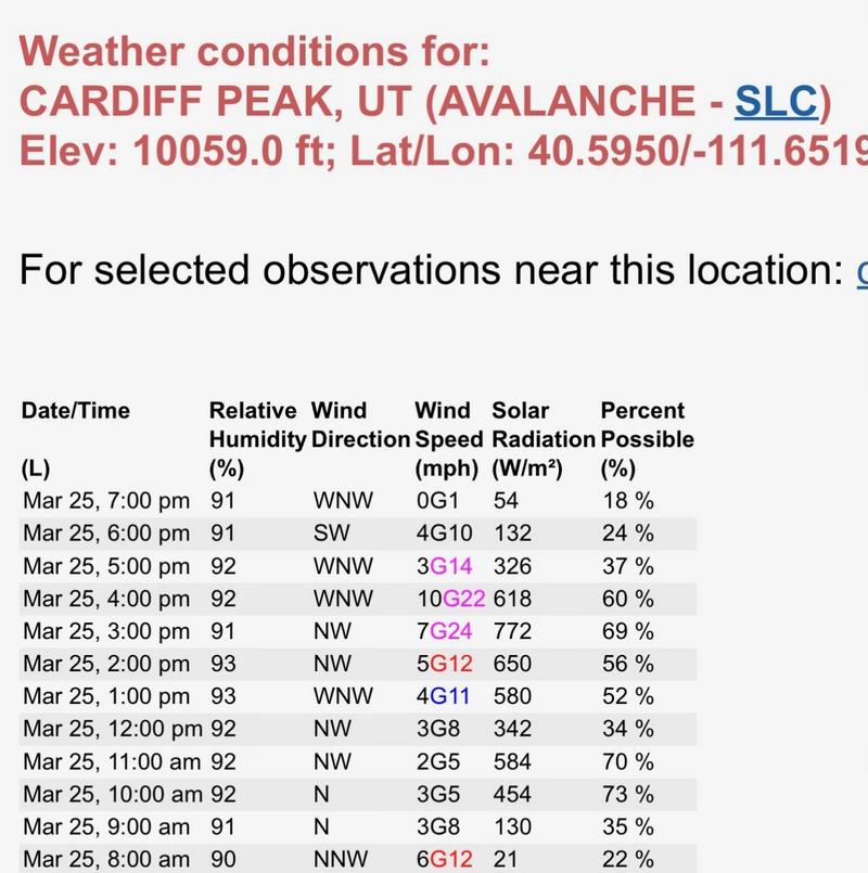
This avalanche is notable for several reasons. It appears to have started as a dry snow avalanche, with dry rollerballs present around it. Although the debris was wet snow, the surrounding trees contained cold dry snow, and there were settlement cones in the aspens. What's intriguing is that this avalanche likely released or was triggered sometime in the late afternoon. The nearby Cardiff Peak weather station (10,059') recorded the highest solar radiation for the day during the hour or so before the avalanche was observed. There was also an uptick in snowfall in some locations right before this time period as well as a report from nearby Emma ridgelines of the snow surface taking additional heat right around the same time.
Weather from Cardiff Peak Below
Map location of top of crown

Images of crown, debris, and crown profile

Video
Coordinates