SPECIAL ANNOUNCEMENT |
 |
We've got two avalanche education events this week – a FREE women's avalanche beacon clinic 9 am Monday morning at Alta, and a FREE avalanche awareness talk at the SL REI on Tuesday at 7 pm. Check out our calendar off the HOME page for more details on all the upcoming events. |
|
|
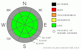
BOTTOM LINE
Danger by aspect and elevation on slopes approaching 35° or steeper.
(click HERE for tomorrow's danger rating)
|
|
|
|
CURRENT CONDITIONS |

|
Warm temperatures, thin weak snowpack and a general lack of interest from backcountry skiers all describe current conditions in the mountains. Temperatures creeped into the mid 30s along the ridges on Saturday accompanied by light westerly winds. Southerly aspects became damp and produced some rollerballs. (
PHOTO
) |
|
|
RECENT ACTIVITY |

|
One skier was able to coax a newer cornice to break during the day on Saturday with no real consequences. (PHOTO) Other observations include widespread weakening snow with associated crusts that will most likely be our focus once we get a decent amount of new snow built up. Many locations outside of the Cottonwoods have very limited potential for snow related recreation (PHOTO). |
|
|
THREAT #1 |

|
| WHERE |
PROBABILITY |
SIZE |
TREND |

|
|
|
|
| |
|
|
Over the next
24 hours.
|
|
|
Use normal caution. |
|
|
MOUNTAIN WEATHER |

|
We'll see partly cloudy skies and mild temperatures in the mountains today with light westerly winds. A disturbance will move through Monday into Monday night which should produce some snow. It looks like potentially a 6 inch event with around a half inch of water associated with the snow. Ridging then moves back in and we'll again be on the downslope side of the ridge while the long wave trof effects the eastern half of the US. |
|
|
GENERAL ANNOUNCEMENTS |
If you want to get this avalanche advisory e-mailed to you daily click HERE.
UDOT highway avalanche control work info can be found by calling (801) 975-4838. Our statewide toll free line is 1-888-999-4019 (early morning, option 8).
The UAC depends on contributions from users like you to support our work. To find out more about how you can support our efforts to continue providing the avalanche forecasting and education that you expect please visitour Friends page.
If you’re getting out and see anything we should know about please let us know. You can leave a message at (801) 524-5304 or 1-800-662-4140, or email us at uac@utahavalanchecenter.org. (Fax 801-524-6301).
The information in this advisory is from the U.S. Forest Service, which is solely responsible for its content. This advisory describes general avalanche conditions and local variations always occur.
Bruce Tremper will update this forecast by 7:30 on Monday morning. |
|
|
This information does not apply to developed ski areas or highways where avalanche control is normally done. This advisory is from the U.S.D.A. Forest Service, which is solely responsible for its content. This advisory describes general avalanche conditions and local variations always occur. |
|
This advisory provided by the USDA Forest Service, in partnership with:
The Friends of the Utah Avalanche Center, Utah Division of State Parks and Recreation, Utah Division of Emergency Management, Salt Lake County, Salt Lake Unified Fire Authority and the friends of the La Sal Avalanche Center. See our Sponsors Page for a complete list. |
