25th Annual Black Diamond Fall Fundraising Party
Thursday, September 13; 6:00-10:00 PM; Black Diamond Parking Lot
25th Annual Black Diamond Fall Fundraising Party
Thursday, September 13; 6:00-10:00 PM; Black Diamond Parking Lot
| Advisory: Uintas Area Mountains | Issued by Craig Gordon for Thursday - March 1, 2018 - 3:31am |
|---|

|
bottom line Heads up- the avalanche danger will be on the rise the next 24-36 hours. For today, in mid and upper elevation terrain, especially in the wind zone at and above treeline, the avalanche danger is MODERATE. Human triggered avalanches are POSSIBLE on steep wind drifted slopes facing the north half of the compass, particularly those with an easterly component to their aspect. An avalanche triggered today can quickly get out of hand if it breaks into weak layers of snow, now buried deeper in our snowpack. Lose some elevation or switch aspect and you'll find LOW avalanche danger on lower elevation, wind sheltered terrain and on most slopes facing the south half of the compass.
|
 |
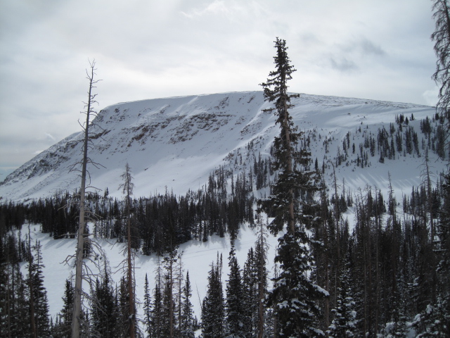
current conditions March is roaring in like a lion and southwest winds are ramping up into the 30's ahead of a strong storm slated to slide through the region this weekend. Meanwhile closer to home, under cloudy skies, temperatures have warmed into the teens overnight. Recent winds have worked over some of our upper elevation terrain, but lose a little elevation and head to low angle, wind sheltered slopes and you'll be treated to some of the best riding and turning conditions all year.
Above are 24 hour temperatures and snow depth from upper Trial Lake along with winds and temperatures from Windy Peak. More remote Uinta weather stations are found here
Ted was near Bald Mountain Tuesday and found stable snow, good riding, and commented on how the big terrain is starting to fill in, but still remains a bit on the rocky side. More on is his travels here. You can find a great body of recent trip reports, observations, and snow data here.
|
 |
recent activity
|
| type | aspect/elevation | characteristics |
|---|

|

|
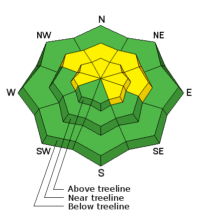
LIKELIHOOD
 LIKELY
UNLIKELY
SIZE
 LARGE
SMALL
TREND
 INCREASING DANGER
SAME
DECREASING DANGER
|
|
description
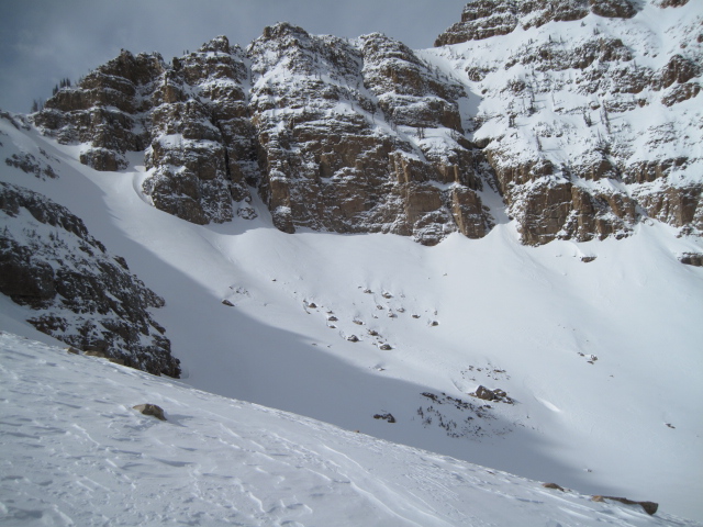
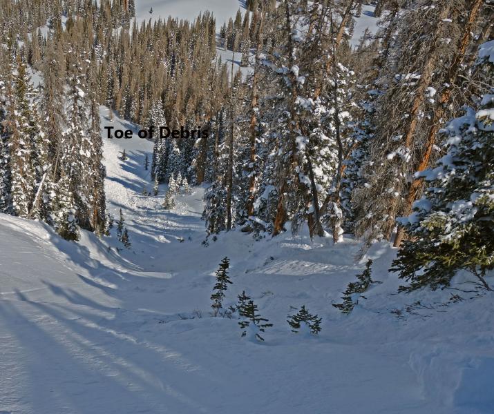
Definitely big enough to catch your attention and take you for a nasty ride through trees... the images above are of a slab from yesterday that broke into weak, sugary snow on a steep, shady slope. Here is Dave’s take on things- "This slab illustrates our current avalanche hazard pretty well. Most slopes are stable and you can ride a lot of places. In fact we have skied areas right next to this slope. However, you can still trigger avalanches in specific terrain. Which is the definition of a moderate hazard ("heightened avalanche conditions on specific terrain features, evaluate snow and terrain carefully; identify features of concern"). Features of concern right now are steep northerly facing slopes that are weak and thin due to rocks, previous avalanches, etc." So here's the deal... this avalanche dragon isn't healing any time soon and prime suspects include terrain that has already avalanched this year along with a vast majority of steep, shady slopes on the south half of the range. Terrain with these characteristics remains suspect and should be considered guilty until proven otherwise. Sounds complicated, but the answer is easy. The way we manage unpredictable avalanche dragons is to simply avoid where they live. So today you'll want to steer clear of steep, rocky, wind drifted slopes, especially if they've got a "trapdoor" or punchy feeling. |
| type | aspect/elevation | characteristics |
|---|

|
|
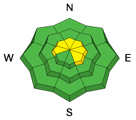
LIKELIHOOD
LIKELY
UNLIKELY
SIZE
 LARGE
SMALL
TREND
INCREASING DANGER
SAME
DECREASING DANGER
|
|
description
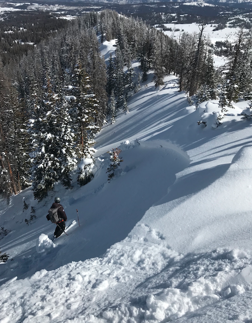
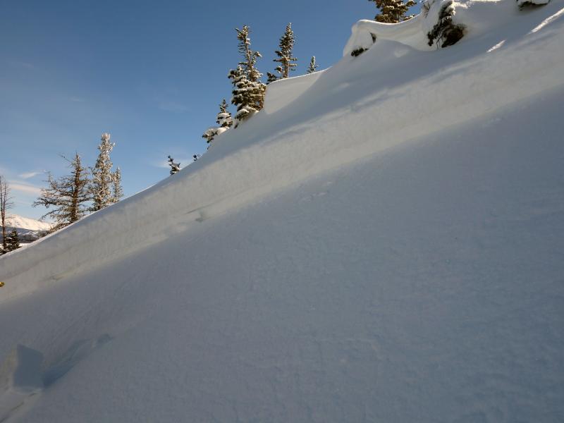
As winds ramp up, they'll find enough loose snow to whip into a fresh batch of wind drifts. While today's drifts may be a little more stubborn, they still have the possibility to break into several storms worth of snow. Once triggered, they're gonna pack a punch and will most likely boss you around. You can ride safely today by looking for clues to unstable snow such as shooting cracks. In addition, tweak small test slopes like road banks and see how they're reacting before getting into steep, commiting terrain. And finally, consider avoiding fat, rounded pillows of snow, especially if they sound hollow like a drum. |
 |
weather
A fast moving impulse swings through the region today. We can expect scattered snow showers and temperatures warming into the upper 20's. Southwest winds increase as the day wares on and should be cranking into the 50's and 60's by around sunset. Strong ridgetop winds are expected tonight through Friday before diminishing Saturday. Snow, heavy at times, develops Saturday through Saturday night and it looks like a foot or more of snow is a solid bet. |
| general announcements The information in this advisory expires 24 hours after the date and time posted, but will be updated by 7:00 AM Friday March 2nd, 2018. If you're getting out and about, please let me know what you're seeing especially if you see or trigger and avalanche. I can be reached at [email protected] or 801-231-2170 It's also a good time to set up one of our very popular avalanche awareness classes. Reach out to me and I'll make it happen. This information does not apply to developed ski areas or highways where avalanche control is normally done. This advisory is from the U.S.D.A. Forest Service, which is solely responsible for its content. This advisory describes general avalanche conditions and local variations always occur. |