25th Annual Black Diamond Fall Fundraising Party
Thursday, September 13; 6:00-10:00 PM; Black Diamond Parking Lot
25th Annual Black Diamond Fall Fundraising Party
Thursday, September 13; 6:00-10:00 PM; Black Diamond Parking Lot
| Advisory: Uintas Area Mountains | Issued by Craig Gordon for Monday - February 12, 2018 - 3:38am |
|---|


|
bottom line While the avalanche hazard is generally LOW be on the lookout for shallow drifts along the leeward side of upper elevation ridges. In addition, avalanches breaking to our midpack facet/crust combo remain possible in isolated terrain. Most experienced riders I know, continue to avoid bulls-eye avalanche terrain... steep slopes facing north half of the compass, especially those in the wind zone.
|
 |
special announcement
We still have a few open slots for this weeks Avy Moto 101. Click here for more details and to register. |
 |
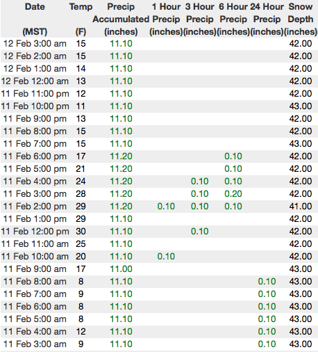
current conditions Under mostly cloudy skies, temperatures are in the teens and single digits. Southerly winds increased midday Sunday and have been blowing steadily in the 30's and 40's along the high ridges. Saturday's little storm delivered 5" of snow that helped smooth out old tracks and take the edge off of pre-existing crusts. Ridng and turning condtions are surprisingly good. particularly on mid elevation, wind sheltered slopes.
Above are 24 hour temperatures and snow depth from Trial Lake along with winds and temperatures from Windy Peak. More remote Uinta weather stations are found here
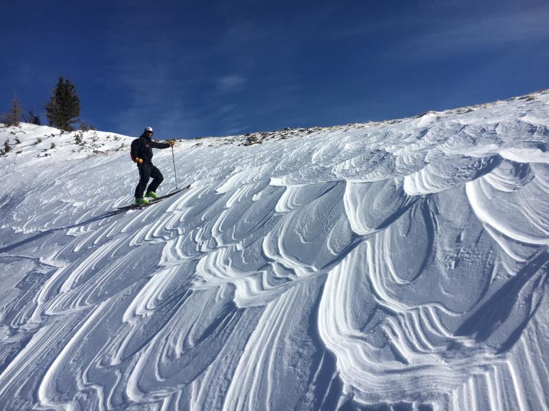
We were in Upper Chalk Creek Friday and found mostly stable snow and a mixed bag of snow conditions. Above, Andy skins in a sea of silky, sustrugi.
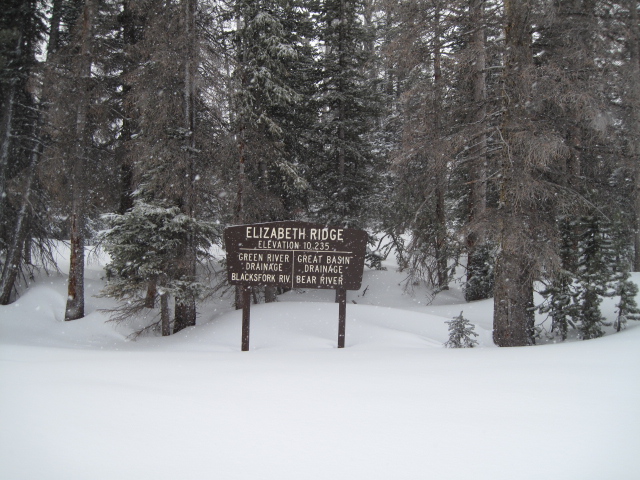
Meanwhile, Ted was on the eastern side of the range near Elizabeth Pass and commented how this time of year the sign above is usually buried with snow. More on our travels along with a great body of recent trip reports, observations, and snow data are found here.
|
 |
recent activity
Shallow wind slabs and sluffing on steep slopes were reported yesterday, otherwise no significant new avalanche activity. |
| type | aspect/elevation | characteristics |
|---|

|

|
LIKELIHOOD
 LIKELY
UNLIKELY
SIZE
 LARGE
SMALL
TREND
 INCREASING DANGER
SAME
DECREASING DANGER
|
|
description
Today's winds will whip Saturday's light density snow into fresh drifts, senstive to our additional weight. Found on the leeward side of upper elevation ridges and around terrain features like chutes and gullies, recently formed drifts will predictably break at or below our skis, board, or sled. While mostly manageable in size and depth take care that a small slide doesn't blindside you in steep, high consequence, commiting terrain. |
| type | aspect/elevation | characteristics |
|---|

|

|
LIKELIHOOD
 LIKELY
UNLIKELY
SIZE
 LARGE
SMALL
TREND
 INCREASING DANGER
SAME
DECREASING DANGER
|
|
description
As the snowpack gets comfortable in its own skin, the possibilty of triggering an avalanche that breaks to our persistent midpack weakness, the Thanksgiving crust/facet combo, begins to decrease... and that's good news, suggesting we're trending in the right direction. I wouldn't exactly call it a "green light, ride if it's white" kind of snowpack, but I do think you'd really have to go out of your way to trigger a significant avalanche today. The most likely type of terrain is steep, upper elevation slopes, especially those facing the north half of the compass. While more the execption than the rule, once triggered, an avalanche breaking near our midpack problem child will quickly get out of hand and could instantly ruin our day. Fortunately, the riding conditions are improving on other aspects and we have more options on the table to avoid this avalanche dragon. Simply swing around to lower elevation slopes or choose low angle terrain with no steep slopes above or adjacent to where you're riding. |
 |
weather Look for mostly cloudy skies and light snow as a weak storm system crosses the region today. Temperatures climb into the upper 20's and overnight lows dip into the teens. Southerly winds blow in the 40's along the high ridges, but decrease as the day wares on. A break in the action is on tap for Tuesday/Wednesday with another round of snow slated for late Wednesday and Thursday. |
| general announcements The information in this advisory expires 24 hours after the date and time posted, but will be updated by 7:00 AM Tuesday February 13th, 2018. If you're getting out and about, please let me know what you're seeing especially if you see or trigger and avalanche. I can be reached at [email protected] or 801-231-2170 It's also a good time to set up one of our very popular avalanche awareness classes. Reach out to me and I'll make it happen. This information does not apply to developed ski areas or highways where avalanche control is normally done. This advisory is from the U.S.D.A. Forest Service, which is solely responsible for its content. This advisory describes general avalanche conditions and local variations always occur. |