25th Annual Black Diamond Fall Fundraising Party
Thursday, September 13; 6:00-10:00 PM; Black Diamond Parking Lot
25th Annual Black Diamond Fall Fundraising Party
Thursday, September 13; 6:00-10:00 PM; Black Diamond Parking Lot
| Advisory: Uintas Area Mountains | Issued by Craig Gordon for Friday - February 9, 2018 - 3:20am |
|---|

|
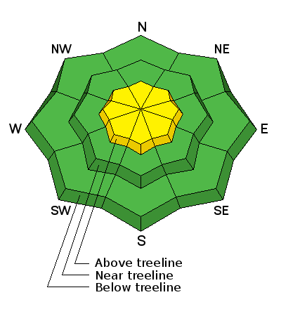
bottom line In the wind zone, at and above treeline, the avalanche danger is MODERATE. Human triggered avalanches are possible on steep, wind drifted slopes, especially those facing the north half of the compass and particularly those with an easterly component to their aspect. Once triggered, today's avalanches can quickly get out of hand if they break into weak layers of snow now buried several feet deep in our snowpack. Wind sheltered mid and low elevation terrain, especially south facing slopes offer generally LOW avalanche danger.
|
 |
current conditions High clouds are streaming into the area, keeping temperatures mild and in the mid to upper 20's. Westerly winds ramped up right around lunch time yesterday and have been blowing steadily in the 30's and 40's along the high ridges. Monday nights little blast of winter stacked up nearly 4" of dense, spongy snow, greatly improving spirits as well as riding and turning conditions. Low angle, wind sheltered slopes are the ticket, where you won't bottom out to the old snow surface
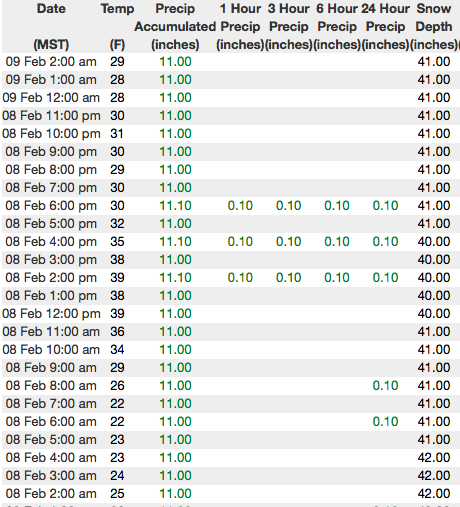
Above are 24 hour temperatures and snow depth from Trial Lake along with winds and temperatures from Windy Peak. More remote Uinta weather stations are found here
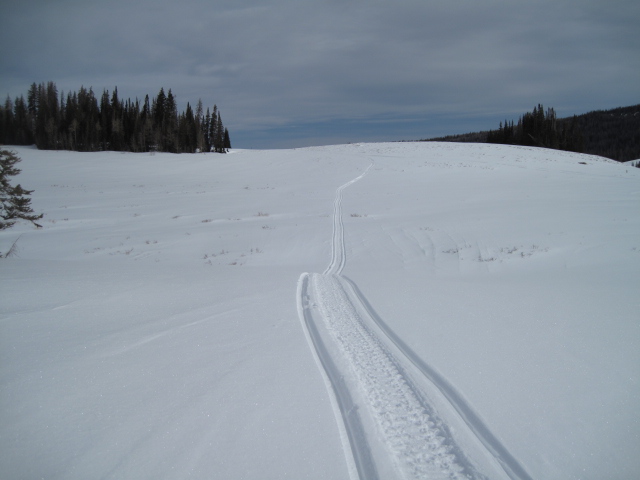
Ted was near Moffit Peak yesterday and found a little fresh snow, good riding conditions, and mostly stable snow. More on his travels along with a great body of recent trip reports, observations, and snow data are found here.
|
 |
recent activity No significant new avalanche activity to report. |
| type | aspect/elevation | characteristics |
|---|

|

|
LIKELIHOOD
 LIKELY
UNLIKELY
SIZE
 LARGE
SMALL
TREND
 INCREASING DANGER
SAME
DECREASING DANGER
|
|
description
As the snowpack gets comfortable in its own skin, the possibilty of triggering an avalanche that breaks to our persistent weakness (seen as the red line in the pit above) now buried 2'-3' deep in the midpack, begins to decrease... and that's good news, suggesting we're trending in the right direction. And while no avalanches were reported to us yesterday, it's only been a couple of days since the last slide we know of broke to our midpack problem child. That said, I'm not gonna roll the dice and take my chances. No it's not a widespread issue, but the consequences remain serious. Once triggered, an avalanche breaking into these layers will quickly get out of hand and could instantly ruin our day. The most likely suspects are steep, wind drifted slopes facing north half of the compass. Fortunately with a little new snow, the riding conditions are improving on other aspects and we have more options on the table to avoid this avalanche dragon. Simply swing around to lower elevation slopes or choose low angle terrain with no steep slopes above or adjacent to where you're riding. (C.Brown photo) |
| type | aspect/elevation | characteristics |
|---|

|
|
LIKELIHOOD
 LIKELY
UNLIKELY
SIZE
 LARGE
SMALL
TREND
 INCREASING DANGER
SAME
DECREASING DANGER
|
|
description
While there's not a tremendous amount of snow available for transport, the Uinta's are a big range. In fact, it never ceases to amaze me how winds can find enough loose snow to whip up and create fresh wind slabs. Found mostly on the leeward side of upper elevation ridges, I bet there's a slab or two lurking around a gully wall or entrance to a chute. In either case, today you'll want to look for and avoid any fat, rounded piece of snow, especially if it sounds hollow like a drum. |
 |
weather
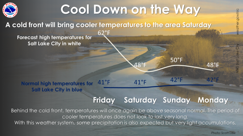
Expect high clouds and temperatures climbing into the upper 30's. Westerly winds blow in the 40's and may increase later today. A cold front slides through the area Saturday morning ushering in cooler temperatures along with the possibility of light snow showers. |
| general announcements The information in this advisory expires 24 hours after the date and time posted, but will be updated by 7:00 AM Saturday February 10th, 2018. If you're getting out and about, please let me know what you're seeing especially if you see or trigger and avalanche. I can be reached at [email protected] or 801-231-2170 It's also a good time to set up one of our very popular avalanche awareness classes. Reach out to me and I'll make it happen. This information does not apply to developed ski areas or highways where avalanche control is normally done. This advisory is from the U.S.D.A. Forest Service, which is solely responsible for its content. This advisory describes general avalanche conditions and local variations always occur. |