25th Annual Black Diamond Fall Fundraising Party
Thursday, September 13; 6:00-10:00 PM; Black Diamond Parking Lot
25th Annual Black Diamond Fall Fundraising Party
Thursday, September 13; 6:00-10:00 PM; Black Diamond Parking Lot
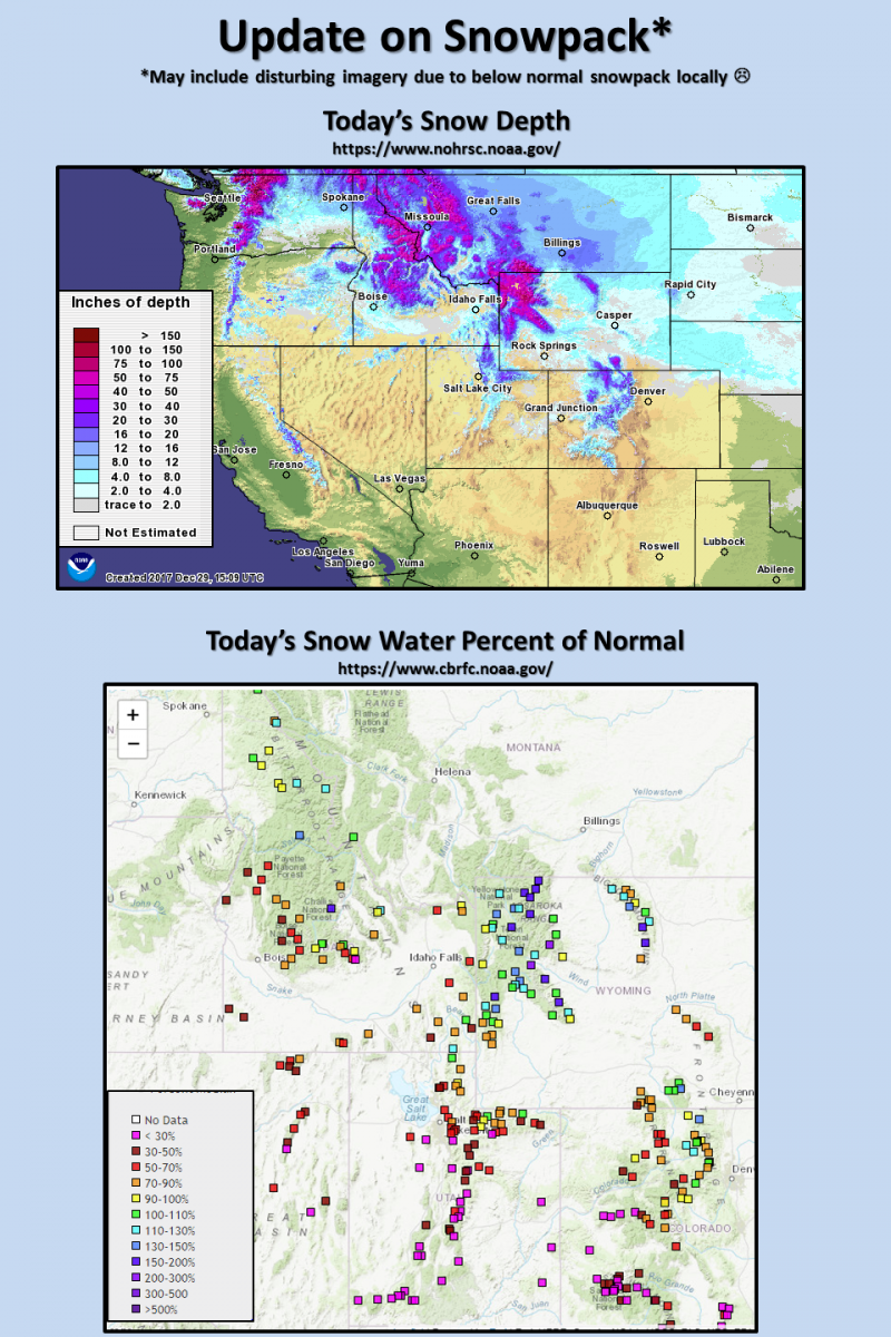
| Advisory: Uintas Area Mountains | Issued by Craig Gordon for Sunday - December 31, 2017 - 4:10am |
|---|

|
bottom line HEADS UP.... AVALANCHE CONDITIONS REMAIN SKETCHY In upper elevations, at and above treeline, the avalanche danger is CONSIDERABLE. Human triggered avalanches are likely, especially on steep, wind drifted slopes, and particularly on slopes facing the north half of the compass. MODERATE avalanche danger exists on mid and low elevation shady slopes. Human triggered avalanches are possible on steep slopes with recent deposits of wind drifted snow. Low elevation south facing slopes and terrain that held no snow prior to the Christmas Eve storm offer generally LOW avalanche danger.
|
 |
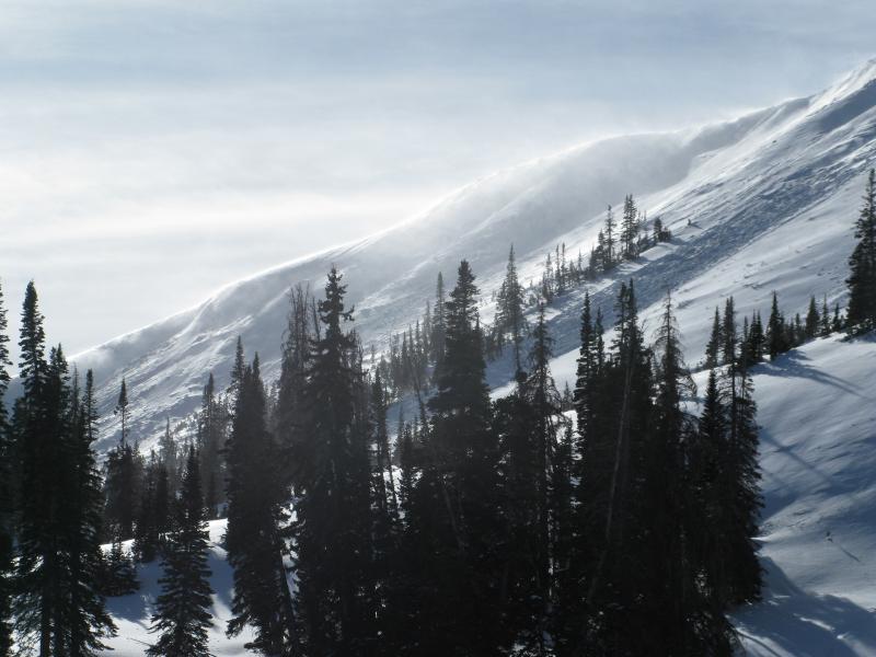
current conditions Under a big, bright, beautiful moon, skies are clear and temperatures in the teens and low 20's. Westerly winds are still humming in the 30's and 40's along the high peaks. Depite the lack of snow, riding and turning conditions remain quite good, especially on low angle, wind sheltered terrain.
Above are 24 hour temperatures and snow depth from Trial Lake along with winds and temperatures from Windy Peak. More remote Uinta weather stations are found here Recent trip reports and findings can be seen here.
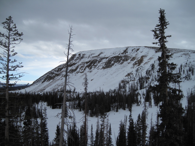
Ted was up on Bald Mountain Pass yesterday, noting you can still see the summer hiking trail on Bald Mountain... a testiment to just how thin the snowpack is for late December.
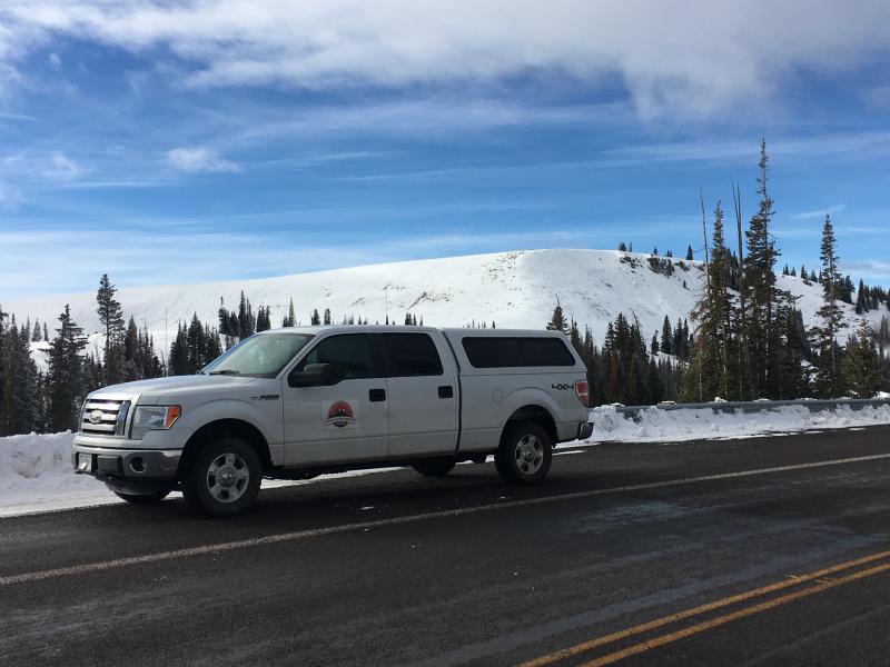
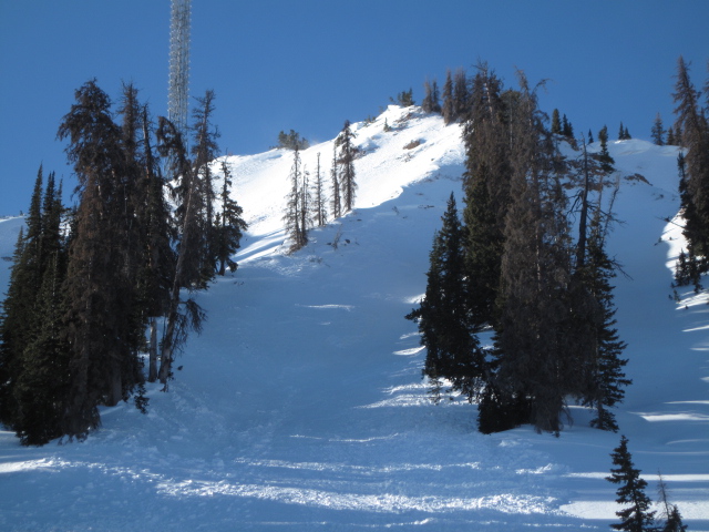
With it's easy access, Wolf Creek Pass is a seamless pre or post work grab. However... just 'cause you can see your rig from the ridge, doesn't mean the snowpack is good to go or shares your same level of stoke.
The graphic above says it all... lean is optimal in some cases, but when it comes to snowpack it leads to dangerous avy conditions. |
 |
recent activity A BUSY WEEK ON THE EASTERN FRONT-
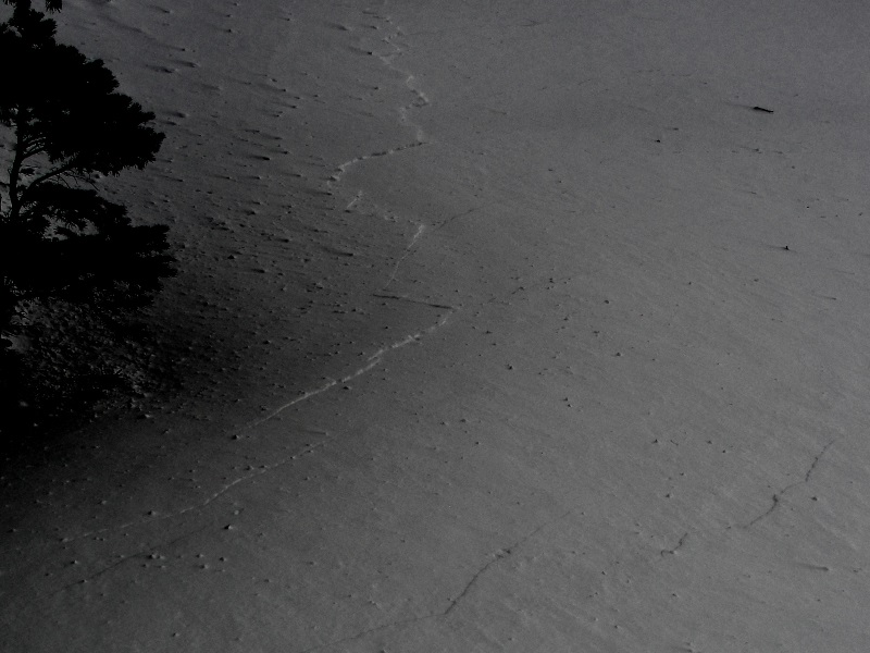
Yesterday Big Al and the BCI crew spotted this fresh slide on the south end of Double Hill.
Ted visited the Chalk Creek slide that caught, carried, buried, and injured a local sledder on Tuesday. Fortunately at the end of the day the rider came home... his sled however might need a rebuild. Ted's great viddy recap is found HERE Riders first hand account is posted here.
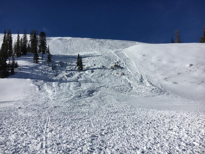
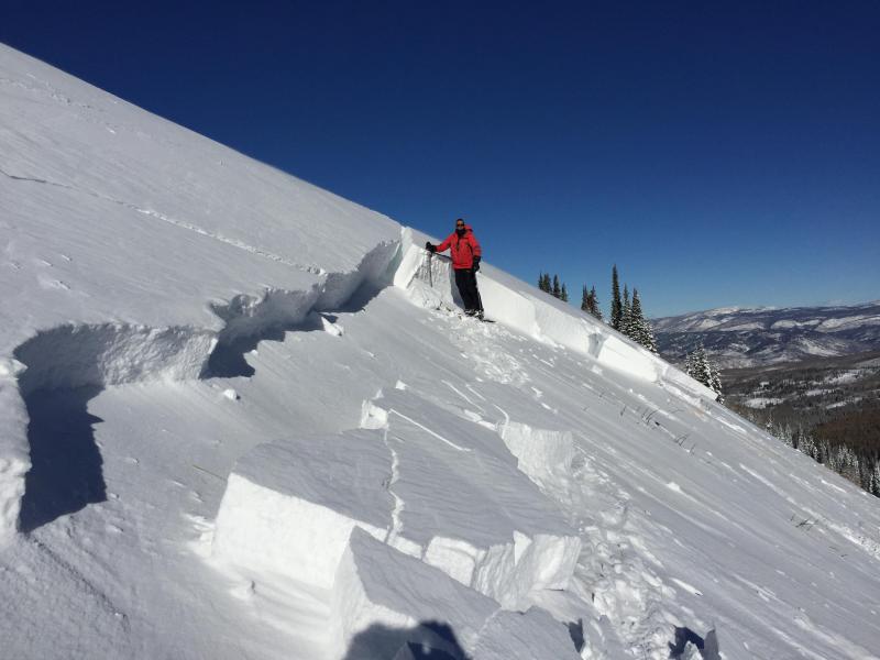
On Wednesday, Ted and I rolled onto this slide on Double Hill just as the dust was settling. Averaging 4' deep and over 700' wide, this avalanche was triggered low on an adjacent slope. This is the kind of unpredictable avalanche dragon we're dealing with right now. Click HERE for more beta and a short viddy describing what we're seeing on the North Slope. More on this slide and other region-wide reports click here.
On Tuesday, we spotted this remotely triggered slide that's 3' deep x 500' wide on a steep wind drifted slope in Campbell Hollow. Click |
| type | aspect/elevation | characteristics |
|---|

|

|
LIKELIHOOD
 LIKELY
UNLIKELY
SIZE
 LARGE
SMALL
TREND
 INCREASING DANGER
SAME
DECREASING DANGER
|
|
description
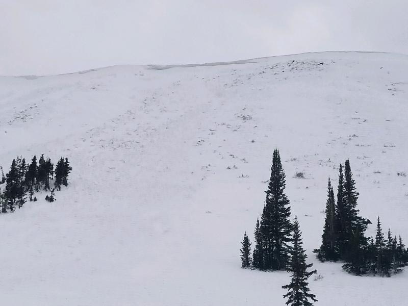
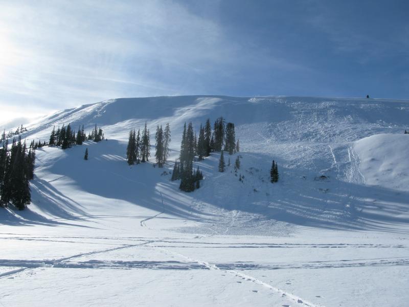
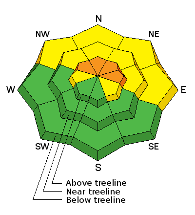
While avalanche activity has become more hit or miss the past few days, the fact remains, we have an unusual snowpack structure for the western Uinta's right now. No, it's not our usual weak mess of sugary snow that feels like a sandbox. On the contrary, it's actually comprised of a complex mix of crusts and fragile, sugary facets sandwiched in between. So... the snowpack has body and it has structure. It also has the Christmas storm on top that consolidated into a cohesive slab. We have all the ingredients for a slab avalanche and many steep, wind drifted slopes are just waiting for a trigger like us to come along and knock the legs out from underneath it. So our problem child is a persistent slab and that's an issue because anything "persistent" in the snowpack takes a long time to heal. But we don't need to roll the dice and hope for the best. The way we manage this avalanche dragon is avoidance. Simply avoid the terrain the avalanche dragon lives in... steep, mid and upper elevation, wind drifted slopes, especially those facing the north half of the compass. The good news is, you don't have to stay home and hide under your bed. There's plenty of good riding on low angle slopes and big open meadows.
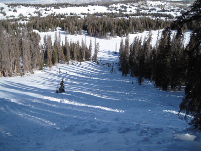
The best strategy is easy... it's avoidance. Simply avoid being on or underneath steep, wind drifted slopes facing the north half fo the compass. Remember- there are plenty of south facing slopes throughout the range, like the one pictured above, where you can ride and you don't even have to deal with this issue. |
| type | aspect/elevation | characteristics |
|---|

|
|
LIKELIHOOD
LIKELY
UNLIKELY
SIZE
 LARGE
SMALL
TREND
INCREASING DANGER
SAME
DECREASING DANGER
|
|
description
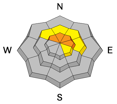
West and southwest winds continued blowing into the 40's and 50's for most of yesterday and even though they're running out of fresh snow to work with, they continued whipping up a fresh batch of stiff wind slabs. While found mostly along the leeward side of mid and upper elevation ridges, I wouldn't be too surprised to find sensitive drifts cross-loaded around terrain features like chutes and gully walls. Common theme is... slabs are most prevalent on slopes facing the north half of the compass. Today you'll want to look for and avoid any fat, rounded piece of snow, especially if it sounds hollow like a drum. The snowpack is still relatively thin and the bummer with low tide conditions is, triggering even a small slide greatly increases your chances of slamming into a season ending rock or stump.
Remember- clues to unstable snow include shooting cracks and whoomphing sounds or collapses of the snowpack. (Michael J image) |
 |
weather Today we can expect mostly sunny skies and temperatures warming into the mid 30's. West and northwest winds blow in the 30's and 40's, but should relax somewhat later this afternoon. A dry airmass remains in place through at least the middle of the week. |
| general announcements The information in this advisory expires 24 hours after the date and time posted, but will be updated by 7:00 AM Monday January 1, 2018. If you're getting out and about, please let me know what you're seeing especially if you see or trigger and avalanche. I can be reached at [email protected] or 801-231-2170 It's also a good time to set up one of our very popular avalanche awareness classes. Reach out to me and I'll make it happen. This information does not apply to developed ski areas or highways where avalanche control is normally done. This advisory is from the U.S.D.A. Forest Service, which is solely responsible for its content. This advisory describes general avalanche conditions and local variations always occur. |