25th Annual Black Diamond Fall Fundraising Party
Thursday, September 13; 6:00-10:00 PM; Black Diamond Parking Lot
25th Annual Black Diamond Fall Fundraising Party
Thursday, September 13; 6:00-10:00 PM; Black Diamond Parking Lot
| Advisory: Uintas Area Mountains | Issued by Craig Gordon for Sunday - December 24, 2017 - 3:49am |
|---|


|
bottom line In mid and upper elevations, at and above treeline, a CONSIDERABLE avalanche danger exists. Human triggered avalanches are likely, especially on steep, wind drifted slopes, and particularly on slopes facing the north half of the compass. A MODERATE avalanche danger exists at lower elevations and human triggered avalanches are possible on steep slopes with recent deposits of wind drifted snow. South facing terrain, at mid and lower elevations offer LOW avalanche danger.
|
 |
avalanche watch THE FOREST SERVICE UTAH AVALANCHE CENTER IN SALT LAKE CITY HAS ISSUED A BACKCOUNTRY AVALANCHE WATCH. * TIMING…IN EFFECT FROM 0600 MST THIS MORNING TO 0600 MST Monday. * AFFECTED AREA…FOR THE MOUNTAINS OF NORTHERN UTAH INCLUDING THE WASATCH RANGE...OGDEN AREA MOUNTAINS...BEAR RIVER RANGE...WESTERN UINTA MOUNTAINS... * AVALANCHE DANGER…THE AVALANCHE DANGER FOR THESE AREAS WILL BE RISING AND COULD REACH HIGH WITHIN THE NEXT 24 HOURS. SNOWFALL TONIGHT WILL POTENTIALLY MAKE VERY DANGEROUS AVALANCHE CONDITIONS. * IMPACTS…ADDITIONAL HEAVY SNOW COMBINED WITH WIND COULD CREATE WIDESPREAD AREAS OF UNSTABLE SNOW. BOTH HUMAN TRIGGERED AND NATURAL AVALANCHES WILL BECOME LIKELY. STAY OFF OF AND OUT FROM UNDER SLOPES STEEPER THAN 30 DEGREES. |
 |
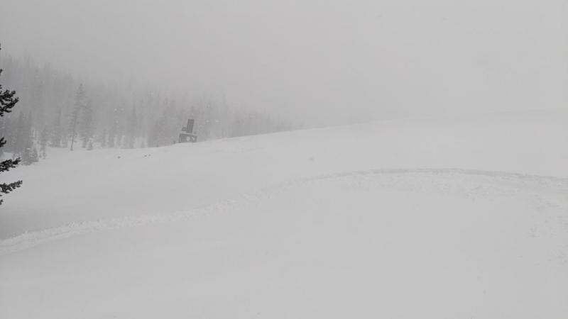
current conditions Yeah... I know, it didn't take long 'til I knew I totally blew the forecast yesterday. Snow intensity increased late in the morning and by midday nearly 18" of medium density snow stacked up. Looks like this was a North Slope storm with the south half of the range registering closer to a foot of snow. Currently, skies are clear and temperatures in the single digits. After a brief late night lull, southerly winds are once again ramping up, blowing in the 20's and 30's with gusts in the 40's along the high ridges. Heads up... go lightly. Even with this thick coat of fresh, white paint it's still super thin out there.
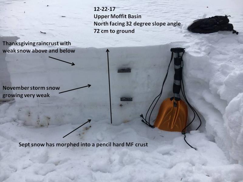
Mark Staples and the Back Country Institute (BCI) crew were near Double Hill Friday, whilst Ted and I were in Upper Moffit Basin. In either case, our trip reports and findings can be seen here.
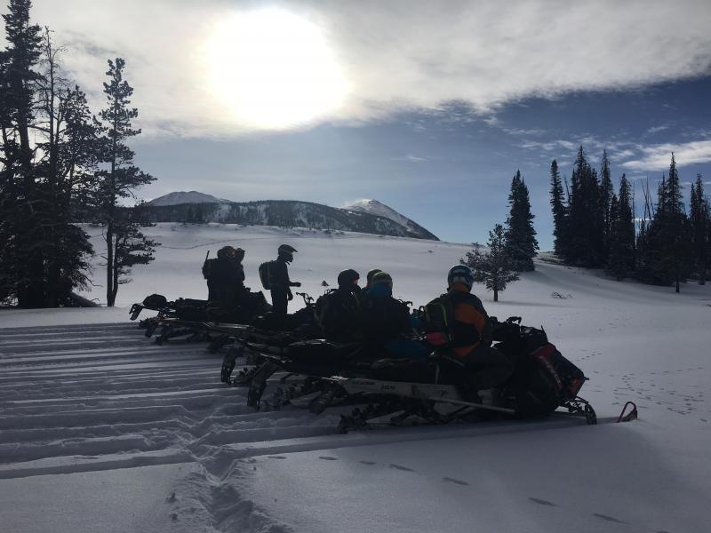
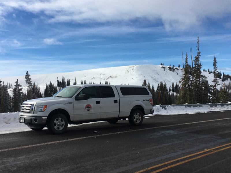
With it's easy access, Wolf Creek Pass is a seamless pre or post work grab. However... just 'cause you can see your rig from the ridge, doesn't mean the snowpack is good to go or shares your same level of stoke. |
 |
recent activity
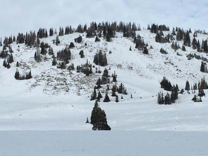
Visibility was very limited yesterday and I didn't get any reports from our big terrain, but my colleague Seth Roller did trigger this small slide on a test slope near Trial Lake. In addition, there were plenty of reports of collapsing and cracking of the snow.... huge Red Flags! . |
| type | aspect/elevation | characteristics |
|---|

|

|
LIKELIHOOD
 LIKELY
UNLIKELY
SIZE
 LARGE
SMALL
TREND
 INCREASING DANGER
SAME
DECREASING DANGER
|
|
description
Winds are always the great equalizer on the eastern front and yesterday was no differant. With plenty of fresh snow to work with, and gusting into the 60's, southerly winds whipped up a widespread round of sensitive drifts. Due to the strength of the winds, dense cohesive slabs formed lower downslope than you might suspect and winds cross-loaded terrain features like chutes and gullies. Common theme is, slabs are most prevelent on slopes facing the north half of the compass. Today you'll want to look for and avoid any fat, rounded piece of snow, especially if it sounds hollow like a drum. Remember- clues to unstable snow include shooting cracks and whoomphing sounds or collapses of the snowpack. The snowpack is still relatively thin and the bummer with low tide conditions is, triggering even a small slide greatly increases your chances of slamming into a season ending rock or stump. |
| type | aspect/elevation | characteristics |
|---|

|

|
LIKELIHOOD
 LIKELY
UNLIKELY
SIZE
 LARGE
SMALL
TREND
INCREASING DANGER
SAME
DECREASING DANGER
|
|
description
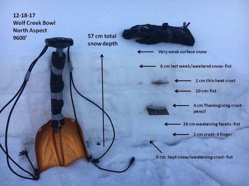
Here's where it gets tricky. We've got a complex snowpack with a myriad of crusts and weak, sugary snow sandwiched in between. Yes, we've got a deceptively tricky snowpack. As a matter of fact, this layering is the kind of combination when I see the vast majority of close calls and near misses in the western Uinta's. Before yesterday's big storm, we got nickled, dimed, and teased with bits and pieces of little storms and there wasn't enough weight to activate any of the buried weak layers. However, with yesterday's welcome addition I think we've hit a critical crossroads and our complex snowpack is teetering on the edge. I bet a number of big slopes came to life during the height of yesterdays storm, but I'd also wager there's plenty of slopes just waiting for us to come along and knock the legs out from underneath. Once triggered, an avalanche could quickly get of hand as it breaks to weaker snow near the ground. The best strategy is easy... it's avoidance. Simply avoid being on or underneath steep, wind drifted slopes facing the north half fo the compass. Remember- there are plenty of south facing slopes you can ride throughout the range where you don't even have to deal with this issue.
South half of the range- this snowpit above clearly illustrates the complex snow structure on shady, north facing slopes.
North half of the range... much different snowpack Click here for a short viddy describing the setup.
Here's your exit strategy for today. South facing terrain that had little or no old weak snow prior to yesterday's big storm. |
 |
weather
|
| general announcements The information in this advisory expires 24 hours after the date and time posted, but will be updated by 7:00 AM Monday December 25, 2017. If you're getting out and about, please let me know what you're seeing especially if you see or trigger and avalanche. I can be reached at [email protected] or 801-231-2170 It's also a good time to set up one of our very popular avalanche awareness classes. Reach out to me and I'll make it happen. This information does not apply to developed ski areas or highways where avalanche control is normally done. This advisory is from the U.S.D.A. Forest Service, which is solely responsible for its content. This advisory describes general avalanche conditions and local variations always occur. |