25th Annual Black Diamond Fall Fundraising Party
Thursday, September 13; 6:00-10:00 PM; Black Diamond Parking Lot
25th Annual Black Diamond Fall Fundraising Party
Thursday, September 13; 6:00-10:00 PM; Black Diamond Parking Lot
| Advisory: Uintas Area Mountains | Issued by Craig Gordon for Wednesday - December 13, 2017 - 3:19am |
|---|

|
bottom line In general the avalanche danger is LOW and human triggered slides are unlikely.
|
 |
special announcement Huge thanks to the Park City Professional Ski Patrol for hosting Monday nights avy awareness presentation. Great turnout.... great vibe... and of course, great collective energy. The information in this advisory expires 24 hours after the date and time posted, but will be updated by 7:00 AM on Saturday Dec. 16th. |
 |
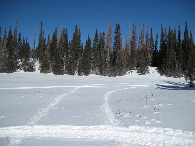
current conditions No change from earlier in the week. Skies are clear with temperatures in the upper 20's and low 30's... a couple degrees warmer than in the City of Salt this morning. North and northwest winds are calm at the trailheads, but along the high ridges, they're blowing 15-25 mph. It's been nearly two weeks since our last storm. Despite the lack of fresh snow, total snow depths are hanging tough, still hovering just around two feet. Getting around the range is slow and travel limited to road rides and grassy meadows.
Road rides and rock free, grassy meadows are the only game in town. |
 |
recent activity No recent avalanche activity to report. |
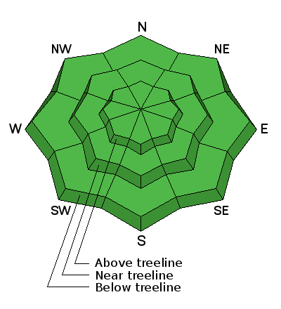
| type | aspect/elevation | characteristics |
|---|

|
|
LIKELIHOOD
 LIKELY
UNLIKELY
SIZE
 LARGE
SMALL
TREND
 INCREASING DANGER
SAME
DECREASING DANGER
|
|
description
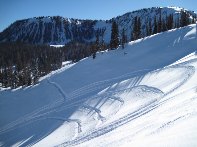
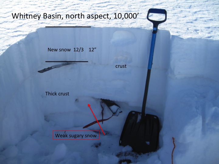
The snowpack, or lack thereof, is comfortable in its own skin. Other than a shallow drift or two along the leeward side of the highest ridges, you'd be pretty hard pressed to trigger an avalanche today and the avalanche danger is generally LOW. As a matter of fact, the chances of slamming into a season enidng rock or stump are greater than triggering a slide. Looking into the future- there's some junk in our snowpacks trunk and upper elevation, shady slopes facing the north half of the compass have a house of cards snow structure. Eventually winter will return from it's hiatus and things will get tricky. Take advantage of the beautiful weather, get out and about and look at the snow layering to see what we'll be riding on once it does start snowing.
Ted was in Whitney Basin this week and found a snowpack that, while stable right now, is gonna give us heartburn in the future. |
 |
weather
There's some hope in sight. Not a big storm, but maybe enough to blow out the valley mank late in the week. In the meantime, a weak weather system brushes by the area late this afternoon through tonight, bringing increasing clouds and a chance of light snow. High pressure returns for Thursday and Friday. The next chance for appreciable snow comes Friday night into Saturday, and although details regarding how much moisture and snow remains uncertain at this time, it appears a few inches of snow are possible. |
| general announcements The information in this advisory expires 24 hours after the date and time posted, I'll up date this advisory by 7:00 AM Saturday December 16, 2017. If you're getting out and about, please let me know what you're seeing especially if you see or trigger and avalanche. I can be reached at [email protected] or 801-231-2170 It's also a good time to set up one of our very popular avalanche awareness classes. Reach out to me and I'll make it happen. This information does not apply to developed ski areas or highways where avalanche control is normally done. This advisory is from the U.S.D.A. Forest Service, which is solely responsible for its content. This advisory describes general avalanche conditions and local variations always occur. |