25th Annual Black Diamond Fall Fundraising Party
Thursday, September 13; 6:00-10:00 PM; Black Diamond Parking Lot
25th Annual Black Diamond Fall Fundraising Party
Thursday, September 13; 6:00-10:00 PM; Black Diamond Parking Lot
| Advisory: Uintas Area Mountains | Issued by Craig Gordon for Saturday - November 25, 2017 - 4:20am |
|---|

|
bottom line In general the avalanche danger is LOW and the chances of slamming into a season ending rock or stump are greater than triggering an avalanche. However, it's not full on green light... ride it if it's white conditions. While more the exception than the rule, steep, upper elevation north facing slopes with old, sugary snow near the ground are still likely suspects and in terrain with these characteristics you could trigger a slide that breaks deeper than you might expect. That said... it's a long winter and it's just getting started. Play it safe and find a low angle grassy meadow where you can avoid both rocks and avalanches.
|
 |
special announcement With no storms in sight, this advisory is valid through midnight Sunday Nov. 26th and will be updated early next week as conditions warrant. |
 |
current conditions Severe clear, as high pressure dominates our weather pattern. However, yesterday's dry cold front knocked temperature down slightly. Currently, it's in the mid 20's and low 30's with southwest winds blowing 15-30 mph along the highest ridgelines.
Above are 24 hour temperatures and snow depth from Trial Lake and winds from Windy Peak
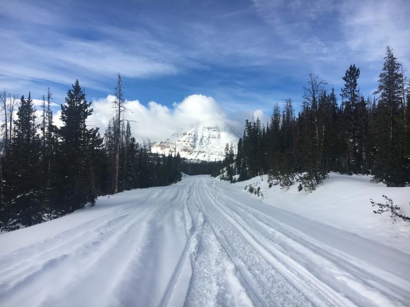
With only two feet of snow on the North half of the range and about 1/2 that amount south of Bald Mountain Pass, road rides and low angle grassy slopes are the only game in town. Last Friday's big storm delivered warm dense snow that favored the northern half of the range.
Mark poked around in the snow near Wolf Creek Pass earlier this week and generally found snow about a foot deep that was a mix of old weak snow near the ground and some lighter newer snow on top. See photo below.
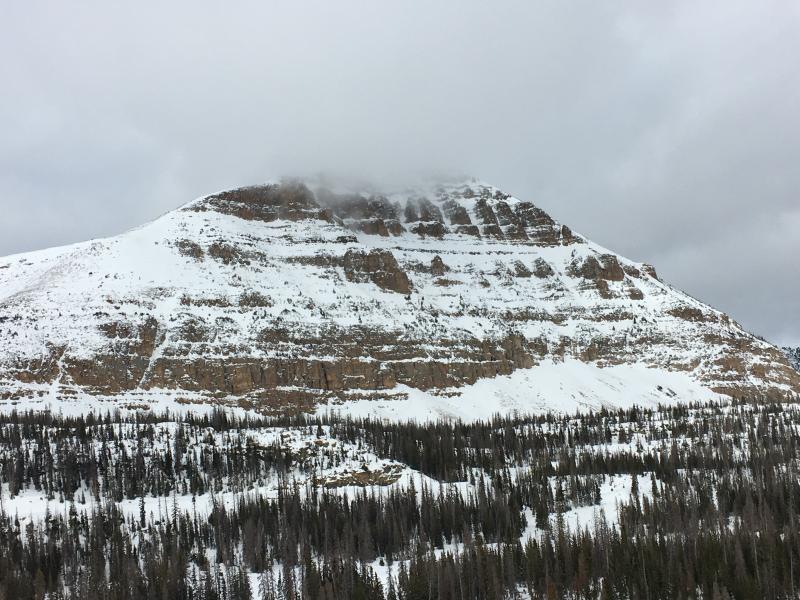
Meanwhile, Ted and I were on the north half of the range and found a deeper snowpack. In general we're off to a good start and my video... click here to view... explains the setup. |
 |
recent activity
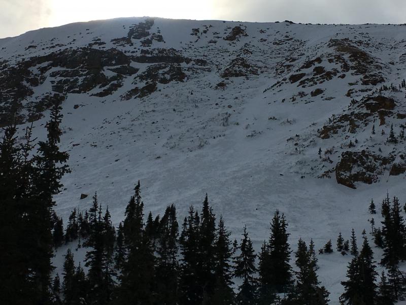
Ted and I found a sizeable natural avalanche on the steep, north facing bowl of Murdock Peak, just of the Mirror Lake Highway. Most likely running during last Thursday nights big storm, this slide was 3-4' feet, 400' wide, and broke to weak facets near the ground. Click here for a viddy descriptor explaining this avalanche. |
| type | aspect/elevation | characteristics |
|---|

|
|
LIKELIHOOD
 LIKELY
UNLIKELY
SIZE
 LARGE
SMALL
TREND
 INCREASING DANGER
SAME
DECREASING DANGER
|
|
description
The avalanche conditions are pretty straight-forward and in general the snowpack has adjusted to last weeks big storm and it's comfortable in its own skin. However, the Uinta's are a big place and if you wanted to trigger a slide I bet you could find a connected piece of snow on a high elevation, shady, north facing slope. Yep... the same types of slopes that held snow from September and October. Remember- that early season snow grew weak and sugary. The bummer with triggering an avalanche this time of year is, it reveals rocks, stumps, and other natural obstacles which are barely hidden under the early season, shallow snowpack. |
 |
weather
|
| general announcements I'll be issuing regularly scheduled advisories once the snow starts flying in earnest. In the meantime, if you're getting out and about, please let me know what you're seeing especially if you see or trigger and avalanche. I can be reached at [email protected] or 801-231-2170 It's also a good time to set up one of our very popular avalanche awareness classes. Reach out to me and I'll make it happen. This information does not apply to developed ski areas or highways where avalanche control is normally done. This advisory is from the U.S.D.A. Forest Service, which is solely responsible for its content. This advisory describes general avalanche conditions and local variations always occur. |