25th Annual Black Diamond Fall Fundraising Party
Thursday, September 13; 6:00-10:00 PM; Black Diamond Parking Lot
25th Annual Black Diamond Fall Fundraising Party
Thursday, September 13; 6:00-10:00 PM; Black Diamond Parking Lot
| Advisory: Uintas Area Mountains | Issued by Mark Staples for Monday - November 20, 2017 - 11:46am |
|---|

|
bottom line There are plenty of other hazards besides avalanches with such thin snow cover. The trouble is that upper elevation north facing slopes with good coverage are the ones most likely to produce an avalanches and the avalanche danger on these slopes is MODERATE. Play it safe and find a low angle grassy meadow where you can avoid both rocks and avalanches.
|
 |
current conditions Last Friday's storm delivered warm dense snow that seems to have favored the northern half of the western Uinta Mountains. The storm ended Friday night and the sun came out for the weekend. Friday storm totals are:
I poked around in the snow near Wolf Creek Pass today and generally found snow about a foot deep that was a mix of old weak snow near the ground and some lighter newer snow on top. See photo below.
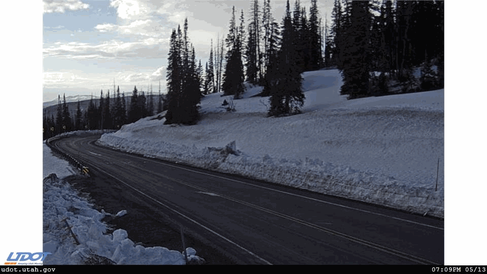
Below are the current UDOT camera images from Wolf Creek Summit at 9400 ft.
|
 |
recent activity No avalanches were reported. Avalanches occurred in the Wasatch mountains which got less snow, so it's fair to say a few probably occurred in the Uinta mountains Friday night because it got more snow and strong winds. One avalanche in Little Cottonwood Canyon was 2000 feet wide. |
| type | aspect/elevation | characteristics |
|---|

|
|
LIKELIHOOD
 LIKELY
UNLIKELY
SIZE
 LARGE
SMALL
TREND
 INCREASING DANGER
SAME
DECREASING DANGER
|
|
description
There's just enough snow to ski on grassy slopes and sledding is basically not an option. Unfortunatley slopes with the best coverage are ones were you are most likely to trigger an avalanche. These are high elevation, northerly facing slopes that held snow from Sept/Oct which became faceted. Where this snow is capped by new snow and a wind slab from Friday's storm (Nov 17) is where you are most likely to trigger an avalanche. There's some good riding on low angle, grassy slopes, and the name of the game is avoiding both avalanches and injury. The season is young. If you get out take the time to practice with your rescue gear. The trouble with early season is both the shallow snow which makes hitting rocks and stumps a hazard. Also, we're typcially not ready to deal with dangerous avalanche conditions on our first few days out, but conditions can become dangerous instantly with the next storm. Be ready - Get the Gear, Get the Training, and Get the Forecast. With dry weather ahead, the snow on many slopes may continue to weaken even though we'll have warm weather in the valleys. See the video below on why this happens: |
 |
weather There's a weak storm moving through northern Utah today that will bring cloudy skies and gusty W and NW winds of 25-35 mph and some higher gusts. Unfortunately the long range forecasts are showing mostly dry conditions. Hopefully that will change and we'll start getting snow. |
| general announcements I'll be issuing regularly scheduled advisories once the snow starts flying in earnest. In the meantime, if you're getting out and about, please let me know what you're seeing especially if you see or trigger and avalanche. I can be reached at [email protected] or 801-231-2170 It's also a good time to set up one of our very popular avalanche awareness classes. Reach out to me and I'll make it happen. |