25th Annual Black Diamond Fall Fundraising Party
Thursday, September 13; 6:00-10:00 PM; Black Diamond Parking Lot
25th Annual Black Diamond Fall Fundraising Party
Thursday, September 13; 6:00-10:00 PM; Black Diamond Parking Lot
| Advisory: Uintas Area Mountains | Issued by Craig Gordon for Monday - March 27, 2017 - 3:22am |
|---|


|
bottom line We start off with LOW avalanche danger for most of the day. As the storm gets rolling, pockets of MODERATE avalanche danger develop and human triggered avalanches become possible on steep wind drifted slopes at and above treeline in the wind zone.
|
 |
current conditions Clouds are streaming in from the west ahead of our next storm system slated to arrive in the next couple hours. Until then, southwest winds are blowing in the teens and temperatures register in the low to mid 20's. Riding and turning conditions remain quite good on wind sheltered upper elevation slopes facing the north half of the compass.
Above... 24 hour winds and snow data from Windy Peak (10,166') and the Trail Lake snotel site (9,992') Real time temperatures, snowfall and wind for the western Uintas are found here. Snowpack observations and trip reports are found here. |
 |
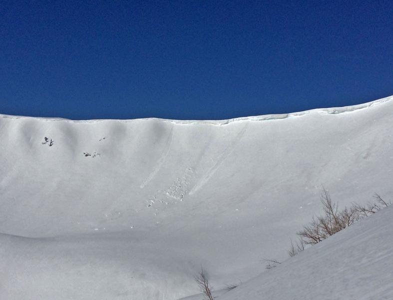
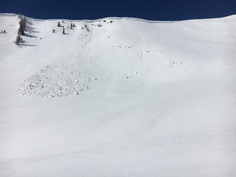
recent activity
Dave Kikkert spotted this natural cornice fall yesterday in Upper Weber Canyon. Overall, Dave reports stable snow and excellent riding conditions. His take on things is found here. A full list of Uinta avalanche activity is found here. |
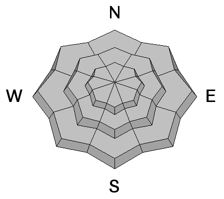
| type | aspect/elevation | characteristics |
|---|

|

|
LIKELIHOOD
 LIKELY
UNLIKELY
SIZE
 LARGE
SMALL
TREND
 INCREASING DANGER
SAME
DECREASING DANGER
|
|
description
There's a storm on the doorstep and once it starts materializing, winds will have something to work with. As the new snow starts stacking up later today, fresh drifts sensitive to our additional weight start to form on steep, leeward slopes, though I think they'll be isolated to upper elevation terrain in the wind zone. While predictably breaking at or below our skis, board, or sled, as always, look for and avoid any fat, rounded piece of snow, especially if it feels or sounds hollow like a drum. In general, we've got a solid, well-behaved snowpack, today's avalanche hazard is straight-forward, and this is an easy avalanche problem to deal with. Lose a little elevation and you lose the problem. |
| type | aspect/elevation | characteristics |
|---|

|
|
LIKELIHOOD
 LIKELY
UNLIKELY
SIZE
 LARGE
SMALL
TREND
 INCREASING DANGER
SAME
DECREASING DANGER
|
|
description
|
 |
weather A Pacific storm system gradually crosses the region today through tomorrow bringing cool, breezy conditions and snow, heavy at times. Looks like close to a foot of snow for storm totals by midday Tuesday. In the mean-time, expect west and northwest winds to ramp up slightly, blowing in the 30's along the high ridges. Temperatures climb into the low 30's and dip into the teens overnight. A break is slated for late Tuesday and Wednesday with the next storm system sliding through late Thursday into Saturday.
|
| general announcements Remember your information can save lives. If you see anything we should know about, please participate in the creation of our own community avalanche advisory by submitting snow and avalanche conditions. You can call me directly at 801-231-2170, email [email protected] The information in this advisory is from the US Forest Service which is solely responsible for its content. This advisory describes general avalanche conditions and local variations always occur. The information in this advisory expires 24 hours after the date and time posted, but will be updated by 7:00 AM on Tuesday March 28th. |