25th Annual Black Diamond Fall Fundraising Party
Thursday, September 13; 6:00-10:00 PM; Black Diamond Parking Lot
25th Annual Black Diamond Fall Fundraising Party
Thursday, September 13; 6:00-10:00 PM; Black Diamond Parking Lot
| Advisory: Uintas Area Mountains | Issued by Craig Gordon for Wednesday - March 8, 2017 - 3:37am |
|---|

|
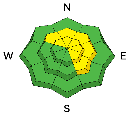
bottom line In mid and upper elevation terrain, at and above treeline, you'll find MODERATE avalanche danger. Human triggered avalanches are POSSIBLE on steep, wind drifted, leeward slopes facing the north half of the compass, especially slopes with an easterly component to their aspect. Looking for LOW avalanche danger? Stick with wind sheltered low and mid elevation terrain with no steep slopes above or adjacent to where you're riding or swing over to slopes facing the south half of the compass.
|
 |
current conditions High clouds over the region kept temperatures mild overnight and currently register in the 20's and low 30's. Southwest winds are blowing 25-35 mph along the high ridges. Recent winds have worked our big open bowls, but lose a little elevation, steer towards wind sheltered, mid elevation terrain and you'll be rewarded with cold, creamy snow.
Real time wind, snow, and temperatures for the Uinta's are found here
Ted was in Whitney Basin yesterday and found great riding, predictable avalanche conditions, and.... lots of wind along the ridges. This guy knows the Uinta's like no other. More on his thoughts, travels, and insight can be found here. Snowpack observations and trip reports are found here. |
 |
recent activity
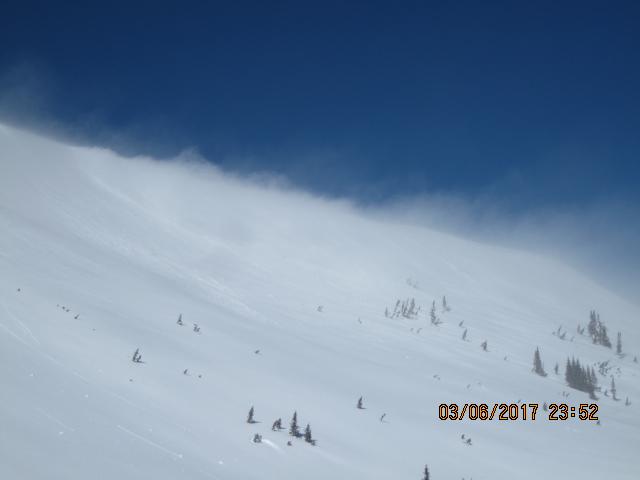
Pretty straight-forward and not particularly connected, "pockety" best describes recent avalanche activity across the range. Breaking close to a foot deep, fresh drifts were sensitive to the additional weight of riders yesterday. (Kikkert and Brown photos) A full list of Uinta avalanche activity is found here. |
| type | aspect/elevation | characteristics |
|---|

|
|
LIKELIHOOD
 LIKELY
UNLIKELY
SIZE
 LARGE
SMALL
TREND
 INCREASING DANGER
SAME
DECREASING DANGER
|
|
description
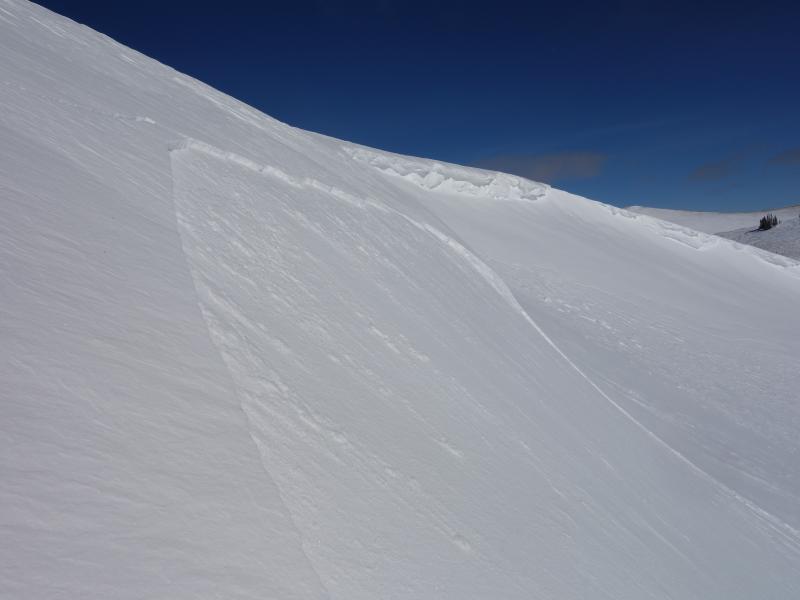
The winds are starting to feel like your old college roomate that decides to couch surf longer than they were invited for. And they've been camping out over the region since Saturday! With no shortage of light density snow to blow around, fresh drifts sensitive to our additional weight are today's main avalanche concern. It's a pretty straight-forward avalanche dragon to contend with. Mid and upper elevation, cross-loaded chutes, gullies, or bowl features are likely suspects. Remember- if you're getting into steep, commiting terrain, keep in mind that even a small slide can quickly ruin your day. So today you'll want to look for and steer clear of both soft and hard, fat rounded pieces of snow, particularly if they feel or sound hollow like a drum. The good news is... this is an easy avalanche problem to avoid. Simply lose some elevation, get into wind sheltered terrain, and you not only lose the problem, you get some great riding in to boot... not a bad deal! |
| type | aspect/elevation | characteristics |
|---|

|

|
LIKELIHOOD
 LIKELY
UNLIKELY
SIZE
 LARGE
SMALL
TREND
INCREASING DANGER
SAME
DECREASING DANGER
|
|
description
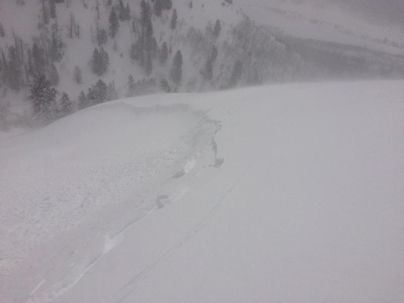
Pictured above, one of the medium sized corni in Upper Weber Canyon. These unpredictable pieces of snow are breaking further back than you might expect and you definitely don't want to be on the receiving end of one of these boxcar-like monsters. (C. Brown photo) |
 |
weather A mild westerly flow over the region gives us partly cloudy skies with temperatures warming into the low 40's. Winds blow in the 20's and 30's and vary between west and southwest. Not much going on in the weather department... hit or miss snow showers the next couple of days with continued warming temperatures |
| general announcements Remember your information can save lives. If you see anything we should know about, please participate in the creation of our own community avalanche advisory by submitting snow and avalanche conditions. You can call me directly at 801-231-2170, email [email protected] The information in this advisory is from the US Forest Service which is solely responsible for its content. This advisory describes general avalanche conditions and local variations always occur. The information in this advisory expires 24 hours after the date and time posted, but will be updated by 7:00 AM on Thursday March 9th. |