25th Annual Black Diamond Fall Fundraising Party
Thursday, September 13; 6:00-10:00 PM; Black Diamond Parking Lot
25th Annual Black Diamond Fall Fundraising Party
Thursday, September 13; 6:00-10:00 PM; Black Diamond Parking Lot
| Advisory: Uintas Area Mountains | Issued by Craig Gordon for Monday - March 6, 2017 - 3:26am |
|---|

|
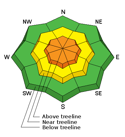
bottom line In the wind zone at and above treeline, you'll find CONSIDERABLE avalanche danger and human triggered avalanches are LIKELY on steep, upper elevation wind drifted, leeward slopes. Mid elevation terrain offers MODERATE avalanche danger and human triggered avalanches are possible on steep slopes with recent deposits of wind drifted snow. Looking for LOW avalanche danger? Stick with wind sheltered low and mid elevation terrain with no steep slopes above or adjacent to where you're riding.
|
 |
current conditions Skies cleared early this morning in the wake of yesterday's powerful cold front and temperatures are in the low teens and single digits. The North Slope was the clear winner for this storm, receiving 8" of medium density snow. From Trial lake to Daniel's most areas stacked up 4" or 5" of white paint. Yesterday's trailer tipping southwest winds switched to the west and northwest right around 10:00 last night as the front roared through the region and have relaxed somewhat, currently blowing in the 30's and 40's. Redeem the sick day voucher... riding and turning conditions are outstanding! Real time wind, snow, and temperatures for the Uinta's are found here Snowpack observations and trip reports are found here. |
 |
recent activity
A full list of Uinta avalanche activity is found here. |
| type | aspect/elevation | characteristics |
|---|

|
|
LIKELIHOOD
 LIKELY
UNLIKELY
SIZE
 LARGE
SMALL
TREND
 INCREASING DANGER
SAME
DECREASING DANGER
|
|
description
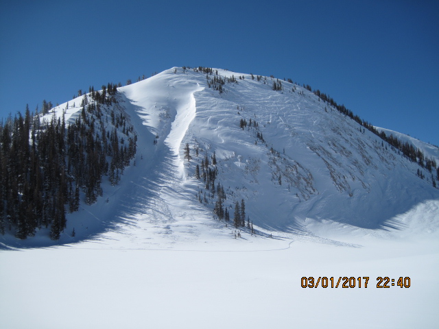
Fresh drits, old drifts, we've got 'em all and they'll be difficult to identify today because now they're covered over with fresh snow. The main theme is... winds have been all over the place the past 48 hours, loading slopes in unusual locations and forming both hard and soft wind slabs. So, the key to a successful powder day is avoiding terrain where you can trigger an avalanche. Today you'll want to look for and steer clear of hard, fat rounded pieces of snow, particularly if they feel or sound hollow like a drum. I think the danger of trigger an avalanche is most concentrated on mid and upper elevation, cross-loaded chutes, gullies, or bowl features. Any avalanche triggered in terrain with these characteristics may be a little bigger than you bargained for. The good news is... this is an easy avalanche problem to avoid. Simply lose some elevation, get into wind sheltered terrain, and you begin to lose the problem.
Pictured above... a perfect example how wind can channel snow into terrain features and crossload chutes and gullies. |
| type | aspect/elevation | characteristics |
|---|

|
|
LIKELIHOOD
 LIKELY
UNLIKELY
SIZE
LARGE
SMALL
TREND
INCREASING DANGER
SAME
DECREASING DANGER
|
|
description
Corni... they're ridiculous this year, stretch for miles along the ridges, and are breaking back further than you might expect. You definitely want to give these unpredictable boxcar monsters the respect they deserve. |
 |
weather Snow showers linger over the region throughout the day stacking up a couple additional inches. High temperatures reach into the 20's with overnight lows dipping into the teens. West and northwest winds relax throughout the day and then switch to the southwest by around sunset. A drying trend with warming temperatures is on tap for Tuesday and Wednesday. |
| general announcements Remember your information can save lives. If you see anything we should know about, please participate in the creation of our own community avalanche advisory by submitting snow and avalanche conditions. You can call me directly at 801-231-2170, email [email protected] The information in this advisory is from the US Forest Service which is solely responsible for its content. This advisory describes general avalanche conditions and local variations always occur. The information in this advisory expires 24 hours after the date and time posted, but will be updated by 7:00 AM on Tuesday March 7th. |