25th Annual Black Diamond Fall Fundraising Party
Thursday, September 13; 6:00-10:00 PM; Black Diamond Parking Lot
25th Annual Black Diamond Fall Fundraising Party
Thursday, September 13; 6:00-10:00 PM; Black Diamond Parking Lot
| Advisory: Uintas Area Mountains | Issued by Craig Gordon for Saturday - February 25, 2017 - 3:49am |
|---|


|
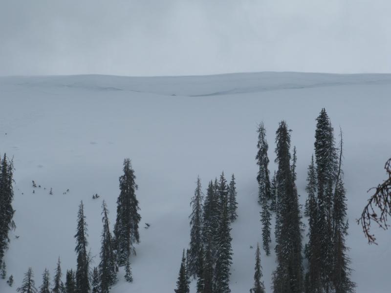
bottom line At and above treeline, especially in the wind zone, you'll find pockets of CONSIDERABLE avalanche danger. Human triggered avalanches are LIKELY on steep wind drifted slopes facing the north half of the compass and especially in terrain with an easterly component to its aspect. Once triggered, today's avalanches will fan out, entraining more snow than you might expect. While less pronounced, a MODERATE avalanche danger is found in mid elevation terrain and human triggered avalanches are possible on steep slopes with recent deposits of wind drifted snow. Wind sheltered slopes in mid and lower elevations offer LOW avalanche danger.
|
 |
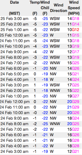
current conditions Under clear skies, overnight temperatures crashed like a bad stock option and currently sit in negative territory. Throw in some west and southwest winds blowing in the teens and low 20's and wind chill values clock in at -25 degrees along the ridges. Just a couple inches of cold, Utah smoke fell yesterday, topping off storm totals that now register at just over 30". On a go anywhere supportable base, riding and turning conditions are about as good as they get... yep, it's over-the-head and over-the-hood.
Real time wind, snow, and temperatures for the Uinta's are found here Snowpack observations and trip reports are found here. |
 |
recent activity
Other than a few long running sluffs and shallow softs slabs, the snowpack has been remarkably well behaved and avalanche conditions are pretty straight-forward. A full list of Uinta avalanche activity is found here. |
| type | aspect/elevation | characteristics |
|---|

|

|
LIKELIHOOD
 LIKELY
UNLIKELY
SIZE
 LARGE
SMALL
TREND
 INCREASING DANGER
SAME
DECREASING DANGER
|
|
description
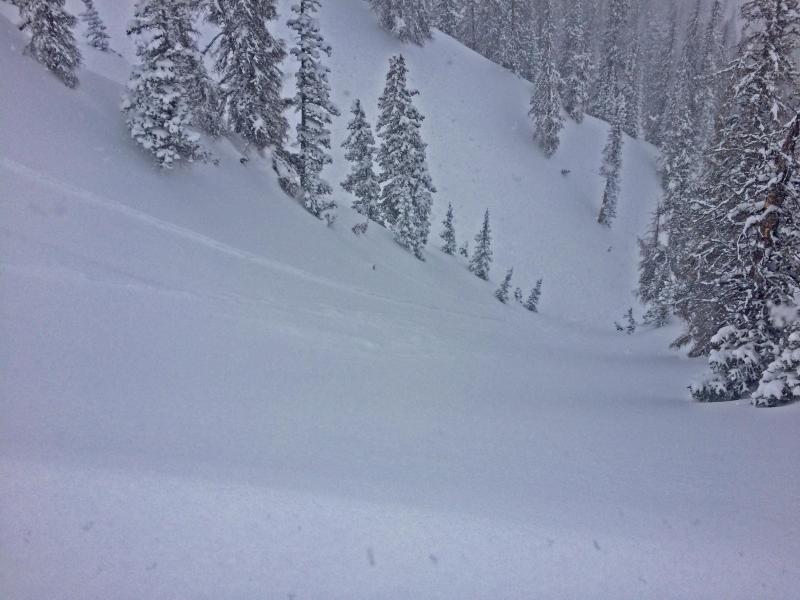
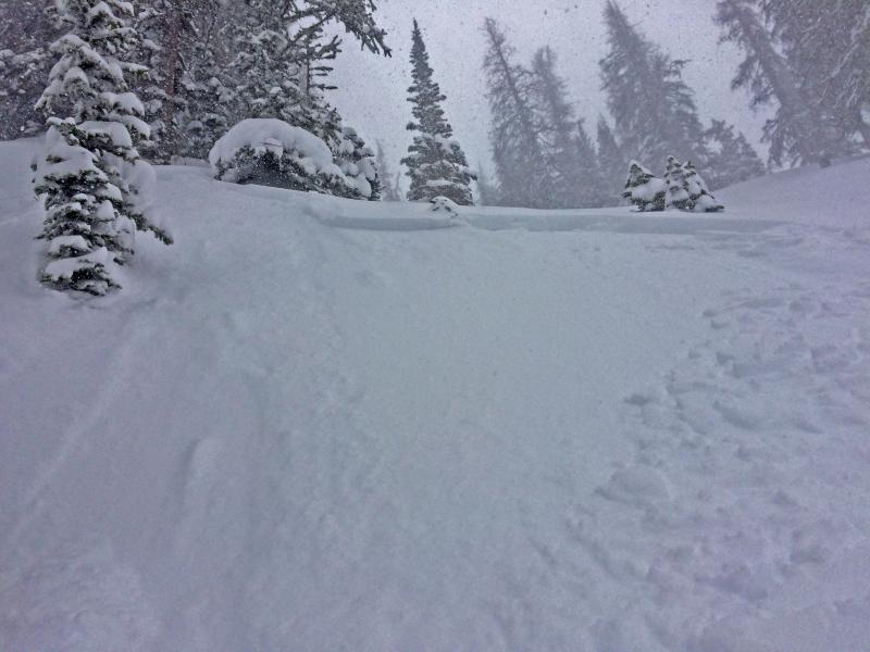
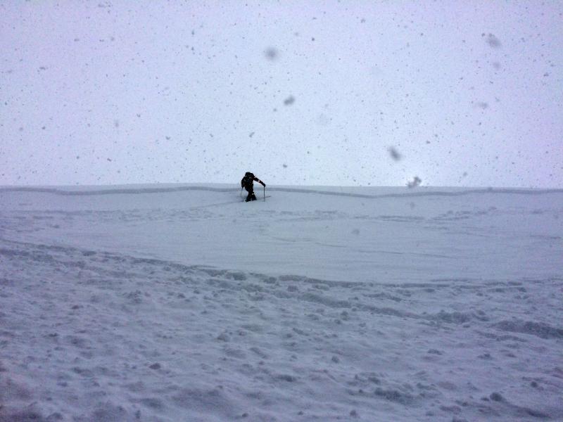
A little time and last nights frigid temperatures helped lock up most of our storm snow instabilities and I bet things aren't nearly as reactive or tender as they've been the past few days. However, we've got no shortage of light density snow available to blow around and the Uinta's are a big place. And remember, just a little uptick in wind speeds can rapidly change the whole equation. That said, I'm sure there's a wind drift or two lurking on the leeward side of an upper elvation ridge, or around a terrain feature like a chute or gully wall that'll react to our additional weight. Predictably breaking at or below our skis, board, or sled and failing about a foot deep, these are the kind of avalanches that most high-end sledders can manage, but are gonna be large enough to boss around a skier, boarder, or snowshoer. No matter what we ride, gather some solid beta by stomping on road cuts and test slopes and see how they're reacting before charging into steep, committing terrain.
With a little bit of wind, Thursday's slabs became more connected, and started breaking a bit wider and deeper as the afternoon wore on. |
| type | aspect/elevation | characteristics |
|---|

|

|
LIKELIHOOD
LIKELY
UNLIKELY
SIZE
 LARGE
SMALL
TREND
INCREASING DANGER
SAME
DECREASING DANGER
|
|
description
Recent winds coupled with dense snow are adding another layer to the already ginormous ridgeline corni. These unpredictable boxcar monsters are breaking further back than you'd think, and can easily take you for an unexpected, terrifying, elevator ride to the ground floor. |
 |
weather A weak system crossing the area later today, produces a few light snow showers and keeps a cold airmass in place. Highs barely crack into the low teens with overnight lows dipping into negative territory. West and southwest winds blow in the 20's with the highest peaks producing a few gusts in the mid 30's. A more robust storm rolls through the region Sunday night. |
| general announcements Remember your information can save lives. If you see anything we should know about, please participate in the creation of our own community avalanche advisory by submitting snow and avalanche conditions. You can call me directly at 801-231-2170, email [email protected] The information in this advisory is from the US Forest Service which is solely responsible for its content. This advisory describes general avalanche conditions and local variations always occur. The information in this advisory expires 24 hours after the date and time posted, but will be updated by 7:00 AM on Sunday February 26th. |