25th Annual Black Diamond Fall Fundraising Party
Thursday, September 13; 6:00-10:00 PM; Black Diamond Parking Lot
25th Annual Black Diamond Fall Fundraising Party
Thursday, September 13; 6:00-10:00 PM; Black Diamond Parking Lot
| Advisory: Uintas Area Mountains | Issued by Craig Gordon for Sunday - February 19, 2017 - 4:30am |
|---|

|
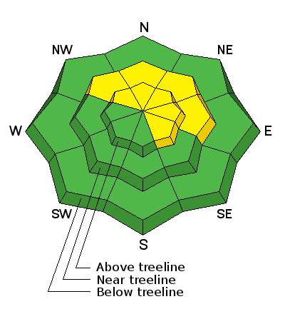
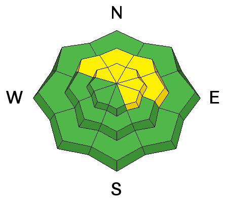
bottom line At and above treeline in the wind zone, you'll find MODERATE avalanche danger on steep leeward slopes facing the north half of the compass. Both new and old wind drifts will react to our additional weight and human triggered avalanches are possible. Once triggered, today's avalanches may pack more of a punch than you might expect. Wind sheltered terrain and most slopes facing the south half of the compass offer LOW avalanche danger.
|
 |
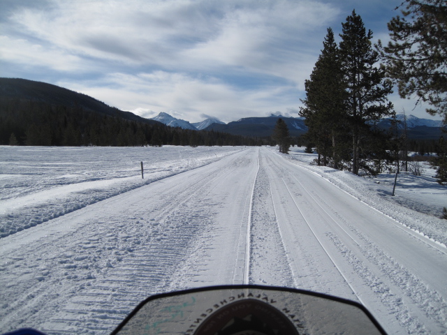
current conditions Skies are mostly cloudy, with temperatures in the mid 20's and low 30's. Yesterdays system delivered more blow than snow.... don't ya know. Just a few inches fell, but southwest winds continue hammering into the 30's and 40's along the ridges. On a go anywhere base and with a little effort, you'll find cold, creamy snow on wind sheltered shady slopes. Real time wind, snow, and temperatures for the Uinta's are found here
Miles o' fresh ROY... it'll get ya where ya need to go in a hurry! Snowpack observations and trip reports are found here. |
 |
recent activity
Ted was on the North Slope yesterday and found sensitive corni and a few pockety fresh wind drifts on steep, leeward slopes. More on his travels here. A full list of Uinta avalanche activity is found here. |
| type | aspect/elevation | characteristics |
|---|

|
|
LIKELIHOOD
 LIKELY
UNLIKELY
SIZE
 LARGE
SMALL
TREND
 INCREASING DANGER
SAME
DECREASING DANGER
|
|
description
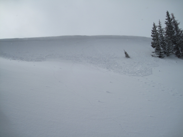
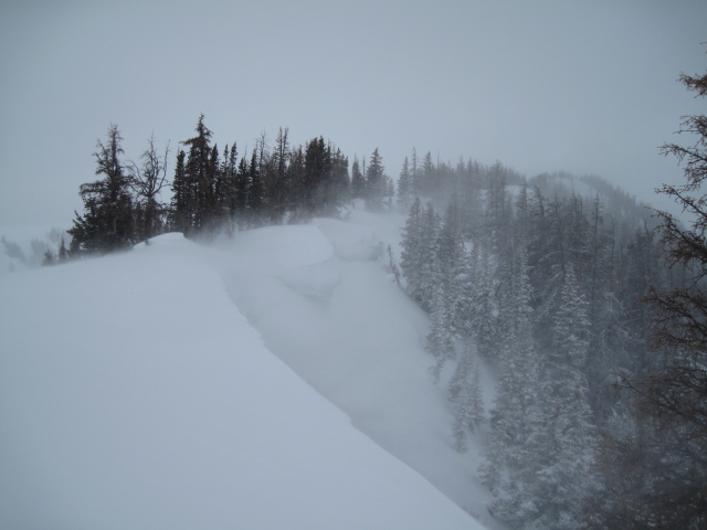
Southwest winds continued cranking overnight and they've got plenty of dense, slab building material to work with. More snow and wind is on the way today and I think today's slabs are gonna be a bit more touchy, breaking wider and deeper than you might expect. Once triggered, these slabs could easily show you who's boss. Fortunately, we can manage the avalanche dragon by avoiding the problem. Found mostly along the leeward side of upper elevation ridges and around terrain features like chutes, gullies, or sub-ridges, it's a good day to look for and avoid any fat, rounded piece of snow, especially if it sounds or feels hollow like a drum. Here's a short viddy explaining the setup for the next couple of days.
Yesterday's wind created sensitive, yet shallow soft slabs on leeward slopes and added another layer to the already ginormous ridgeline corni. |
 |
weather Moisture on the doorstep this morning should slide through the region later today rapidly stacking up 3"-6" of snow. Southwest winds will be a nuisance, blowing into the 50's and 60's along the high peaks. High temperatures don't vary much from where we're at this morning. Skies clear tonight into much of Monday. Light snow is expected Monday night through Tuesday, with a stronger storm on tap for later in the week.
|
| general announcements Remember your information can save lives. If you see anything we should know about, please participate in the creation of our own community avalanche advisory by submitting snow and avalanche conditions. You can call me directly at 801-231-2170, email [email protected] The information in this advisory is from the US Forest Service which is solely responsible for its content. This advisory describes general avalanche conditions and local variations always occur. The information in this advisory expires 24 hours after the date and time posted, but will be updated by 7:00 AM on Monday February 20th. |