25th Annual Black Diamond Fall Fundraising Party
Thursday, September 13; 6:00-10:00 PM; Black Diamond Parking Lot
25th Annual Black Diamond Fall Fundraising Party
Thursday, September 13; 6:00-10:00 PM; Black Diamond Parking Lot
| Advisory: Uintas Area Mountains | Issued by Craig Gordon for Wednesday - February 15, 2017 - 3:27am |
|---|


|
bottom line While not widespread and making up a small portion of the terrain available to ride in today, in the wind zone, on steep leeward slopes, pockets of MODERATE avalanche danger exist. Both new and old wind drifts will predictably react to our additional weight and human triggered avalanches are possible. Heads up... once triggered, today's avalanches may fan out and entrain a bit more snow than you'd expect. On the south half of the compass expect the avalanche danger to rise to MODERATE and human triggered avalanches become possible on steep sunny slopes as the day heats up.
|
 |
special announcement Thursday, Feb 16 - The Utah Adventure Journal Speaker Series presents Brendan Leonard with a presentation at Snowbird's Wildflower Lounge at 6 p.m. about his new book Sixty Meters to Anywhere. The presentation is free, but a donation for the Utah Avalanche Center enters you into a drawing for great prizes. |
 |
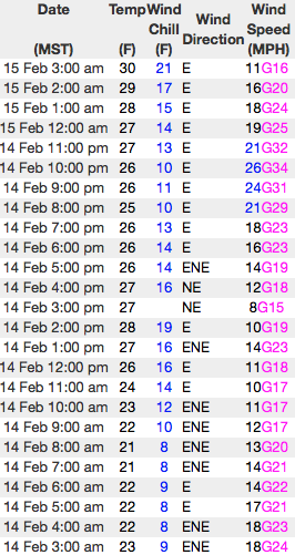
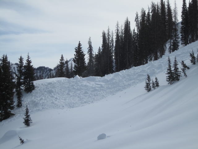
current conditions Skies are clear and temperatures inverted... meaning it's in the teens at most trailheads and low 30's along the ridges. Winds are blowing east and northeast, 15-25 mph along the high peaks. South facing terrain took on heat the past few days and you'll find a variable crust, but swing around to the north half of the compass, gain a little elevation and you'll be treated to soft, shallow, creamy snow.
Real time wind, snow, and temperatures for the Uinta's are found here
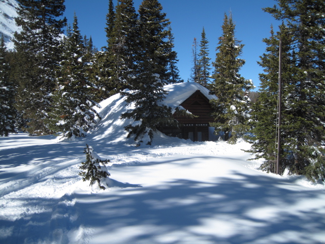
The Mirror Lake Guard Station just looks like a speed bump in the road... man the Uinta's are white! Snowpack observations and trip reports are found here. |
 |
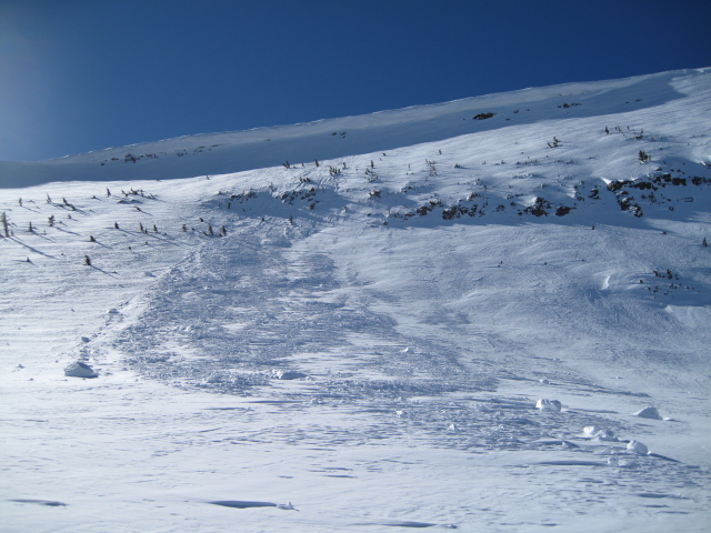
recent activity
A full list of Uinta avalanche activity is found here. |
| type | aspect/elevation | characteristics |
|---|

|
|
LIKELIHOOD
 LIKELY
UNLIKELY
SIZE
 LARGE
SMALL
TREND
 INCREASING DANGER
SAME
DECREASING DANGER
|
|
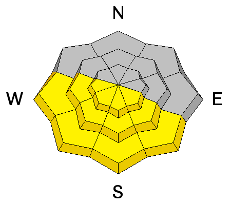
description
The sun is high in the sky and it's starting to beam down intensly. If you're feeling like an ant under a magnifying glass... so is the snowpack. As temperatures rise, expect the snow surface on steep sun exposed terrain to heat up and become moist. As the day wares on, you'll want to avoid any steep slope that feels unsupportable or punchy... kinda like a trap door. In addition, steer clear of terrain traps like gullies and road cuts where wet, heavy, cement-like debris can stack up very deeply. |
| type | aspect/elevation | characteristics |
|---|

|
|
LIKELIHOOD
LIKELY
UNLIKELY
SIZE
LARGE
SMALL
TREND
 INCREASING DANGER
SAME
DECREASING DANGER
|
|
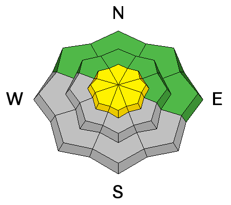
description
East and northeast winds increased slightly yesterday, but there's not much snow blowing around. However, the Uinta's are a big range and I bet there's a rogue drift or two lurking on the leeward side of upper elevation ridges, or around a terrain feature like a gully wall or chute. While manageably breaking at or below our skis, board, or sled I always think about the consequences of triggering even a small slide and getting dragged over a rock band or slammed into a tree. Also, remember that snow conditions can change rapidly this time of year, so if you're bowl hopping, re-evaluate the snow by tweaking small test slopes similar in aspect, elevation, and slope angle to what you want to ride. See how they're reacting before charging into a big, committing line.
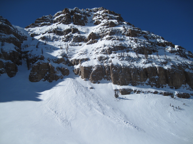
In addition, cornices have grown extremely large and recent warm temperatures are turning these boxcar monsters into unpredictable beasts. Once released, a cornice crashing down on the slope below can easily trigger an avalanche, entraining more snow then you might've bargained for and stacking up large piles of tree snapping debris. |
 |
weather High pressure is steering the weather train the next few days, providing sunny skies, temperatures warming into the 40's, and northerly winds blowing 10-20 mph along the high ridges. Southwesterly flow kicks in on Thursday along with increasing mid and high clouds. Light snow develops Thursday night, opening the door to a series of weak storms slated for the weekend through early next week. |
| general announcements Remember your information can save lives. If you see anything we should know about, please participate in the creation of our own community avalanche advisory by submitting snow and avalanche conditions. You can call me directly at 801-231-2170, email [email protected] The information in this advisory is from the US Forest Service which is solely responsible for its content. This advisory describes general avalanche conditions and local variations always occur. The information in this advisory expires 24 hours after the date and time posted, but will be updated by 7:00 AM on Thursday February 16th. |