25th Annual Black Diamond Fall Fundraising Party
Thursday, September 13; 6:00-10:00 PM; Black Diamond Parking Lot
25th Annual Black Diamond Fall Fundraising Party
Thursday, September 13; 6:00-10:00 PM; Black Diamond Parking Lot
| Advisory: Uintas Area Mountains | Issued by Craig Gordon for Monday - February 6, 2017 - 3:18am |
|---|

|
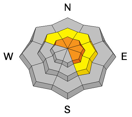
bottom line Heads up... the avalanche danger will be rising the next couple of days. For today, in the wind zone at and above treeline, a CONSIDERABLE avalanche danger exists and human triggered avalanches are likely on steep, leeward slopes. MODERATE avalanche danger is found on steep, shady slopes at mid and lower elevations and human triggered avalanches are POSSIBLE. Remember- any avalanche that breaks to weaker snow, now buried a couple feet deep in the snowpack will get out of hand quickly, resulting in a dangerous slide. Terrain facing the south half of the compass offers LOW avalanche danger.
|
 |
special announcement Do you buy groceries at Smiths? When you register your Smith’s rewards card with their Community Rewards program, they will donate to the Utah Avalanche Center whenever you make a purchase. It's easy, only takes a minute, and doesn't cost you anything. Details here. |
 |
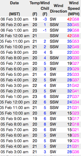
current conditions High clouds are streaming into the region and southwest winds started cranking about the time Lady Gaga landed on the 50 yard line. Currently, winds are blowing 40-70 mph and temperatures are in the 20's. Despite recent winds, excellent riding and turning conditions are found on wind sheltered, shady slopes.
Real time wind, snow, and temperatures for the Uinta's are found here Snowpack observations and trip reports are found here. |
 |
recent activity No significant avalanche activity observed or reported from yesterday. A full list of Uinta avalanche activity is found here. |
| type | aspect/elevation | characteristics |
|---|

|
|
LIKELIHOOD
 LIKELY
UNLIKELY
SIZE
 LARGE
SMALL
TREND
 INCREASING DANGER
SAME
DECREASING DANGER
|
|
description
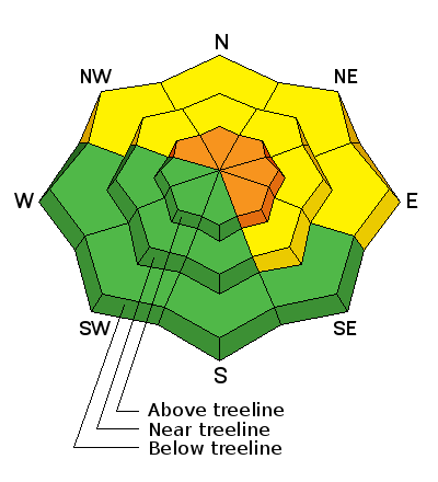
Surface hoar and near surface facets- Mark posted an informative viddy explaining the setup and his decision yesterday not to ride a slope because of the snow structure his crew found. On the north half of the compass, a fragile layer of surface hoar and weak, sugary, near surface facets were preserved and buried prior to the big January storm cycle. Suspect terrain includes mid and low elevation creek bottoms and terrain features where cold air pools. These weak layers are now buried a foot or so beneath the snow surface. With a series of storms headed our way, additional snow and water weight could bring these dormant layers back to life. It's a deceptive setup for sure, but it doesn't have to be a roll of the dice. With a little homework, by digging around you can easily identify slopes that have a suspect snowpack and simply avoid them. |
| type | aspect/elevation | characteristics |
|---|

|
|
LIKELIHOOD
 LIKELY
UNLIKELY
SIZE
 LARGE
SMALL
TREND
INCREASING DANGER
SAME
DECREASING DANGER
|
|
description
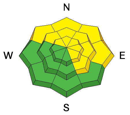
Winds are cranking and there's no shortage of snow available for transport. On the leeward side of upper elevation ridges and around terrain features like chutes and gullies, todays fresh drifts will react to our additional weight and will break deeper than you'd expect. Before getting into steep, committing terrain, stomp on a few road cuts similar in aspect, elevation, and slope angle to what you wanna ride and see how they're reacting.
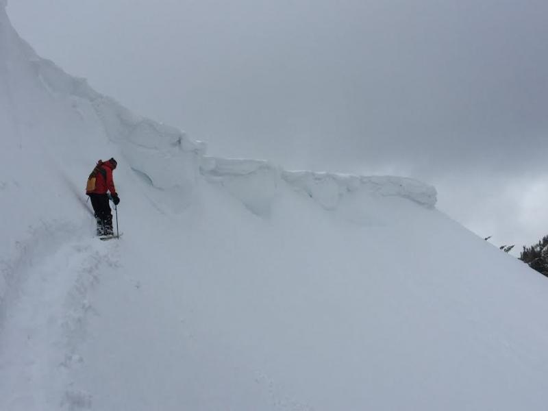
In addition, cornices have grown YUUUGE the past few days and will break further back than you might expect. You definitely don't want to walk out to see what's on the other side of these unpredictable, boxcar sized monsters. |
 |
weather Clouds thicken, southwest winds nuke in the 60's and 70's, and light snow develops later this morning. Today, expect a couple inches of snow with temperatures rising into the 30's. The storm ramps up tonight into Tuesday with a foot or two of snow a good bet by Wednesday morning. Several more storm systems are on tap through next weekend. |
| general announcements Remember your information can save lives. If you see anything we should know about, please participate in the creation of our own community avalanche advisory by submitting snow and avalanche conditions. You can call me directly at 801-231-2170, email [email protected] The information in this advisory is from the US Forest Service which is solely responsible for its content. This advisory describes general avalanche conditions and local variations always occur. The information in this advisory expires 24 hours after the date and time posted, but will be updated by 7:00 AM on Tuesday February 7th. |