25th Annual Black Diamond Fall Fundraising Party
Thursday, September 13; 6:00-10:00 PM; Black Diamond Parking Lot
25th Annual Black Diamond Fall Fundraising Party
Thursday, September 13; 6:00-10:00 PM; Black Diamond Parking Lot
| Advisory: Uintas Area Mountains | Issued by Craig Gordon for Wednesday - January 25, 2017 - 3:06am |
|---|

|
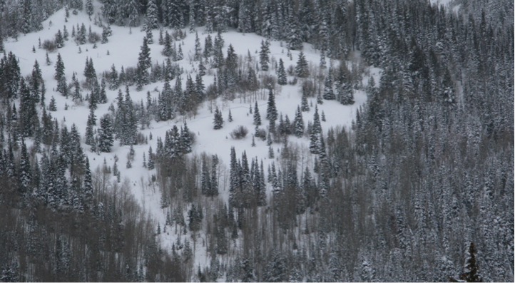
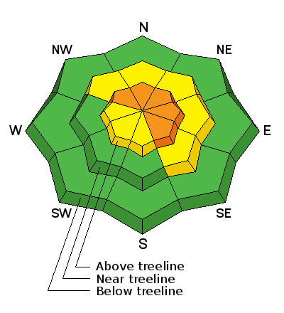
bottom line In the wind zone, at and above treeline, the avalanche danger is CONSIDERABLE. Human triggered avalanches are LIKELY on steep, wind drifted slopes, especially those on the leeward side of upper elevation ridges and particularly those with an easterly component to their aspect. Remember- any avalanche that breaks to weaker snow, now buried deep in the snowpack will get out of hand quickly, resulting in a dangerous slide. A MODERATE avalanche danger is found in mid elevation terrain and human triggered avalanches are POSSIBLE on steep slopes with recent deposits of wind drifted snow. Low elevation terrain and most slopes facing the south half of the compass offer LOW avalanche danger.
|
 |
special announcement TONIGHT- Wednesday- January 25th 6:00 PM. I'll be giving a FREE avalanche awareness presentation at Cycle City in Evanston. I'll address sled specific avalanche concerns as well as current conditions. To reserve a seat, please RSVP at 307- 789-7533... operators are standing by :) |
 |
current conditions Under a cold, moist, northerly flow, light snow is falling and temperatures are in the icebox... registering in negative territory. Along the high ridges west and northwest winds are blowing 10-20 mph producing a wind chill of -22 degrees. Of course you'll forget about the cold in a hurry, because the riding and turning conditions are about as good as it gets, especially on mid and low elevation, wind sheltered, shady slopes. Real time wind, snow, and temperatures for the Uinta's are found here
Another beautiful JG pit profile clearly illustrating our current snowpack setup. JG was in the Hoyt Peak environs and his take on things is found here. Snowpack observations and trip reports are found here. |
 |
recent activity
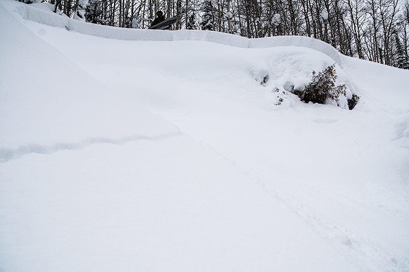
Very sensitive slabs formed at all elevations and they remain reactive to the additional weight of a person, breaking several feet deep yesterday. A full list of Uinta avalanche activity is found here. (Provo Bros photo)
|
| type | aspect/elevation | characteristics |
|---|

|

|
LIKELIHOOD
 LIKELY
UNLIKELY
SIZE
 LARGE
SMALL
TREND
 INCREASING DANGER
SAME
DECREASING DANGER
|
|
description
Winds finally relaxed yesterday and I was finding the snowpack well behaved and predictable. That said... I took my own advisory advice and stuck on wind sheltered slopes and had an amazing day of riding, rather than getting on steep, wind drifted slopes where I knew I could trigger an avalanche. While things are adjusting to the big storm and the trend is towards stability, I think you can still find plenty of slopes in the wind zone where you could trigger a drift that breaks several feet deep. You're best bet right now is give the big, north facing bowls a chance to settle out, let them get comfortable in their own skin, and in a few days, this avalanche problem is gonna be a moot point. |
| type | aspect/elevation | characteristics |
|---|

|

|
LIKELIHOOD
LIKELY
UNLIKELY
SIZE
 LARGE
SMALL
TREND
 INCREASING DANGER
SAME
DECREASING DANGER
|
|
description
Near surface facets and surface hoar, notoriously tricky weak layers, are now buried a couple feet deep in our snowpack and the additional weight of the recent storms is gonna bring these dormant layers back to life. While many slopes avalanched naturally during the storm, there's still plenty more that just need a trigger like us to come along and knock the legs out from underneath them. Any avalanche that breaks into weak layers buried deep in the snowpack will be dangerous. But the solution for the next couple of days is easy. Simply avoid being on, under, or connected to steep, wind drifted slopes, especially those facing the north half of the compass and particularly those with an easterly component to their aspect.
Clean shears reveal a persist buried weak layer. |
 |
weather A weak system sliding through the area brings periods of low density snow to the region today. Snow gradually tapers off in the afternoon or evening. Highs barely reach into the mid teens and crash to near zero again tonight. West-northwest winds blow 10-20 mph along the high ridges. Cold temperatures and a little light snow may continue at times through tomorrow. A strong warming trend is expected Friday into next week as a ridge dominates the weather pattern. |
| general announcements Remember your information can save lives. If you see anything we should know about, please participate in the creation of our own community avalanche advisory by submitting snow and avalanche conditions. You can call me directly at 801-231-2170, email [email protected] The information in this advisory is from the US Forest Service which is solely responsible for its content. This advisory describes general avalanche conditions and local variations always occur. The information in this advisory expires 24 hours after the date and time posted, but will be updated by 7:00 AM on Thursday January 26th. |