25th Annual Black Diamond Fall Fundraising Party
Thursday, September 13; 6:00-10:00 PM; Black Diamond Parking Lot
25th Annual Black Diamond Fall Fundraising Party
Thursday, September 13; 6:00-10:00 PM; Black Diamond Parking Lot
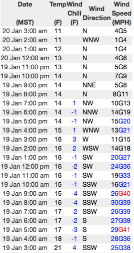
| Advisory: Uintas Area Mountains | Issued by Craig Gordon for Friday - January 20, 2017 - 3:18am |
|---|


|
bottom line In the wind zone, at and above treeline, pockets of MODERATE avalanche danger exist. While making up a small portion of the terrain available to ride in today, fresh wind slabs reactive to our additional weight are POSSIBLE on steep, wind drifted slopes, especially those on the leeward side of upper elevation ridges. Remember- any avalanche that breaks to weaker snow, now buried deep in the snowpack will get out of hand quickly, resulting in a dangerous slide. Lose some elevation and you lose the problem. Wind sheltered mid and lower elevation terrain offers green light conditions and in general, a LOW avalanche danger.
|
 |
current conditions Yesterday's quick hitter delivered 3" of snow and the North Slope is the main beneficiary. Temperatures cooled overnight and currently register in the low to mid teens. Thursday morning jumped out the gates with strong southwest winds, but they died off around lunchtime and have been blowing lightly for the past 12 hours. Our shallow coat of white paint helped soften some of the crusts and old tracks, and today you'll find excellent riding and turning conditions on wind sheltered, shady slopes.
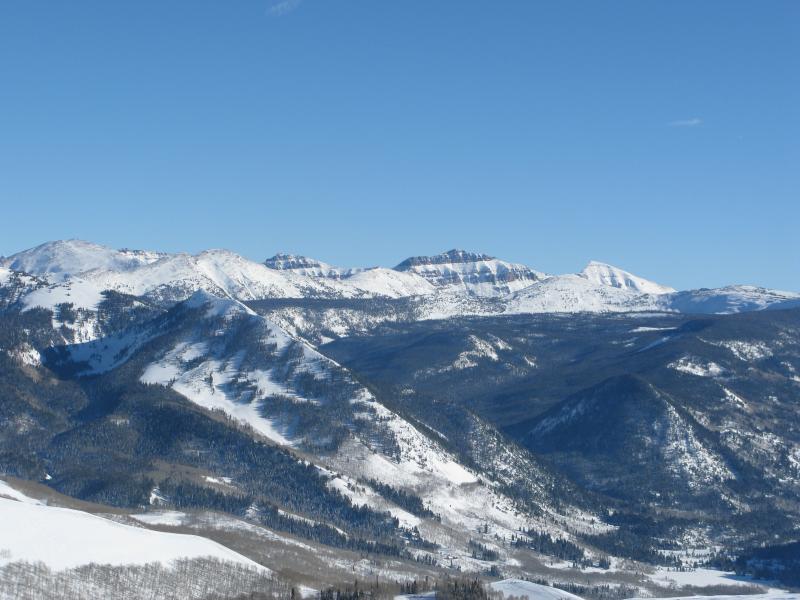
Getting out of the valley smog offers amazing views of the eastern front. Additional snowpack observations and trip reports are found here.
Above... a 24 hour run of the Windy Peak weather station. Real time wind, snow, and temperatures for the Uinta's are found here |
 |
recent activity
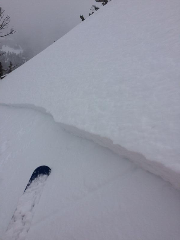
A few shallow, yet energetic and very manageable wind slabs were easily triggered yesterday on steep, leeward slopes yesterday. (C.Brown photo) A full list of Uinta avalanche activity is found here.
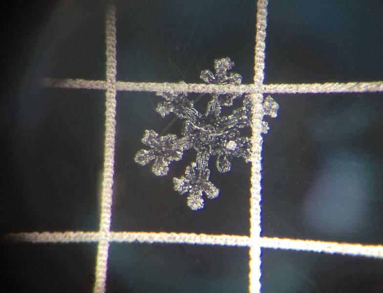
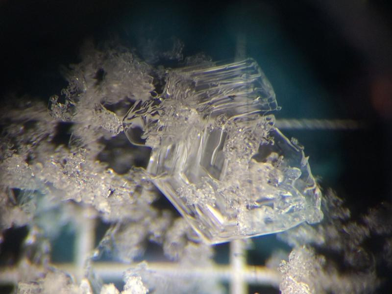
Dave Kikkerts beautiful snow crystal images illustrate flawless stellers that fell straight out of the sky preserving surface hoar and near surface facets in wind sheltered terrain. This tricky setup is something to keep an eye on with a good shot of snow on tap for early next week. |
| type | aspect/elevation | characteristics |
|---|

|
|
LIKELIHOOD
 LIKELY
UNLIKELY
SIZE
 LARGE
SMALL
TREND
 INCREASING DANGER
SAME
DECREASING DANGER
|
|
description
In high alpine terrain above treeline, recent winds have found enough loose snow to whip into fresh drifts, sensitive to our additional weight. Found mostly near and along the leeward side of upper elevation ridges, I bet there's a pocket or two that formed around a terrain feature like a chute or gully wall. In any case, today's shallow slabs will predictably break at or below our skis, boards, or sleds.
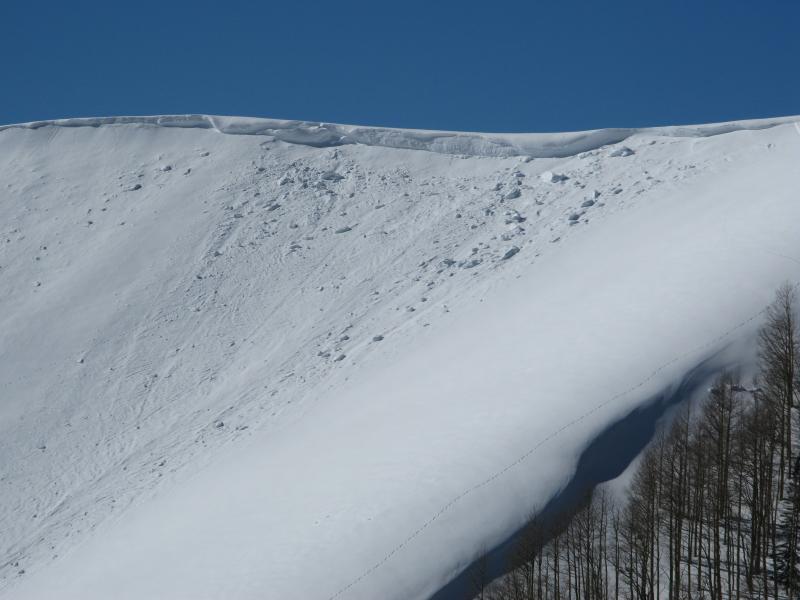
Not a big slab by any means, but might trip you up in steep, radical, unforgiving terrain. (C. Brown photo)
In addition, cornices have grown large and may break back further than you might expect. Your best bet with these boxcar monsters is to give 'em lots of distance. |
| type | aspect/elevation | characteristics |
|---|

|
|
LIKELIHOOD
 LIKELY
UNLIKELY
SIZE
 LARGE
SMALL
TREND
 INCREASING DANGER
SAME
DECREASING DANGER
|
|
description
I think you'd really have to go out of your way to hunt down terrain where you could trigger a slide that breaks into weak snow now buried several feet under the snow surface. While it's highly unlikey, remember- all we need to do is find a weaknesses in the slab, collapse that slope, and now we've got something unmanageable to deal with. The usual suspects come to mind... steep, rocky terrain with a thin, weak snowpack. If you're charging hard today, think about the consequences of triggering a slide. Have a solid game plan and exit strategy in place and make sure to communicate that with your partners.
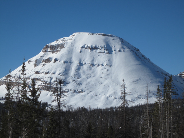
Steep, unforgiving places like Bald Mountain, pictured above, is the kind of terrain where you could trigger a small avalanche that breaks into deeper buried weak layers as snow crashes down on the slope below. (T. Scroggin photo) |
 |
weather A break in the action this morning leads to a mostly cloudy day with high temperatures reaching into the upper 20's. Southerly winds bump into the 20's and 30's by days end with a few gusts in the 40's tonight. Our next storm system dives south tonight, though we should pickup a couple inches Saturday morning as the flow becomes northwesterly. A lull is slated for Saturday night into Sunday morning, before the next system arrives Sunday afternoon, and continues through at least Monday. |
| general announcements Remember your information can save lives. If you see anything we should know about, please participate in the creation of our own community avalanche advisory by submitting snow and avalanche conditions. You can call me directly at 801-231-2170, email [email protected] The information in this advisory is from the US Forest Service which is solely responsible for its content. This advisory describes general avalanche conditions and local variations always occur. The information in this advisory expires 24 hours after the date and time posted, but will be updated by 7:00 AM on Saturday January 21st. |