25th Annual Black Diamond Fall Fundraising Party
Thursday, September 13; 6:00-10:00 PM; Black Diamond Parking Lot
25th Annual Black Diamond Fall Fundraising Party
Thursday, September 13; 6:00-10:00 PM; Black Diamond Parking Lot
| Advisory: Uintas Area Mountains | Issued by Craig Gordon for Friday - January 6, 2017 - 5:26am |
|---|

|
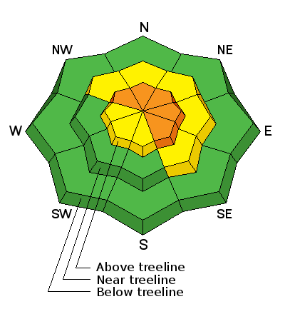
bottom line In upper elevation terrain, particularly leeward slopes in the wind zone, at and above treeline, a CONSIDERABLE avalanche danger exists. Dangerous, human triggered avalanches are LIKELY on steep, wind drifted slopes, especially those facing the north half of the compass, and particularly those with an easterly component to their aspect. Once triggered, today's avalanches have the potential to break deep and wide and can get out of hand quickly, resulting in a dangerous avalanche. You'll find a MODERATE avalanche danger on steep wind drifted slopes at mid elevations and human triggered avalanches are POSSIBLE. If you're looking for LOW avalanche danger simply stick on gentle terrain, like big, open meadows, with no steep slopes above or adjacent to where you're riding.
|
 |
current conditions Skies cleared and temperatures crashed like a bad stock option. Currently, it's -10 to -15 degrees at most of our remote weather station locations. With north and northeast winds blowing 20-30 mph along the high ridges, wind chill factors are registering in at -30 degrees... ouch. Our last storm delivered 2' of snow and the riding is the best it's been in years. It's also a bit sketchy on steep slopes, but fortunately you don't have to hang it out today to get great pow. Five star riding conditions are found on low angle, low elevation, sheltered slopes and meadows. Real time wind, snow, and temperatures for the Uinta's are found here. Snowpack observations and trip reports are found here. |
 |
recent activity
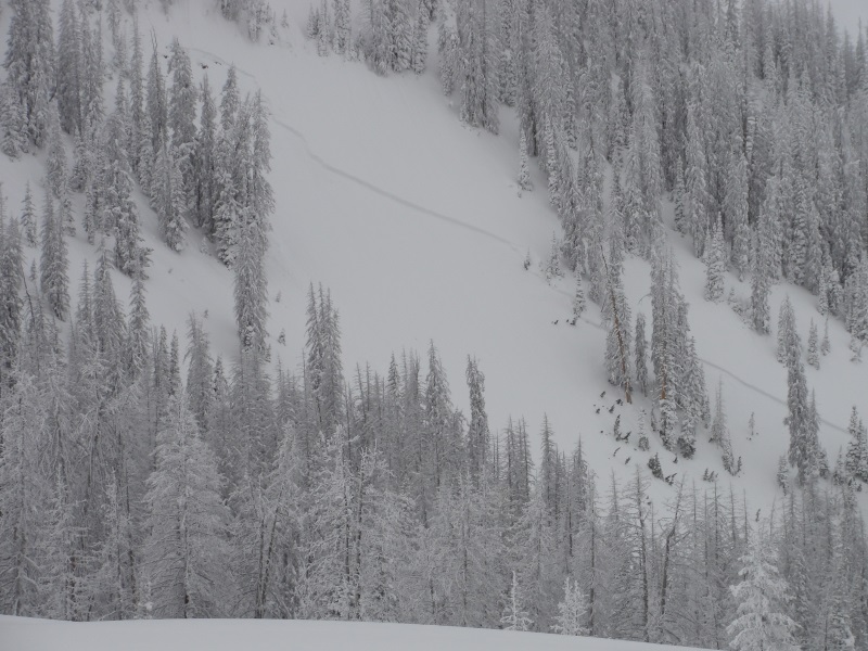
Yesterday morning, a very experienced backcountry rider unintentionally triggered this 2' deep x 250' wide avalanche. He was caught and carried, but fortunately came out unscathed and on top. An excellent write up and humbling reflection is found here. A full list of recent Uinta avalanche activity is found here. |
| type | aspect/elevation | characteristics |
|---|

|
|
LIKELIHOOD
 LIKELY
UNLIKELY
SIZE
 LARGE
SMALL
TREND
 INCREASING DANGER
SAME
DECREASING DANGER
|
|
description
During, and now after our latest big storm, winds have been cranking from every direction. The old slabs are now covered over with fresh slabs and they'll be hard to detect. In either case, they'll be sensitive to our additional weight. In addition, these pieces of snow are connected, meaning they'll break deeper and wider than we might expect and they have the possibility to break above us or even adjacent to the slope we're riding. So triggering one of these can easily ruin your day. It doesn't mean you can't ride... it does mean you'll wanna steer clear of steep, wind drifted terrain and be on the look out for and avoid any rounded, fat, pillows of snow, especially if they feel or sound hollow like a drum. Tweak a couple of road cuts and see how they're reacting and take that information to help you decide where to ride safely today.
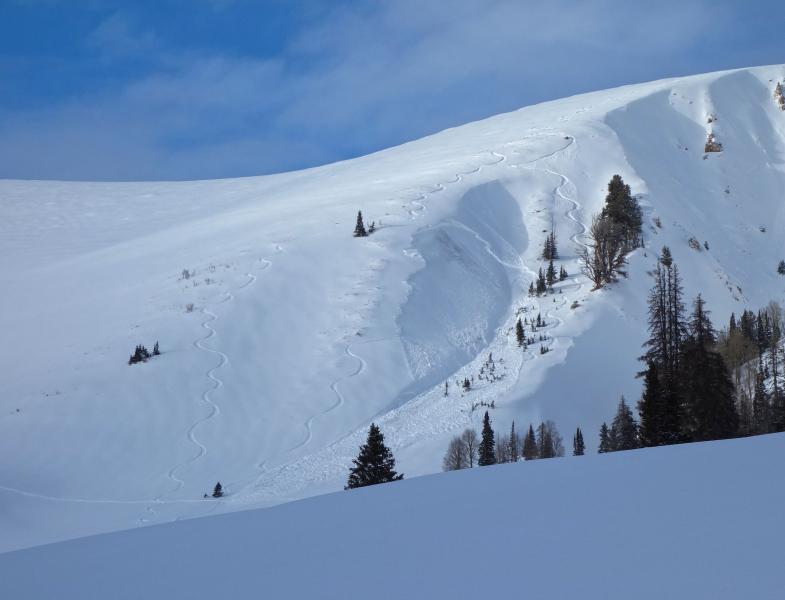
A little coaxing on a steep, wind drifted slope yesterday, knocked the legs out from this slab resulting in a piece of snow that was packing a punch! (Kikkert photos) |
| type | aspect/elevation | characteristics |
|---|

|

|
LIKELIHOOD
 LIKELY
UNLIKELY
SIZE
 LARGE
SMALL
TREND
INCREASING DANGER
SAME
DECREASING DANGER
|
|
description
The latest storm came in warm, wet, and windy, stressing the snowpacks weak layers and putting it to the test. While a few steep slopes avalanched naturally and broke into weak snow within our pack, these slides were pockety and not widespread... and that's good news. While I think many slopes are getting comfortable in their own skin, I'm not willing to bet my life on just a few pieces of information and I think any steep, rocky, upper elevation slope facing the north half of the compass is guilty until proven otherwise.
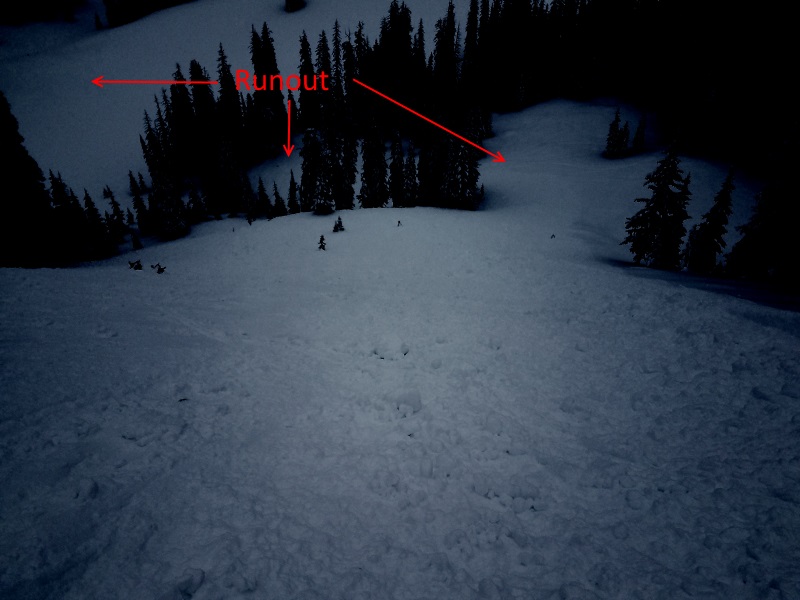
In the image above, a natural avalanche triggered near the ridge line crashed down on the slope below, knocking out two smaller pockets. Of note, the smaller slides broke into old snow, and all this debris stacked up very deeply in this gully or what we call a terrain trap. |
 |
weather It'll be sunny, yet very cold today with high temperatures barely cracking into the teens and overnight lows sinking to negative territory. Northerly winds blowing in the 20's and 30's along the ridges will make it pretty rugged in the high country. Slow warming on Saturday and then an active pattern with lots of wind, water, and rising temperatures returns for late in the weekend through much of next week. |
| general announcements Remember your information can save lives. If you see anything we should know about, please participate in the creation of our own community avalanche advisory by submitting snow and avalanche conditions. You can call me directly at 801-231-2170, email [email protected] The information in this advisory is from the US Forest Service which is solely responsible for its content. This advisory describes general avalanche conditions and local variations always occur. The information in this advisory expires 24 hours after the date and time posted, but will be updated by 7:00 AM on Saturday January 7th. |